At the arrival of European colonists the area was inhabited by the indigenousMohican Indians. To the west of the river were the Mohawk and other four tribes of the Iroquois Confederacy, extending past what is now the border of New York state. The first known European exploration of Columbia County was in 1609, when Henry Hudson, an English explorer sailing for the Dutch, ventured up the Hudson River. An accident to his craft forced him to stop at what is now known as Columbia County and there search for food and supplies.[4] In 1612, the Dutch established trading posts and minor settlements, building New Amsterdam (now New York City) and Fort Orange (now Albany). Fort Orange became a center of the fur trade with the Mohawk people. Traders stopped at points along the Hudson River on their travels between New Amsterdam and Fort Orange; small settlements arose along the river to supply the traders' ships.[4]
Dutch colonists bought land [from whom?] near Claverack in 1649 and 1667.[5] As more Dutch arrived, the region slowly developed. In 1664, the English took over New Netherland and renamed it the "Province of New York"; they also renamed Fort Orange "Albany".[5]
In the late 17th century, Robert Livingston, a Scots immigrant by way of Rotterdam, built on his connections as Indian agent in the colony and purchased two large tracts from the Native Americans. He gained much larger grants from the provincial government, for a total of 160,240 acres. He was made lord of Livingston Manor by the Crown, with all its perquisites, and developed the property with tenant farmers. In 1710, he sold 6,000 acres of his property to Queen Anne of Great Britain for use as work camps and for the resettlement of Palatine German refugees. The Crown had supported their passage to New York, and they were to pay off the cost by indentured labor.[6] Some 1,200 Palatine Germans were brought to Livingston Manor (now Germantown). New York's Governor Hunter had also helped with these arrangements: the workers were to make naval stores (e.g., pitch, resin, and turpentine) from the pine trees in the Catskill Mountains.
They were promised land for resettlement after completing their terms of indenture.[5] They were refugees from years of religious fighting along the border with France, as well as crop failures from a severe winter.[6] Work camps were established on both sides of the Hudson River. The Germans quickly established Protestant churches at the heart of their community, which recorded their weddings, births and deaths, among the first vital records kept in the colony.[6]
After many years, some of the colonists were granted land in the frontier of the central Mohawk Valley west of present-day Little Falls in the 100 lots of the Burnetsfield Patent; in the Schoharie Valley, and other areas, such as Palatine Bridge along the Mohawk River west of Schenectady. They were buffer communities between the British settlements and the Iroquois and French (the latter located mostly in Canada.)
Columbia County was formed in 1786 after the American Revolutionary War from portions of Albany County,[nb 1] once a vast area until new communities were developed and jurisdictions were organized. In 1799, the southern boundary of Columbia County was moved southward to include that portion of Livingston Manor located in Dutchess County.
In the nineteenth century, the Vermont Central Railway was constructed to the area. It provided transportation north towards Rutland and Burlington, Vermont, and south towards the major junction town of Chatham, New York, for travel to points west, south and east.
A large number of LGBT artists and writers settled in Columbia County in the late 20th century, including Ellsworth Kelly, who moved to the county in 1970, followed by James Ivory and Ismail Merchant (1975) and the poet John Ashbery (1978).[7]
This section needs expansion with: content on the 19th and 20th centuries. But for one single item after the 1700s both are entirely skipped.. You can help by adding to it. (September 2021)
Government and politics
United States presidential election results for Columbia County, New York[8]
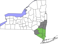
Voters in Columbia County since the mid-19th century have mostly elected Republicans to office. But from 1996 to 2007, new voter registrations by Democrats have outpaced those by Republicans by a margin of 4 to 1.[9] Democrats have been able to win the county in every presidential election since 1996, with Joe Biden's 57% of the vote in 2020 being the highest for a Democrat in the county since 1964.
According to the U.S. Census Bureau, the county has a total area of 648 square miles (1,680 km2), of which 635 square miles (1,640 km2) is land and 14 square miles (36 km2) (2.1%) is water.[11]
Columbia County is in the southeast south-to-central part of New York State, southeast of Albany and immediately west of the Massachusetts border. The western border is the Hudson River.
The highest point is on the Massachusetts state line, near the summit of Alander Mountain, at approximately 2,110 feet (640 m) above sea level, in the town of Copake. The lowest point is at or near sea level, along the Hudson.
Columbia County is accessible by two limited-access highways. The Taconic State Parkway, which is not accessible to trucks or commercial traffic, runs through the center of the county from south to north, ending at an interchange with Interstate 90 and connecting the county with points south. Columbia County is the last New York county located along eastbound Interstate 90 (and the first county along westbound I-90), which passes through the towns of Canaan and Chatham as the Berkshire Connector portion of the New York Thruway. I-90 has two exits within the county; for the southbound Taconic State Parkway in Chatham, and for NYS Route 22 in Canaan. Depending on precise location within the county, road travel distance to New York City ranges between 96 and 145 miles (154 and 233 km).
Several other major routes cross Columbia County including north–south U.S. Route 9, east–west NYS Route 23, north–south NYS Route 22 and a short portion of east–west U.S. Route 20 in the county's northeastern corner.
The Hudson River forms the western border of the county. Other notable creeks include; the Ancram Creek, Claverack Creek, Copake Creek, Kinderhook Creek, Roeliff-Jansen Kill, and Valatie Kill. The Rossman Falls and Stuyvesant Falls lie on the Kinderhook Creek. Notable lakes and ponds include Copake Lake, Kinderhook Reservoir, Queechy Lake, and Lake Taghkanic.
Columbia County is home to many local farms supplying the area with fresh meat, eggs, herbs, and produce, including Holmquest, Ronnybrook, Fix Brothers Fruit Farm, Eger Brothers, Hover Farms, Marsh Meadow Farm, Schober Farm, Millerhurst, Ooms Farm, Churchtown Dairy, Pigasso, Common Hands Farm, Darlin' Doe, Letterbox Farm Collective, Blue Star Farm, Green Mead Farm, Little Ghent Farm, and Ironwood Farm.[12] Other farms include the large, well-known Hawthorne Valley Farm which includes a farm store and training programs, the biodynamic Roxbury Farm, and FarmOn! at Empire Farm, also a teaching farm.
As of the census[18] of 2000, there were 63,094 people, 24,796 households, and 16,588 families residing in the county. The population density was 99 inhabitants per square mile (38/km2). There were 30,207 housing units at an average density of 48 units per square mile (19/km2). The racial makeup of the county was 92.09% White, 4.52% Black or African American, 0.21% Native American, 0.80% Asian, 0.03% Pacific Islander, 0.90% from other races, and 1.45% from two or more races. 2.53% of the population were Hispanic or Latino of any race. 17.2% were of German, 14.7% Italian, 14.5% Irish, 9.0% English, 6.3% Polish and 6.1% American ancestry according to Census 2000. 94.0% spoke English and 2.1% Spanish as their first language.
There were 24,796 households, out of which 29.90% had children under the age of 18 living with them, 52.20% were married couples living together, 10.30% had a female householder with no husband present, and 33.10% were non-families. 27.10% of all households were made up of individuals, and 11.50% had someone living alone who was 65 years of age or older. The average household size was 2.43 and the average family size was 2.95.
In the county, the population was spread out, with 24.10% under the age of 18, 6.40% from 18 to 24, 26.90% from 25 to 44, 26.30% from 45 to 64, and 16.40% who were 65 years of age or older. The median age was 40 years. For every 100 females there were 99.00 males. For every 100 females age 18 and over, there were 95.30 males.
The median income for a household in the county was $41,915, and the median income for a family was $49,357. Males had a median income of $34,702 versus $25,878 for females. The per capita income for the county was $22,265. About 6.40% of families and 9.00% of the population were below the poverty line, including 11.80% of those under age 18 and 6.80% of those age 65 or over.
As of the 2010 census, the racial makeup of the county was 90.6% White, 4.5% African American, 0.2% Native American and 1.6% Asian. Hispanic or Latino people of any race were 3.9% of the population.[19]
Interstate 90 runs east–west through the county. The Taconic State Parkway runs from I-90 south towards Westchester County. The main arterial north–south road, U.S. 9, runs through the larger towns towards the Hudson River.
South Korean singer Some of this article's listed sources may not be reliable. Please help improve this article by looking for better, more reliable sources. Unreliable citations may be challenged and removed. (January 2020) (Learn how and when to remove this message) K.WillK.Will in 2013Background informationBirth nameKim Hyung-sooBorn (1981-12-30) December 30, 1981 (age 42)Seoul, South KoreaGenresK-popballadR&BOccupation(s)SingerYears active2007–presentLabelsBig HitStarshipWebsiteOf…
Ball used in volleyball A volleyball is a ball used to play indoor volleyball, beach volleyball, or other less common variations of the sport. Volleyballs are spherical in shape and typically comprise eighteen nearly rectangular panels made from synthetic or genuine leather. These panels are organized into six identical sections, each consisting of three panels. They are carefully wrapped around a bladder to form the complete volleyball. A valve permits the internal air pressure to be adjusted. …
Konkona Sen SharmaKonkona Sen Sharma di Taj Land EndLahir3 Desember 1979 (umur 44)New Delhi, IndiaPekerjaanAktrisTahun aktif2000–sekarangSuami/istriRanvir Shorey (2010–sekarang) Konkona Sen Sharma (bahasa Bengali: কঙ্কনা সেন শর্মা; kelahiran 3 Desember 1979) adalah seorang aktris India. Ia adalah putri dari pembuat film dan aktris Aparna Sen. Sharma biasanya tampil pada rumah seni dan film independen India Membuat debutnya sebagai artis cilik dalam f…
Angkatan Bersenjata AzerbaijanAzərbaycan Silahlı QüvvələriLambang Angkatan Bersenjata AzerbaijanDidirikan26 Juni 1918Formasi terkini9 Oktober 1991Angkatan Angkatan Darat Angkatan Udara Angkatan LautMarkas besarBaku, AzerbaijanKepemimpinanPanglima Tertinggi Presiden Ilham AliyevMenteri Pertahanan Koljen Zakir HasanovKepala Staf Letjen Karim ValiyevKekuatan personelUsia penerimaan18–35 (Reguler)Wajib militer12–18 bulan untuk angkatan darat[1]Ketersediaanmenurut usia3.000…
История ШвейцарииШвейцария до объединения (1291) Доисторическая Швейцария Римская Швейцария Верхняя Бургундия Швейцарский союз (1291—1798) Федеративная хартия Экспансия Реформация в Швейцарии Три Лиги Лига десяти сообществ Лига дома Божьего Серая лига Во время Наполеоновск�…
South West Snooker Academy The South West Snooker Academy (or the Capital Venue) is located in Gloucester Business Park. It was purposely built for snooker in July 2010 but is now home to the owner Paul Mount's business MIUS.[1] History The South West Snooker Academy opened in 2010, with an exhibition match between Jimmy White and Tony Drago, both players who were managed by the Academy's owner Paul Mount. The venue had thirteen full-size snooker tables, a match arena with over 300 tiere…
International political in Latin America and the Caribbean. Permanent Conference of Political Parties of Latin America and the CaribbeanCOPPPAL Conferencia Permanente de Partidos Políticos de América Latina y el CaribeConférence permanente des partis politiques d'Amérique latine et des CaraïbesPresidentAlejandro Moreno Cárdenas,[1] MexicoVice PresidentAlberto Aguilar Iñárritu, MexicoFounded12 October 1979 (1979-10-12)IdeologyBig tentFactions:LiberalismSoc…
Pangeran Archie dari SussexKelahiran6 Mei 2019 (umur 5)The Portland Hospital, London, Britania RayaNama lengkapArchie Harrison Mountbatten-WindsorAyahPangeran Harry, Adipati SussexIbuMeghan Markle Keluarga Kerajaan Britania Raya dan Wilayah Persemakmuran lainnya Baginda Sang RajaBaginda Sang Permaisuri Paduka Sang Pangeran WalesPaduka Sang Putri Wales Paduka Pangeran George dari Wales Paduka Putri Charlotte dari Wales Paduka Pangeran Louis dari Wales Paduka Sang Adipati SussexPaduka Sang Ad…
Forest in New Jersey, United States This article needs additional citations for verification. Please help improve this article by adding citations to reliable sources. Unsourced material may be challenged and removed.Find sources: Ramapo Mountain State Forest – news · newspapers · books · scholar · JSTOR (December 2021) (Learn how and when to remove this message) Ramapo Mountain State ForestStream along the MacEvoy Trail in Ramapo Mountain State Forest.Ra…
German military occupation of Denmark during World War II This article needs additional citations for verification. Please help improve this article by adding citations to reliable sources. Unsourced material may be challenged and removed.Find sources: Denmark in World War II – news · newspapers · books · scholar · JSTOR (August 2023) (Learn how and when to remove this message) Headquarters of the Schalburg Corps, a Danish SS unit, after 1943. The occupie…
Season of television series Survivor: Worlds ApartSeason 30Region 1 DVD coverPresented byJeff ProbstNo. of days39No. of castaways18WinnerMike HollowayRunners-upCarolyn RiveraWill Sims IILocationSan Juan del Sur, Nicaragua[1] No. of episodes14ReleaseOriginal networkCBSOriginal releaseFebruary 25 (2015-02-25) –May 20, 2015 (2015-05-20)Additional informationFilming datesAugust 4 (2014-08-04) –September 11, 2014 (2014-09-11)Season chronology← Previous…
This article needs additional citations for verification. Please help improve this article by adding citations to reliable sources. Unsourced material may be challenged and removed.Find sources: Ythan Estuary – news · newspapers · books · scholar · JSTOR (December 2011) (Learn how and when to remove this message) Designations Ramsar WetlandOfficial nameYthan Estuary & Meikle LochDesignated30 March 1998Reference no.939[1] Mid to upper reac…
هذه المقالة يتيمة إذ تصل إليها مقالات أخرى قليلة جدًا. فضلًا، ساعد بإضافة وصلة إليها في مقالات متعلقة بها. (نوفمبر 2019) يو إس إس رينجر (سي في-4) الخدمة المشغل بحرية الولايات المتحدة[1] الوزن 14500 طن[1]، و14576 طن، و17577 طن الطول 234.4 متر العرض 33.4 متر السرعة 2…
Greek Orthodox monastery in Constantinople Studite monks redirects here. For the Ukrainian religious society, see Studite Brethren. Byzantine miniature depicting the Stoudios Monastery and the Propontis (Sea of Marmara), from the Menologion of Basil II (c. 1000). The Monastery of Stoudios, more fully Monastery of Saint John the Forerunner at Stoudios (Greek: Μονή του Αγίου Ιωάννη του Προδρόμου εν τοις Στουδίου, translit. Monē tou Hagiou Iōannē …
هذه المقالة تحتاج للمزيد من الوصلات للمقالات الأخرى للمساعدة في ترابط مقالات الموسوعة. فضلًا ساعد في تحسين هذه المقالة بإضافة وصلات إلى المقالات المتعلقة بها الموجودة في النص الحالي. (أغسطس 2016) هذه المقالة يتيمة إذ تصل إليها مقالات أخرى قليلة جدًا. فضلًا، ساعد بإضافة وصلة إل…
Municipality in Galicia, SpainSantiago de CompostelaMunicipalityCathedralHostal dos Reis CatólicosPraterías squareSan Martiño PinarioPazo de Raxoi FlagCoat of armsLocation of Santiago de CompostelaSantiago de CompostelaShow map of GaliciaSantiago de CompostelaShow map of SpainCoordinates: 42°52′40″N 8°32′40″W / 42.87778°N 8.54444°W / 42.87778; -8.54444Country SpainAutonomous Community GaliciaProvinceA CoruñaParishes 30 ArínsBandoA BarcielaBustoO…


")


")


")


