|
Liste der Landschaftsschutzgebiete in Wilhelmshaven Die Liste der Landschaftsschutzgebiete in Wilhelmshaven enthält die Landschaftsschutzgebiete der kreisfreien Stadt Wilhelmshaven in Niedersachsen.
| Bild
|
Nummer
|
Bezeichnung des Gebietes
|
Fläche in Hektar
|
WDPA-ID
|
Koordinaten[1]
|
Datum der
Verordnung
|
|
|
LSG WHV 00009
|
Alter Friedhof
|
2,50
|
319544
|
Position53.52178.0994
|
1938
|
|
|
LSG WHV 00010
|
Der Krähenbusch
|
1,30
|
320321
|
Position53.52448.10104
|
1938
|

|
LSG WHV 00012
|
Wilhelmshavener Park (Kurpark)
|
15,00
|
325893
|
Position53.52568.12012
|
1938
|

|
LSG WHV 00015
|
Groß Belt
|
0,70
|
321176
|
Position53.5268.06791
|
1938
|

|
LSG WHV 00016
|
Potenburg
|
0,30
|
323704
|
Position53.52998.0719
|
1938
|

|
LSG WHV 00020
|
Siebethsburg
|
4,30
|
324556
|
Position53.53178.10781
|
1938
|

|
LSG WHV 00028
|
Friedhof Aldenburg
|
8,20
|
320896
|
Position53.53938.07514
|
1938
|

|
LSG WHV 00029
|
Altengrodener Weg
|
6,90
|
319533
|
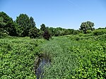
Position53.55188.09535
|
1938
|
|
LSG WHV 00031
|
Heete mit Heeteniederung
|
0,50
|
321492
|
Position53.55258.10423
|
1938
|
|
|
LSG WHV 00033
|
8 Warfen
|
0,30
|
319420
|
Position53.54118.08199
|
1938
|

|
LSG WHV 00037
|
Wilhelmshavener Friedhof
|
8,60
|
325892
|
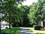
Position53.54158.11748
|
1938
|
|
LSG WHV 00039
|
Bauernhof Frerichs
|
0,60
|
319805
|
Position53.54928.10901
|
1938
|

|
LSG WHV 00040
|
Alte und Neue Maade
|
22,50
|
319520
|
Position53.53868.06512
|
1983
|
|
|
LSG WHV 00041
|
Bauernhöfe
|
2,50
|
319807
|
Position53.55318.08445
|
1938
|

|
LSG WHV 00042
|
Kreuzelwerk
|
1,10
|
|
Position53.56398.10261
|
1938
|
|
|
LSG WHV 00046
|
Deichzug Langewerth
|
13,00
|
320299
|
Position53.53728.04717
|
1938
|

|
LSG WHV 00047
|
Bauernhof Oyensburg
|
0,50
|
319806
|
Position53.54818.04462
|
1938
|

|
LSG WHV 00049
|
Burg Kniphausen
|
8,10
|
320187
|
Position53.55068.05299
|
1938
|

|
LSG WHV 00051
|
Mönkeburger Busch
|
0,60
|
323027
|
Position53.55168.0579
|
1938
|

|
LSG WHV 00052
|
Dorfwarf Hohewerth
|
2,50
|
320408
|
Position53.55158.06251
|
1938
|

|
LSG WHV 00053
|
Hohewerther Grashaus
|
1,20
|
321718
|
Position53.55318.07015
|
1938
|

|
LSG WHV 00054
|
Deichzug Steindamm bis Schilldeich
|
4,90
|
320300
|
Position53.56088.06011
|
1938
|

|
LSG WHV 00055
|
Deichzug Steindamm über Schnapp
|
10,50
|
320301
|
Position53.56488.06857
|
1938
|

|
LSG WHV 00056
|
Steindamm
|
1,10
|
324814
|
Position53.57098.06727
|
1938
|

|
LSG WHV 00061
|
2 Bauernhöfe in Mitteldeich
|
1,10
|
319410
|
Position53.57418.07763
|
1938
|

|
LSG WHV 00064
|
Bauernhof
|
1,00
|
319804
|
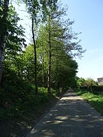
Position53.58458.09455
|
1938
|
|
LSG WHV 00065
|
Deich von Hörn bis Voslapp
|
5,80
|
320297
|
Position53.58268.10091
|
1938
|

|
LSG WHV 00068
|
Ehemaliges Fort Rüstersiel
|
14,50
|
|
Position53.56488.10708
|
1968
|

|
LSG WHV 00069
|
Wehlens
|
35,20
|
325683
|
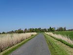
Position53.59138.0288
|
1975
|
|
LSG WHV 00070
|
Breddewarden
|
6,80
|
320069
|
Position53.58348.06404
|
1937
|

|
LSG WHV 00071
|
Utters
|
6,10
|
325377
|
Position53.5978.07354
|
1937
|

|
LSG WHV 00072
|
Stadtpark
|
118,00
|
324763
|
Position53.54498.09793
|
1982
|

|
LSG WHV 00073
|
Alte und Neue Maade zwischen Coldewei und Kreuzelwerk
|
47,00
|
319521
|
Position53.56218.09155
|
1983
|

|
LSG WHV 00077
|
Ehemalige Schießstände Heppens zwischen Freiligrathstraße und Neuengrodendeich
|
13,70
|
320516
|
Position53.54398.12989
|
1994
|
|
|
LSG WHV 00080
|
Hessens
|
109,00
|
329091
|
Position53.51668.07114
|
2004
|
|
LSG WHV 00087
|
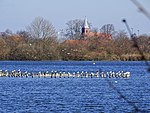
Barghauser See
|
32,00
|
|
Position53.55718.0341
|
2007
|
Anmerkungen
- ↑ Koordinaten wurden dem European Nature Information System (EUNIS) der Europäischen Umweltagentur entnommen: Nationally designated areas (CDDA), Datei CDDA_v12_csv.zip, Stand Oktober 2014. Die Tabellenspalte WDPA-ID gibt die genauen Grenzen an.
Siehe auch
Weblinks
|


