|
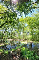
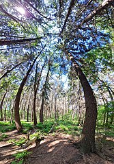
Liste der Landschaftsschutzgebiete im Landkreis Cloppenburg Die Liste der Landschaftsschutzgebiete im Landkreis Cloppenburg enthält die Landschaftsschutzgebiete des Landkreises Cloppenburg in Niedersachsen.
| Bild
|
Nummer
|
Bezeichnung des Gebietes
|
Fläche in Hektar
|
WDPA-ID
|
Koordinaten[1]
|
Datum der
Verordnung
|
|
|
LSG CLP 00001
|
Wald am Kommende Bokelesch (Klosterbusch)
|
13,00
|
325509
|
Position53.15977.66386
|
1992
|
|
|
LSG CLP 00002
|
Osterhauser Wald
|
17,80
|
390330
|
Position53.16647.67726
|
1992
|
|
|
LSG CLP 00003
|
Hollen Brand
|
149,00
|
321727
|
Position53.0877.67674
|
1992
|
|
|
LSG CLP 00004
|
Umgebung des Gutes Reinshaus
|
51,10
|
325288
|
Position53.07057.83623
|
1992
|
|
|
LSG CLP 00005
|
Soestetal zwischen Talsperre und Friesoythe
|
340,00
|
324590
|
Position52.97097.90051
|
1992
|
|
|
LSG CLP 00006
|
Duvensand/ Horstberg
|
370,00
|
320482
|
Position52.96797.88473
|
1992
|
|
|
LSG CLP 00007
|
Igelriede
|
19,70
|
321867
|
Position52.92687.91026
|
1992
|
|
|
LSG CLP 00008
|
Fennens Wald in Osterloh
|
2,50
|
320784
|
Position53.00647.9778
|
1992
|
|
|
LSG CLP 00009
|
Markatal zwischen Markhausen und Ellerbrock
|
220,00
|
322901
|
Position52.96477.81611
|
1992
|
|
|
LSG CLP 00010
|
Lethetal
|
188,00
|
322581
|
Position52.97318.11802
|
1992
|
 Soeste unterhalb von Gut Stedingsmühlen Soeste unterhalb von Gut Stedingsmühlen
|
LSG CLP 00011
|
Soestetal zwischen Cloppenburg und Neumühlen
|
434,00
|
324589
|
Position52.86767.96207
|
1992
|

|
LSG CLP 00012
|
Calhorner Mühlenbachtal zwischen Cappeln und Lager Hase
|
876,50
|
320243
|
Position52.778.05015
|
1992
|
|
|
LSG CLP 00013
|
Tal der Hagelager Bäke bei Bühren
|
18,20
|
324983
|
Position52.80088.21572
|
1992
|
|
|
LSG CLP 00014
|
Paarberg
|
52,50
|
323607
|
Position52.96997.91116
|
1992
|
 Hilgenstaul bei Liener Hilgenstaul bei Liener
|
LSG CLP 00015
|
Hilgenstaul bei Liener
|
4,80
|
321612
|
Position52.83157.74919
|
1992
|
|
|
LSG CLP 00016
|
Schlatt bei Garthe
|
3,40
|
324159
|
Position52.83488.17465
|
1992
|
|
|
LSG CLP 00017
|
Brockhöhe
|
11,60
|
320098
|
Position52.73087.74749
|
1992
|
|
|
LSG CLP 00018
|
Schlatt bei Grönheim
|
1,20
|
324160
|
Position52.88697.86764
|
1992
|
|
|
LSG CLP 00019
|
Ilexbestand
|
1,10
|
321873
|
Position53.04557.85676
|
1992
|
|
|
LSG CLP 00020
|
Röpker Durchstich
|
7,10
|
323947
|
Position52.72317.7772
|
1992
|
|
|
LSG CLP 00021
|
Totenweg in Bösel
|
1,50
|
325207
|
Position53.00017.95647
|
1992
|

|
LSG CLP 00090
|
Vogelschutzgehölz
|
0,60
|
3325433
|
Position53.12187.66657
|
1950
|
|
|
LSG CLP 00092
|
Baumallee am westlichen Soesteufer südlich Friesoythe
|
0,70
|
319814
|
Position53.01687.86154
|
1950
|
|
|
LSG CLP 00093
|
Waldgebiet mit vorgeschichtlichen Funden rechts der Straße Löningen – Elbergen
|
7,70
|
325572
|
Position52.74787.75047
|
1950
|
|
|
LSG CLP 00094
|
Alter Hasearm mit Steilabfall (Lampske Gatt)
|
3,70
|
319551
|
Position52.71047.68031
|
1950
|
|
|
LSG CLP 00095
|
Teich in Westeremstek
|
1,80
|
325113
|
Position52.82948.14214
|
1952
|
|
|
LSG CLP 00098
|
Haseknie
|
0,30
|
321409
|
Position52.7297.75047
|
1954
|
|
|
LSG CLP 00100
|
Mönkeberg
|
0,20
|
323026
|
Position53.15697.67004
|
1955
|
|
|
LSG CLP 00101
|
An der Schweineinsel
|
1,30
|
319637
|
Position53.14527.67422
|
1955
|

|
LSG CLP 00102
|
In den Wietsbergen
|
2,50
|
321917
|
Position53.14877.67167
|
1955
|
|
|
LSG CLP 00103
|
Mennekampsberg
|
2,00
|
322945
|
Position53.14247.67596
|
1955
|
|
|
LSG CLP 00105
|
Grundstück der evangelischen Volksschule in Schwaneburgermoor
|
1,00
|
321255
|
Position53.05347.79466
|
1955
|
|
|
LSG CLP 00106
|
Toter Soeste-Arm
|
0,40
|
325211
|
Position53.16367.74638
|
1956
|
|
|
LSG CLP 00110
|
Ländereien im Seerick
|
4,10
|
322402
|
Position53.14737.66652
|
1962
|
|
|
LSG CLP 00112
|
Dwergter Sand
|
970,00
|
320484
|
Position52.89747.92294
|
1978
|
|
|
LSG CLP 00114
|
Langes Moor
|
65,00
|
322516
|
Position53.10957.85972
|
1984
|
|
|
LSG CLP 00115
|
Hollener See
|
81,00
|
321730
|
Position53.08747.70434
|
1984
|
Anmerkungen
- ↑ Koordinaten wurden dem European Nature Information System (EUNIS) der Europäischen Umweltagentur entnommen: Nationally designated areas (CDDA), Datei CDDA_v12_csv.zip, Stand Oktober 2014. Die Tabellenspalte WDPA-ID gibt die genauen Grenzen an.
Siehe auch
Weblinks
|


