|
Liste der Landschaftsschutzgebiete im Landkreis Diepholz Die Liste der Landschaftsschutzgebiete im Landkreis Diepholz enthält die Landschaftsschutzgebiete des Landkreises Diepholz in Niedersachsen.
| Bild
|
Nummer
|
Bezeichnung des Gebietes
|
Fläche in Hektar
|
WDPA-ID
|
Koordinaten[1]
|
Datum der
Verordnung
|
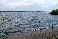
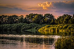
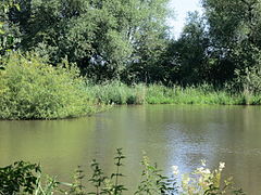
 Sprekelsmeer Sprekelsmeer
|
LSG DH 00001
|
Sprekelsmeer
|
4,50
|
324739
|
Position52.68558.62663
|
1968
|
|
|
LSG DH 00003
|
Kellenberg
|
1084,00
|
322081
|
Position52.59578.53996
|
1966
|
|
|
LSG DH 00008
|
Ostermoor - Felstehausener Schanzen
|
200,00
|
323571
|
Position52.63898.43293
|
1971
|
|
|
LSG DH 00009
|
Barnstorfer Huntetal
|
1475,80
|
319793
|
Position52.71668.49749
|
1967
|
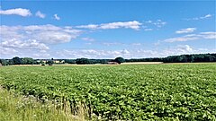
 Stemweder Berg 1 Stemweder Berg 1
|
LSG DH 00010
|
Stemweder Berg
|
717,90
|
324839
|
Position52.45568.4129
|
1971
|
|
|
LSG DH 00011
|
Wegenholz
|
96,00
|
325680
|
Position52.5328.71048
|
1965
|
|
|
LSG DH 00012
|
Böhrde/ Hohes Moor
|
635,00
|
320018
|
Position52.57288.86211
|
1966
|
 Der Dümmer am Windsurfer-Einstieg in Hüde Der Dümmer am Windsurfer-Einstieg in Hüde
|
LSG DH 00014
|
Dümmer
|
1169,70
|
320463
|
Position52.5148.34365
|
1981
|
|
|
LSG DH 00015
|
Maaser Höpen
|
40,00
|
322873
|
Position52.69598.89739
|
1967
|
 Sette Sette
|
LSG DH 00017
|
Die Sette
|
106,00
|
320353
|
Position52.49158.42161
|
1967
|
|
|
LSG DH 00018
|
Bauerbruch
|
230,00
|
319801
|
Position52.67678.41148
|
1967
|
 Diepholzer Moor 1 Diepholzer Moor 1
|
LSG DH 00019
|
Diepholzer Moor
|
26,00
|
320361
|
Position52.58348.31749
|
1968
|
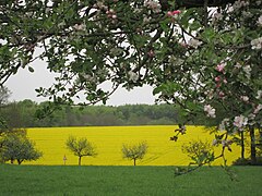
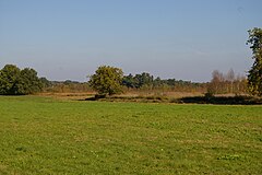
 Großes Meer (Landkreis Diepholz) Großes Meer (Landkreis Diepholz)
|
LSG DH 00020
|
Umgebung des Großen Meeres
|
90,00
|
325287
|
Position52.65398.58002
|
1968
|
|
|
LSG DH 00021
|
Oberwald
|
574,50
|
323422
|
Position52.75698.81274
|
1968
|
|
|
LSG DH 00022
|
Kuhbachtal
|
256,00
|
322353
|
Position52.76438.69651
|
1968
|
|
|
LSG DH 00023
|
Schwafördener Wald
|
100,00
|
324473
|
Position52.71978.85514
|
1968
|
|
|
LSG DH 00024
|
Eitzer Sunder
|
30,00
|
320581
|
Position52.8128.88235
|
1968
|
|
|
LSG DH 00025
|
Dickeler Sand
|
1315,00
|
320335
|
Position52.63988.50291
|
1968
|
|
|
LSG DH 00026
|
Urloge
|
930,00
|
325372
|
Position52.60928.75797
|
1968
|
|
|
LSG DH 00027
|
Sünder
|
440,00
|
324955
|
Position52.71688.94139
|
1968
|
|
|
LSG DH 00028
|
Varrel, Neue Horst, Dankelshorst und Hahnhorst
|
770,00
|
325383
|
Position52.75288.87573
|
1968
|
|
|
LSG DH 00029
|
Totenbruchsmoor
|
37,30
|
325203
|
Position52.76838.74254
|
1968
|
|
|
LSG DH 00030
|
Klausheide
|
166,10
|
322158
|
Position52.71688.53878
|
1968
|
|
|
LSG DH 00031
|
Papenhuser Sunder und Wiethoop
|
374,00
|
323613
|
Position52.8188.84975
|
1968
|
|
|
LSG DH 00032
|
Bockstedter Moor
|
430,00
|
319995
|
Position52.75638.52238
|
1968
|
 Aschener Moor Aschener Moor
|
LSG DH 00033
|
Aschener und Heeder Moor und Hoher Sühn
|
635,00
|
319673
|
Position52.65218.33262
|
1968
|
|
|
LSG DH 00034
|
Falkenhardt und Hengemühle
|
70,00
|
320739
|
Position52.62878.3616
|
1968
|
 Großes Renzeler Moor Großes Renzeler Moor
|
LSG DH 00035
|
Großes Renzeler Moor und Schwarzes Moor
|
1538,50
|
321204
|
Position52.56458.76314
|
1969
|
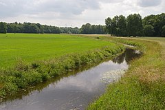 Kleine Aue Kleine Aue
|
LSG DH 00036
|
Kleine Aue
|
1522,30
|
322171
|
Position52.69628.74619
|
1969
|
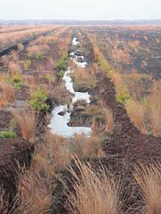
 Nördliches Wietingsmoor im LK Diepholz IMG 4052 Nördliches Wietingsmoor im LK Diepholz IMG 4052
|
LSG DH 00037
|
Nördliches Wietingsmoor
|
688,30
|
323277
|
Position52.73228.61416
|
1969
|
|
|
LSG DH 00038
|
Thielmannshorst, Lembrucher Torfmoor, Brockumer und Stemmer Moor
|
406,00
|
325158
|
Position52.51618.48444
|
1969
|
|
|
LSG DH 00039
|
Mühlenbach - Wedehorner Holz
|
671,10
|
323080
|
Position52.80738.72678
|
1969
|
|
|
LSG DH 00040
|
Weddigeloh
|
248,60
|
325678
|
Position52.66828.65999
|
1969
|
|
|
LSG DH 00041
|
Osterheide
|
95,00
|
323564
|
Position52.478.44523
|
1965
|
|
|
LSG DH 00042
|
Wetscher Fladder und Vossen Neufeld
|
1136,50
|
325847
|
Position52.59378.42379
|
1970
|
|
|
LSG DH 00043
|
Wackelberge und angrenzende Landschaftsteile
|
140,00
|
325492
|
Position52.63948.67507
|
1970
|
|
|
LSG DH 00044
|
Sulinger Moor und Maasener Moor
|
443,20
|
324948
|
Position52.65348.8616
|
1970
|
|
|
LSG DH 00045
|
Scharrel und Bargeloh
|
125,00
|
324119
|
Position52.69128.61802
|
1970
|
|
|
LSG DH 00046
|
Ochsenbruch
|
59,60
|
323431
|
Position52.47168.34428
|
1971
|
|
|
LSG DH 00047
|
Langer Berg
|
740,00
|
322513
|
Position52.56938.6798
|
1972
|
|
|
LSG DH 00048
|
Südliches Kuhbachtal, Bobrink und Groß Lessener Moor
|
1480,00
|
324919
|
Position52.69968.71186
|
1972
|
|
|
LSG DH 00049
|
Böttcher Moor
|
5,00
|
320044
|
Position52.97278.82197
|
1938
|
 Der See im August 2015 Der See im August 2015
|
LSG DH 00050
|
Kirchweyher See
|
160,00
|
322150
|
Position52.9958.88323
|
1975
|
|
|
LSG DH 00051
|
Ristedter Ölpott
|
7,00
|
323904
|
Position52.96218.77262
|
1939
|
|
|
LSG DH 00052
|
Siekholz
|
14,00
|
324565
|
Position52.89768.67534
|
1939
|
|
|
LSG DH 00053
|
Vorwerk Syke
|
2,00
|
325468
|
Position52.91288.84228
|
1948
|
|
|
LSG DH 00054
|
Leerßer Schlatt
|
2,00
|
|
Position52.92098.76279
|
1950
|

|
LSG DH 00056
|
Friedeholz
|
425,00
|
320891
|
Position52.91638.84958
|
1960
|
|
|
LSG DH 00057
|
Streitheide
|
32,00
|
324880
|
Position52.96078.79987
|
1964
|
|
|
LSG DH 00058
|
Die Gesseler Spreeken
|
30,00
|
320343
|
Position52.93638.80098
|
1964
|
|
|
LSG DH 00059
|
Westermark
|
701,50
|
325821
|
Position52.89398.7928
|
1964
|

|
LSG DH 00060
|
Hombach - Finkenbach - Klosterbach
|
2302,00
|
321748
|
Position52.92148.72291
|
1967
|
|
|
LSG DH 00061
|
Blankes Schlatt und Kleines Schlatt
|
7,00
|
319965
|
Position52.95068.85383
|
1969
|
|
|
LSG DH 00062
|
Kirchhof Stuhr
|
0,50
|
322142
|
Position53.02858.75119
|
1950
|
|
|
LSG DH 00063
|
Freidorf
|
269,00
|
320870
|
Position52.82618.87304
|
1971
|
|
|
LSG DH 00064
|
Dehmse
|
771,00
|
320295
|
Position52.82778.57305
|
1970
|
|
|
LSG DH 00065
|
Rutental
|
297,00
|
324057
|
Position52.8058.99031
|
1974
|
|
|
LSG DH 00066
|
Korbinsel
|
67,00
|
322281
|
Position53.02858.87008
|
1977
|
|
|
LSG DH 00067
|
Herrenhassel - Harbergerheide
|
417,00
|
321572
|
Position52.68989.00606
|
1971
|

|
LSG DH 00069
|
Wilshauser Moor
|
30,00
|
325898
|
Position53.01868.69933
|
1950
|

|
LSG DH 00070
|
Huntetal
|
420,00
|
321852
|
Position52.77188.46753
|
1971
|
|
LSG DH 00071
|
Harpstedter Geest I
|
206,00
|
321391
|
Position52.90728.65475
|
1973
|
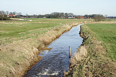
 Hinweistafel im LSG Dünsener Bach - Steller Heide Hinweistafel im LSG Dünsener Bach - Steller Heide
|
LSG DH 00072
|
Dünsener Bach - Steller Heide
|
335,00
|
320474
|
Position53.00778.66725
|
1972
|

|
LSG DH 00073
|
Hachetal I
|
8,60
|
321294
|
Position52.90098.82905
|
1990
|
|
|
LSG DH 00074
|
Rote Riede
|
270,00
|
323970
|
Position52.79328.67226
|
1992
|
 Klosterbach (Varreler Bäke) Klosterbach (Varreler Bäke)
|
LSG DH 00075
|
Klosterbach
|
338,00
|
322206
|
Position52.99988.70596
|
1995
|
|
|
LSG DH 00076
|
Kronsbruch bei Heiligenrode
|
156,00
|
322337
|
Position52.98728.73606
|
1995
|
|
|
LSG DH 00077
|
Hachetal II
|
350,30
|
321295
|
Position52.86268.84237
|
1996
|
|
|
LSG DH 00078
|
Heiligenloher Beeke und angrenzende Bachniederungen
|
400,00
|
321515
|
Position52.77048.54349
|
1996
|
|
|
LSG DH 00079
|
Brinkumer Kronsbruch
|
176,00
|
320094
|
Position53.00728.75997
|
1996
|
|
|
LSG DH 00080
|
Schlatts in der Leerßer Moorheide
|
160,00
|
555632916
|
Position52.92098.7628
|
2016
|
|
|
LSG DH 00081
|
Hache, Ochtum, Klosterbach/Varreler Bäke
|
94,1
|
555632907
|
Position53.02268.817
|
2016
|
|
|
LSG DH 00082
|
Steller Heide
|
78
|
555518501
|
Position53.01628.6816
|
2017
|
|
|
LSG DH 00083
|
Wälder und Schlatts am alten Forstamt Erdmannshausen
|
133
|
555638515
|
Position52.75588.811
|
2017
|
- LSG DH 084 Libellen-Biotop Swinelake 20 ha FFH-Gebiets-Nr. 409
- LSG DH 085 Rathloser Gehäge119 ha FFH-Gebiets-Nr. 287
- LSG DH 086 Schlatts am Wietingsmoor 57 ha FFH-Gebiets-Nr. 286
- LSG DH 087 Neustädter Moor 508 ha FFH-Gebiets-Nr. 67
- LSG DH 088 Hespelohmoor, Holzhauser Bruch und Kulturlandschaft am Renzeler Moor
- LSG DH 089 Rehdener Geestmoor
Anmerkungen
- ↑ Koordinaten wurden dem European Nature Information System (EUNIS) der Europäischen Umweltagentur entnommen: Nationally designated areas (CDDA), Datei CDDA_v12_csv.zip, Stand Oktober 2014. Die Tabellenspalte WDPA-ID gibt die genauen Grenzen an.
Siehe auch
Weblinks
|


.jpg)


.JPG)