|
Phanom Dong Rak district
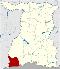
Phanom Dong Rak (Thai: พนมดงรัก, pronounced [pʰā.nōm dōŋ rák]) is the southwesternmost district (amphoe) of Surin province, northeastern Thailand. HistoryThe area was separated from Kap Choeng district and made a minor district (king amphoe) on 1 April 1995.[1] On 15 May 2007, all 81 minor districts were upgraded to full districts.[2] On 24 August the upgrade became official.[3] GeographyNeighboring districts are (from the west clockwise): Ban Kruat of Buriram province; Prasat, Kap Choeng of Surin Province; and Oddar Meancheay of Cambodia. The district is in the Phanom Dong Rak Range, the hills that form a boundary between Thailand and Cambodia. The name of the district translates as 'Dongrak Mountains'. AdministrationThe district is divided into four sub-districts (tambons), which are further subdivided into 55 villages (mubans). There are no municipal (thesaban) areas. There are four tambon administrative organizations (TAO).
References
External links |
|||||||||||||||||||||||||||||||||||||||||||||||||||||||||||
Portal di Ensiklopedia Dunia
