|
Kalmakanda Upazila
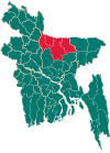
Kalmakanda (Bengali: কলমাকান্দা), originally Karamakhanda, is an upazila of Netrokona District[3] in the Division of Mymensingh, Bangladesh. GeographyKalmakanda is located at 25°05′00″N 90°53′30″E / 25.0833°N 90.8917°E. It has 39275 households in total area 377.41 km2. The upazila is bounded by Meghalaya state of India on the north, Barhatta and Netrokona sadar upazilas on the south, Dharmapasha upazila on the east, Durgapur upazila on the west. DemographicsAccording to the 2011 Census of Bangladesh, Kalmakanda Upazila had 58,069 households and a population of 271,912. 80,534 (29.62%) were under 10 years of age. Kalmakanda has a literacy rate (age 7 and over) of 36.58%, compared to the national average of 51.8%, and a sex ratio of 1016 females per 1000 males. 14,383 (5.29%) lived in urban areas.[5] Ethnic population is 11,613 (4.27%), of which Garo are 8,231 and Hajong 3,172.[6] As of the 1991 Bangladesh census, Kalmakanda had a population of 209,360. Males made up 50.99% of the population, and females 49.01%. The over 18 population of Upazila numbers 103,227. Kalmakanda had an average literacy rate of 21.4% (7+ years); the national average is 32.4%.[7] AdministrationKalmakanda Thana was formed in 1941 and it was turned into an upazila in 1983.[3] Kalmakanda Upazila is divided into eight union parishads: Barakharpan, Kaitali, Kalmakanda, Kharnai, Langura, Nazirpur, Pogla, and Rangchhati. The union parishads are subdivided into 177 mauzas and 347 villages.[8] Notable residents
See alsoReferences
|
||||||||||||||||||||||||||||||
Portal di Ensiklopedia Dunia

