|
Dhobaura Upazila
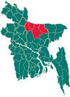
Dhobaura (Bengali: ধোবাউড়া) is an upazila of the Mymensingh District in Bangladesh.[3] HistorySince ancient times, Dhobaura has been inhabited by the Garo people. During the Mughal period, a mosque was built in the village of Darsha which is now in ruins.[4] Dhobaura was formerly known as Jikkowa Bazar. In the mid-18th century, the area was home to Babu Gauriballabh Sen, a prominent agriculturalist. At that time several dhobis led by a dhobi named Sita lived on the bank of a pond (today known as Sita Dighi) that was part of Sen's agricultural land. One day, Sita went missing and could not be found. Her body was found a few days later, floating in the pond. Thinking it was a ghostly incident, Sita's dhobis left the bank and migrated to an unknown place without informing anyone. The village then came to be known as Dhobaura, meaning floating dhoba in the Bengali language. A mouza centered in Dhobaura was later established and not long after it became a union parishad. In 1976, Dhobaura became a thana and in 1983 it was upgraded to an upazila.[4] From 1937 to 1949, Moni Singh's tanka movement spread to Dhobaura. During the Bangladesh Liberation War of 1971, a confrontation took place between the freedom fighters and the Pakistan Army on 19 July. 11 people were killed, including two freedom fighters. On 3 October at midnight, the Pakistani army surprise attacked the Mukti Bahini camp at Guatala Bazar, murdering four freedom fighters. A mass killing was conducted the next day in the same place as well as in Taraikandi Ferry Ghat leading to 120 deaths. 7 mass graves were discovered in Guatala, Taraikandi, Zigatala, Defulia Para, Digalbagh, Milagara, and Goborchena. GeographyDhobaura Upazila (Mymensingh district) with an area of 252.23 km2, is bounded by Meghalaya (Indian) on the north, Phulpur and Purbadhala upazilas on the south, Durgapur upazila on the east, Haluaghat upazila on the west. Main rivers are Nitai and Kangsa. There are many hillocks in the northern region of the upazila. Dhobaura is located at 25°05′30″N 90°32′00″E / 25.0917°N 90.5333°E. It has 44,007 households and a total area of 252.23 km2. DemographicsAccording to the 2011 Census of Bangladesh, Dhobaura Upazila had 44,007 households and a population of 196,284. 59,105 (30.11%) were under 10 years of age. Dhobaura has a literacy rate (age 7 and over) of 29.36%, compared to the national average of 51.8%, and a sex ratio of 1035 females per 1000 males. 6,927 (3.53%) lived in urban areas.[6][7] Bengali Muslims are the majority community in the upazila. 10,765 (5.48%) were members of ethnic population groups, mainly 9,803 Garo and 908 Hajong. Christianity is the second-largest religion, mainly present among the Garo. Hinduism is the third-largest religion, practiced by the Hajong. Languages prevalent in the upazila include Bengali, Arabic, English, Garo and Hajong. Economy and tourismA porcelain mine was discovered in the village of Vedikura in Dakshin Maijpara union.[3] Several Dhobaura's residents are employed abroad in countries such as Malaysia, Saudi Arabia, Bahrain, Kuwait, Singapore and the United Arab Emirates. There are a number of tourist attractions in Dhobaura Upazila. The historic village of Darsha has a very old 3.3-acre pond known as Patharkata as well as ruins of a mosque dating back to the Mughal era. The 7.4-acre Dharam Shah reservoir in Langaljora, Gamaritala is also quite popular. Dhobaura is also home to the practice of bullfighting.[4] AdministrationDhobaura thana, now an upazila, was established in 1976. Porakandulia. The union parishads are subdivided into 99 mazes and 164 villages.[8] The area of the town is 3.82 km2. The town has one dak bungalow. EducationAverage literacy is 65%; males 68% and females 62%. Educational institutions: college 3, high school 20, junior high school 3, madrasa 6, government primary school 43, non-government 44 and kindergarten school 6. See alsoReferences
|
||||||||||||||||||||||||||||||||||||

