|
Batiaghata Upazila
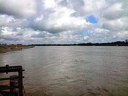
Batiaghata (Bengali: বটিয়াঘাটা) is an upazila of Khulna District in the Division of Khulna, Bangladesh.[3] GeographyBatiaghata is located at 22°44′30″N 89°31′00″E / 22.7417°N 89.5167°E. The Kajibacha river divides it into an eastern and a western part.[3] It has 40779 households and total area 248.31 km2. DemographicsAs of the 2011 Census of Bangladesh, Batiaghata upazila had 40,779 households and a population of 171,691. 32,365 (18.85%) were under 10 years of age. Batiaghata had an average literacy rate of 54.90%, compared to the national average of 51.8%, and a sex ratio of 981 females per 1000 males. 7,675 (4.47%) of the population lived in urban areas.[5][6] According to the 1991 Bangladesh census, Batiaghata had a population of 128184. Males constituted 51.07% of the population, and females 48.93%. The population aged 18 or over is 71,463. Batiaghata has an average literacy rate of 37.7% (7+ years), compared to the national average of 32.4%.[7] Points of interest
AdministrationBatiaghata Upazila is divided into seven union parishads: Amirpur, Baliadanga, Botiaghata, Gongarampur, Jolma, Surkhali, and Vandarkote. The union parishads are subdivided into 127 mauzas and 172 villages.[8] EducationPrimary schools
Secondary school
College
Nearest tourist points
See alsoReferences
|
||||||||||||||||||||||||||||||||
Portal di Ensiklopedia Dunia


