Khulna (Bengali: খুলনা, [ˈkʰulna]) is the third-largest city in Bangladesh, after Dhaka and Chittagong.[4] It is the administrative center of the Khulna District and the Khulna Division. Khulna's economy is the third-largest in Bangladesh, contributing $53 billion in gross regional domestic product and $95 billion in purchasing power parity (PPP) in 2020. In the 2024 census, the city corporation area had a population of 884,445.[5]
Khulna is on the Rupsha and Bhairab River, a strategic point in southwestern Bangladesh. It is also a center of Bangladeshi industry, hosting many of the nation's largest companies. It is served by the Port of Mongla, Bangladesh's second-largest seaport.
Khulna was part of the ancient kingdoms of Vanga, Gangaridai and Samatata. After the end of the Pala Empire, it was ruled by the Sena dynasty during the 12th-century reign of Ballala Sena, and formed part of the Bagri division of Bengal.
During the 14th century, Shamsuddin Firoz Shah was the first Muslim ruler to arrive in the city. Muslim settlements increased during the time of Shamsuddin Ilyas Shah, and many mosques and shrines were established. A Muslim saint, Khan Jahan Ali, acquired a jagir (fiefdom) encompassing a large part of Khulna Division from the king of Gauḍa during the 15th century and renamed the region as Jahanabad. Ali ruled until he died in 1459.[8]
After Ali's death, the city became part of the Bengal Sultanate. During the reign of Daud Khan Karrani in the 16th century, Vikramaditya (one of Karrani's chief ministers) obtained a grant in southern Bengal—including Khulna—when Karrani was fighting the Mughals. Vikramaditya established a sovereign kingdom with its capital at Iswaripur (in present-day Satkhira District). He was succeeded by his son, Pratapaditya, who gained preeminence over the Baro-Bhuyans and controlled southern Bengal. Vikramaditya was defeated by Raja Man Singh I, a Hindu Rajput general of the Mughal emperor Akbar, in 1611.[9]
Khulna was ruled by autonomous Bengali nawabs until 1793 when the British East India Company abolished nizamat (local rule) and took control of the city. Becoming part of Jessore District in 1842, it became the headquarters of Khulna District (the Khulna and Bagerhat subdivisions of Jessore District, the Satkhira subdivision of 24 Parganas district, and the Sundarbans) in 1882.[9] Khulna had a pouroshava (municipal council) in 1884, which became a municipal corporation in 1984.
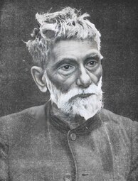
Before 19 August 1947, Khulna District was part of undivided Bengal. Khulna first declared itself as part of India in 1947, and the Indian flag was flown on 15 August. Syed Mohammad Abdul Halim (an official of the Bengali civil service) requested Khulna's inclusion in Pakistan, and the boundary commission declared that the city was part of East Bengal. Sher e Bangla A.K.Fazlul Haq, Muslim League leaders Khan A Sabur, Advocate Hamidul Haq Chowdhury, A. F. M. Abdul Jalil, and Abdul Mojid Khan were also involved in the process.
Pakistani Eastern Command plan for the defense of East Pakistan from 1967 to 1971 (generic representation—some unit locations not shown)
Khulna is Bangladesh's third-largest city, after Dhaka and Chittagong. It is in the southwestern part of the country, on the Rupsha and Bhairab Rivers. Even though the city corporation area is 45.65 square Kilometres, The total city area covers 150.57 square kilometres (58.14 sq mi),[12] and Khulna District covers 4,394.46 square kilometres (1,696.71 sq mi). Khulna is south of Jessore and Narail District, east of Satkhira District, west of Bagerhat and north of the Bay of Bengal. It is part of the Ganges Delta, the world's largest river delta. Sundarbans, the world's largest mangrove forest, is in the southern part of the delta. Tidal-flat ecosystems are adjacent to the city.[13] Khulna is in the northern part of the district, and the Mayur River is the western boundary of its metropolitan area.
Climate
In the Köppen climate classification, Khulna has a tropical wet and dry climate. The city is hot and humid during summer, and pleasantly warm during winter. Khulna is significantly affected by the Monsoon of South Asia. Khulna gets less rainfall than other parts of Bangladesh due to its location and the effects of the Sundarbans south of the city. Its annual average rainfall is 1,878.4 mm (73.95 in)h about 87 percent falling between May and October. Khulna also receives heavy rain from cyclones which form in the Bay of Bengal. The city has an annual average temperature of 26.3 °C (79.3 °F), with monthly averages ranging from 11.4 °C (52.5 °F) on January mornings to 34.6 °C (94.3 °F) during April afternoons.
Khulna is one of two principal naval command centers for the Bangladesh Navy. The BNS Titumir naval base is in the city. Jahanabad Cantonment, containing the Army Service Corps Center and School (ASCC&S), is 15 kilometres (9.3 mi) from Khulna.
Demographics
In the 2011 census, Khulna City Corporation had a population of 751,237 in 177,852 households. Khulna had a sex ratio of 923 females to 1000 males and a literacy rate of 72.7%.[16]
Like the rest of Bangladesh, most of the city's population is Bengali. Khulna's native residents are known as Khulnaiya. Its population also consists of people from neighboring districts (including Noakhali District), BarisalFaridpur Division, and Bihar.
Most residents speak Bengali (the national language), its dialects, and regional languages. English is understood by a large segment of the population, especially in business. An Urdu-speaking population, descendants of Muslims displaced from Bihar in 1947 who sought refuge in East Bengal, lives in the city's Khalishpur area.
Islam is Khulna's major religion, practiced by 90.04% of the population. Other religions are Hinduism (practiced by 8.71%), and Christianity (1.23%).[16]
Khulna is Bangladesh's third-largest economic center. North of the Port of Mongla, it has a variety of industries. Major sectors are jute, chemicals, fish and seafood packaging, food processing, sugar milling, power generation and shipbuilding. The Khulna Chamber of Commerce and Industry (KCCI) regulates commerce through its Licensed Measurers' Department (LMD) and certification, attestation, and publicity departments. The region has an Export Processing Zone, attracting foreign investment. The city is home to branch offices of several national companies, including M. M. Ispahani Limited, BEXIMCO, James Finlay Bangladesh, Summit Power and the Abul Khair Group. Khulna's largest companies include Khulna Shipyard, Bangladesh Cable Shilpa Limited, Bangladesh Oxygen, Platinum Jubilee Mills, Star Jute Mills, and the Khulna Oxygen Company.
Rickshaws are the most popular means of public transport in Khulna for short trips, and auto rickshaws are also common. Nagar Paribahan buses have frequent service between Rupsha and Phultala, with stops throughout Khulna. Motorcycles are popular among the middle class, but wealthier people prefer a private car.
The N7 highway connects Khulna with the rest of Bangladesh, and the Khulna City Bypass is a major road. The R760 connects Satkhira and western Khulna Districts. There are several nationwide bus services available in Khulna (most privately owned), and the Bangladesh Road Transport Corporation operates inter-district buses from the city. Sonadanga Bus Terminal is Khulna's main bus terminal. Major bus routes include Khulna-Jessore-Dhaka; Khulna-Goplaganj-Dhaka; Khulna-Jessore-Kushtia; Khulna-Satkhira; Khulna-Bagerhat; Khulna-Mongla; Khulna-Narail; Khulna-Barisal; Khulna-Rajshahi; Khulna-Faridpur; Khulna-Kuakata, and Khulna-Dhaka-Chittagong.
There is public transportation in Khulna city through the mid 19's. Buses of that urban transportation of Khulna city were called 'Murir Tin'. Today besides the urban transportation buses, Cycle rickshaw, auto rickshaws are playing a vital role in transport within Khulna city and the adjoining metro area. Famous ride sharing services like Uber, Pathao, Obhai also available in the city.
There are also bus and mini-bus services on some routes, connecting suburban areas of the city. Plenty of rental car agencies operate within the city and metro area, where sedans, SUVs, and micro-buses are available to hire hourly or daily.
Print media include the Daily Purbanchal, Daily Janmabhumi, Daily Shomoyer Khobor and Dakhinanchal Protidin. The Daily Tribune is the only English-language newspaper. Electronic media include the Khulna Gazette,[22]Protidin Shebok,[23]Shomoyer Khobor.[24] Radio stations are Bangladesh Betar Khulna, Radio Today (89.6 MHz), Radio Foorti (88.0), and Radio Khulna FM (88.8).
English noble family and quasi-royal family This article needs additional citations for verification. Please help improve this article by adding citations to reliable sources. Unsourced material may be challenged and removed.Find sources: House of Beaufort – news · newspapers · books · scholar · JSTOR (September 2014) (Learn how and when to remove this message) House of BeaufortArms of Beaufort: The royal arms of King Edward III differenced by a bordure c…
Le lichen Xanthoria elegans peut effectuer la photosynthèse jusqu'à −24 °C[1]. Un psychrophile (du grec ψυχρός / psukhros, « le froid », et φίλος / phílos, « ami »), psychrotolérant ou cryophile (du grec κρύος / krúos, « froid ») est un organisme capable de vivre dans les mers polaires ou les abysses (90 % du volume des océans est en dessous de 5 °C [41 °F][2]), les sols gelés ou dans les glaciers.…
One of the 234 State Legislative Assembly Constituencies in Tamil Nadu, in India VedasandurConstituency No. 133 for the Tamil Nadu Legislative AssemblyConstituency detailsCountryIndiaRegionSouth IndiaStateTamil NaduDistrictDindigulLS constituencyKarurEstablished1952Total electors2,63,311[1]ReservationNoneMember of Legislative Assembly16th Tamil Nadu Legislative AssemblyIncumbent S. Gandhirajan Party DMKElected year2021 Vedasandur is a legislative assembly[2][3]…
لمعانٍ أخرى، طالع لور (توضيح). لور تقسيم إداري البلد إيران إحداثيات 26°52′58″N 57°27′49″E / 26.882778°N 57.463611°E / 26.882778; 57.463611 تعديل مصدري - تعديل لور هي قرية في مقاطعة أرومية، إيران. عدد سكان هذه القرية هو 317 في سنة 2006.[1] مراجع ^ تعداد سكان جمهورية إيران ال�…
Unincorporated community in Delaware, United StatesFarnhurst, DelawareUnincorporated communityFarnhurstShow map of DelawareFarnhurstShow map of the United StatesCoordinates: 39°41′35″N 75°34′39″W / 39.69306°N 75.57750°W / 39.69306; -75.57750CountryUnited StatesStateDelawareCountyNew CastleElevation43 ft (13 m)Time zoneUTC-5 (Eastern (EST)) • Summer (DST)UTC-4 (EDT)Area code302GNIS feature ID216946[1] Farnhurst is an unincorporated…
This article is about the region of the southern United States. For the college athletic conference, see Sun Belt Conference. For the region in Europe, see Golden Banana. Region of the southern United States The Sun Belt, highlighted in red The Sun Belt is a region of the United States generally considered stretching across the Southeast and Southwest. Another rough definition of the region is the area south of the 36th parallel. Several climates can be found in the region — desert/semi-desert…
Patrialis Akbar Hakim Konstitusi Republik IndonesiaMasa jabatan13 Agustus 2013 – 27 Januari 2017PresidenSusilo Bambang YudhoyonoJoko WidodoPendahuluProf. Dr. Ahmad Sodiki, S.HPenggantiProf. Dr. Saldi Isra, S.H., M.P.A.Menteri Hukum dan Hak Asasi Manusia Indonesia ke-28Masa jabatan22 Oktober 2009 – 19 Oktober 2011PresidenSusilo Bambang YudhoyonoPendahuluMohammad Andi MattalattaPenggantiAmir SyamsuddinAnggota Dewan Perwakilan Rakyat Republik IndonesiaMasa jabatan1 Oktober…
سيفكابين الاسم النظامي (6R,7R)-3-{[(Aminocarbonyl)oxy]methyl}-7-{(Z)-[2-(2-amino-4-thiazolyl)-1-oxo-2-pentenyl]amino}-8-oxo-5-thia-1-azabicyclo(4.2.0)oct-2-ene-2-carboxylic acid اعتبارات علاجية ASHPDrugs.com أسماء الدواء الدولية طرق إعطاء الدواء Oral معرّفات CAS 135889-00-8 Y ك ع ت J01J01DD17 DD17 تصنيف منظمة الصحة العالمية المراقبة [لغات أخرى][1] …
This article has multiple issues. Please help improve it or discuss these issues on the talk page. (Learn how and when to remove these template messages) The topic of this article may not meet Wikipedia's notability guideline for books. Please help to demonstrate the notability of the topic by citing reliable secondary sources that are independent of the topic and provide significant coverage of it beyond a mere trivial mention. If notability cannot be shown, the article is likely to be merged, …
Rusli Baco Dg. Palabbi Wakil Gubernur Sulawesi TengahMasa jabatan26 Agustus 2019 – 16 Juni 2021PresidenJoko WidodoGubernurLongki DjanggolaPendahuluSudartoPenggantiMa'mun Amir Informasi pribadiLahir24 Juli 1966 (umur 57) Banggai, Sulawesi TengahKebangsaan IndonesiaPartai politikPartai Bintang Reformasi (2000–2011)[1]Partai Amanat Nasional (sejak 2011)Suami/istriMasturaAlma materSekolah Tinggi Ilmu Administrasi Pembangunan PaluUniversitas Muhammadiyah PaluUniversitas…
Old open cluster in the constellation Cancer Messier 67Open cluster Messier 67 in CancerObservation data (J2000.0 epoch)Right ascension08h 51.3mDeclination+11° 49′Distance~2.61–2.93 kly (800–900 pc[1][2][3][4])Apparent magnitude (V)6.1Apparent dimensions (V)30.0′Physical characteristicsRadius10 ly[citation needed]Estimated age3.2 to 5 billion yearsOther designationsNGC 2682, Cr 204AssociationsConstellationCancerSee also: O…
Since 1991, head of state of the RSFSR and Russia President of the Russian FederationПрезидент Российской ФедерацииPresidential emblemPresidential standardIncumbentVladimir Putinsince 7 May 2012Presidential Administration of RussiaStyleMr President(informal)Comrade Supreme Commander(military)His Excellency[1](diplomatic)TypePresidentStatusHead of state Commander-in-chiefMember ofState CouncilSecurity CouncilSupreme Eurasian Economic CouncilResidenceMoscow…
This template does not require a rating on Wikipedia's content assessment scale.It is of interest to the following WikiProjects:Medicine Medicine portalThis template is within the scope of WikiProject Medicine. Please visit the project page for details or ask questions at Wikipedia talk:WikiProject Medicine.MedicineWikipedia:WikiProject MedicineTemplate:WikiProject Medicinemedicine articles Psychology Psychology portalThis template is within the scope of WikiProject Psychology, a collaborative e…
St. Catherine's Island redirects here. For other uses, see St. Catherine's Island, Tenby. United States historic placeSt. Catherine's IslandU.S. National Register of Historic PlacesU.S. National Historic Landmark District Salt marsh on the islandShow map of GeorgiaShow map of the United StatesNearest citySouth Newport, GeorgiaCoordinates31°37′50″N 81°9′36.5″W / 31.63056°N 81.160139°W / 31.63056; -81.160139Area22,265 acres (90.10 km2)[2]Built1566Ar…
Disambiguazione – Se stai cercando altri significati, vedi Benevento (disambigua). Beneventocomune Benevento – Vedutain senso orario in alto a destra: L'Arco di Traiano, la Basilica della Madonna delle Grazie, La Chiesa Longobarda di Santa Sofia, il Teatro Romano e la Villa dei Papi LocalizzazioneStato Italia Regione Campania Provincia Benevento AmministrazioneSindacoClemente Mastella (Noi Campani) dal 20-6-2016 (2º mandato dal 22-10-2021) TerritorioCoordina…
Executive aircraft family by Dassault Falcon 900 A Spanish Air Force Dassault Falcon 900B Role Business jetType of aircraft National origin France Manufacturer Dassault Aviation First flight 21 September 1984; 39 years ago (1984-09-21) Status Active service, in production Primary users French Air and Space ForceJapan Coast GuardNigerian Air ForceRoyal Malaysian Air Force Produced 1984–present Number built >500[1] Developed from Dassault Falcon 50 Variants Dass…
For the radio station in Baltimore, Maryland at 106.5 FM known as WMKR from 1985-1986, see WWMX. Radio station in Pana, IllinoisWMKRPana, IllinoisBroadcast areaTaylorville, IllinoisFrequency94.3 MHz (HD Radio)BrandingGenuine Country 94.3 WMKRProgrammingFormatCountrySubchannelsHD1: WMKR analogHD2: Country New Country 104.1HD3: Soft oldies 96.5 The ChillHD4: Same as HD2OwnershipOwnerMiller Communications, Inc.Sister stationsWRANHistoryFirst air dateJuly 12, 1996Technical informationFacility ID4264…

.jpg)


_%E0%A6%AA%E0%A6%B0%E0%A6%BF%E0%A6%95%E0%A6%B2%E0%A7%8D%E0%A6%AA%E0%A6%A8%E0%A6%BE.png)


.jpg)


")


")


