|
Al-Masara
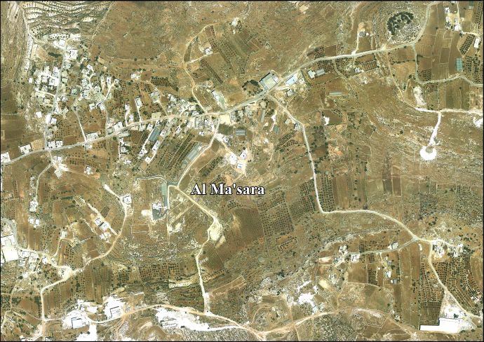
Al-Masara (Arabic: المعصرة, pronounced al-Ma'sara; translation: "the press") is a Palestinian village in the central West Bank, 6.2 km southwest of Bethlehem, part of the Bethlehem Governorate. It is surrounded by a number of smaller Palestinian villages, including Khallet al-Haddad to the east.[2] The population was 1,085 in the 2017 census by the Palestinian Central Bureau of Statistics (PCBS).[1] HistoryName. ArchaeologyIts name, which translates as "the press", derives from the Byzantine Empire-era olive press still located in al-Ma'sara.[2] In 1883 the PEF's Survey of Western Palestine (SWP) noted "heaps of stones and cisterns" at Khurbet Marsia.[3] Establishment (1930)The modern town was founded in 1930 by members of the Arab al-Zawahra and at-Ta'mirah tribes.[2] Post-1967After the Six-Day War in 1967, Al-Masara has been under Israeli occupation. InstitutionsA seven-member local development committee was established by the Palestinian National Authority (PNA) to administer the village, most which is located in Area B giving the PNA jurisdiction over al-Ma'sara's civil affairs.[2] The head of the committee is Mahmoud Alaeddin.[4] There is one mosque, al-Ma'sara Mosque, and a primary and secondary school in the village.[2] EconomyAgriculture accounts for 70% of al-Ma'sara's economic activity, while the civil sector makes up 16%. The total land area is 973 dunams, of which 42 dunams are designated built-up. Most of the remainder is arable land, 505 dunams of which are cultivated.[2] References
Bibliography
External links
|
||||||||||||||||||||||||||||||||||||||||||||||||||||||||||


Portal di Ensiklopedia Dunia