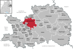
Abtsgmünd

Abtsgmünd
Coat of arms of Abtsgmünd
Location of Abtsgmünd within Ostalbkreis district
Schwäbisch GmündHeidenheim (district)Schwäbisch-Hall (district)Rems-Murr-KreisGöppingen (district)AalenAbtsgmündAdelmannsfeldenBartholomäBöbingen an der RemsBopfingenDurlangenEllenbergEllwangenEschachEssingenGöggingenGschwendHeubachHeuchlingenHüttlingenHüttlingenIggingenJagstzellKirchheim am RiesLauchheimLeinzellLorchMögglingenMutlangenNeresheimNeulerObergröningenOberkochenRainauRiesbürgRiesbürgRosenbergRuppertshofenSchechingenSchwäbisch GmündSpraitbachStödtlenTäferrotTannhausenTannhausenUnterschneidheimWaldstettenWaldstettenWesthausenWörtBavaria
Abtsgmünd is located in Germany
Abtsgmünd
Abtsgmünd
Abtsgmünd is located in Baden-Württemberg
Abtsgmünd
Abtsgmünd
Coordinates: 48°53′39″N 10°00′14″E / 48.89417°N 10.00389°E / 48.89417; 10.00389
CountryGermany
StateBaden-Württemberg
Admin. regionStuttgart
DistrictOstalbkreis
Government
 • Mayor (2018–26) Armin Kiemel[1]
Area
 • Total71.6 km2 (27.6 sq mi)
Elevation
375 m (1,230 ft)
Population
 (2022-12-31)[2]
 • Total7,582
 • Density110/km2 (270/sq mi)
Time zoneUTC+01:00 (CET)
 • Summer (DST)UTC+02:00 (CEST)
Postal codes
73453
Dialling codes07366
Vehicle registrationAA
Websitewww.abtsgmuend.de

Abtsgmünd is a municipality in the German state of Baden-Württemberg, in Ostalbkreis district. Abtsgmünd is located at the confluence of two streams, the Lein and the Kocher. The large area municipality consists of the main town of Abtsgmünd as well as the five districts of Neubronn, Laubach, Untergröningen, Hohenstadt and Pommertsweiler and their associated villages and hamlets. The municipality is a state-recognized recreation area in the Swabian-Franconian Forest Nature Park.

Until 2006, Abtsgmünd was host to the Summer Breeze Open Air metal festival.[3]

Geography

Geographic Location

Abtsgmünd has a share in the natural regions of the Eastern Alb Foreland and the Swabian-Franconian Forest Mountains, both of which belong to the Swabian Keuper-Lias Lands.[4] With 71.6 km² and 7,456 inhabitants, the municipality of Abtsgmünd is the largest municipality in the Ostalbkreis district after the towns, both in area and population.

The main town of Abtsgmünd lies at the confluence of the Lein river into the Kocher (confluence elevation 367.4 m above sea level), predominantly on the left bank of the Kocher and left bank of the Lein. The furthest district of Untergröningen lies over 8 km west-northwest as the crow flies along two river bends on both sides of the Kocher, which there runs at about 355 meters above sea level after about 14 km of waterway.

Neighboring Municipalities

Clockwise from the north, Abtsgmünd borders Adelmannsfelden, Neuler and a small exclave of Hüttlingen, Aalen, Heuchlingen, Schechingen and Obergröningen, Eschach (all in the Ostalbkreis district), and Sulzbach-Laufen (Schwäbisch Hall district).

Municipal Division

Water tower in the Hohenstadt district

The present-day municipality of Abtsgmünd includes the formerly independent municipalities of Abtsgmünd, Hohenstadt, Laubach, Neubronn, Pommertsweiler and Untergröningen with a total of almost 80 villages, hamlets, farms and houses.

In the Abtsgmünd district there is the village of Abtsgmünd, the hamlets of Altschmiede, Hangendenbuch, Neuschmiede, Schäufele, Vorderbüchelberg, Wilflingen and Wöllstein, the farmstead Birkholz and the residential areas Ausägmühle, Fischbach, Öl- und Sägmühle and Pulvermühle. In the Hohenstadt district there is the village of Hohenstadt, the hamlets of Börrat, Butzenberg, Christhäuser, Kocherhof, Köhrhof, Maisenhäuser, Reichertshofen, Rötenbach, Schafhäuser and Steinreute and the farms Bernhardshof, Brastelhof, Fischhaus, Frauenhof and Sandhof. In the Laubach district there is the village of Laubach, the hamlets of Berg, Haag and Leinroden (with Evangelical Church), the town of Roßnagel, the farms Blumenhof, Eichhornhof, Kauhof and Schneiderhaus and the residential area Lustenau. In the Neubronn district there is the village of Neubronn and the farms Eiderhalden, Kellerhaus and Spatzenmühle. In the Pommertsweiler district there is the village of Pommertsweiler, the hamlets of Hinterbüchelberg, Höfenhölzle, Hohenhöfen, Lutstrut, Seelach, Straßdorf, Wildenhäusle, Wildenhof and Zimmerberg, the farms Altweiher, Hammerschmiede, Herrenwald, Mittelhohlenbach (partly also in the Untergröningen district), Neumühle and Ziegelhütte and the residential area Oberhohlenbach (partly also in the Untergröningen district). In the Untergröningen district there is the village of Untergröningen, the hamlets of Billingshalden (Schweizerhof), Burren, Dinkbühl, Letten, Öchsenhof, Rötenbach, Rötenberg and Wegstetten and the residential areas Amselhöfle, Bach, Gschwendhof, Herrenfeld, Märzenhäusle, Mittelhohlenbach (partly also in the Pommertsweiler district), Oberhohlenbach (partly also in the Pommertsweiler district) and Tyrol. Defunct, no longer existing settlements include Wisemberg (Bisems?), Bläsihof and a castle in the Abtsgmünd district, Langenhalde in the Neubronn district, Buelenberg, Otolfsweiler, Deschental and Unterhohlenbach in the Pommertsweiler district as well as Hurrenhof or Steinhöfle, mill, sawmill on the Ochsenbach, Beim Gschwendhof, Steinhalden and Spitz in the Untergröningen district.[5]

History

Until the 18th Century

Abtsgmünd was likely founded from Ellwangen. The town gets its name from the confluence of the Lein into the Kocher river and its affiliation with Ellwangen Monastery (The Gemunden of the Abbot, as distinct from other Gemunden places). Thus, Abtsgmünd is likely an Ellwangen foundation after the 7th century, though the exact time is unknown.

The Ellwangen Monastery established the town to secure its forested area to the southwest. In a property directory of Ellwangen Monastery from 1136, Abtsgmünd is mentioned by the name Gemunden. In the 13th century, the name was changed to Abtzgemunde to avoid confusion with the later Imperial City of Gmünd. This name first appeared in a document by King Conrad IV in 1251.

The late Romanesque ground floor of the parish church tower, built around 1200, shows that the settlement existed earlier.

The Wöllstein Castle was built from Abtsgmünd to secure the rule against the Schenken von Limpurg. The owners changed frequently, but the feudal lordship of the Prince-Provostry of Ellwangen remained intact. An official was appointed to administer it, residing in Wöllstein. In 1609, Heuchlingen, Abtsgmünd and Wöllstein formed the Ellwangen district of Heuchlingen, with the district administrator's seat in Abtsgmünd.

Due to its affiliation with the Prince-Provostry of Ellwangen, Abtsgmünd remained Catholic during the Reformation, while the Kocher valley from Schwäbisch Hall up to Untergröningen became Protestant in 1544.

In the 17th century, the Prince-Provosts founded ironworks. In 1611, a blast furnace was established in Altschmiede in Abtsgmünd, later followed by a forging works. It was destroyed in the Thirty Years' War but rebuilt as a forging works in 1667. In 1699, the works were relocated from the Altschmiede district to Neuschmiede.

19th and 20th Centuries

During the secularization in 1803, Abtsgmünd fell to the territories of New Württemberg and became part of the Kingdom of Württemberg in 1806. The Abtsgmünd ironworks became part of the Swabian Ironworks based in Wasseralfingen. From 1803 to 1934, Abtsgmünd belonged to the Oberamt of Aalen. During administrative reforms in Nazi-era Württemberg, Abtsgmünd was reassigned in 1934 to the Aalen district and in 1938 to the newly structured Aalen county. In 1945, the town became part of the American occupation zone and thus part of the newly founded state of Württemberg-Baden, which merged into the present state of Baden-Württemberg in 1952. Through the district reform in Baden-Württemberg in 1973, Abtsgmünd became part of the Ostalbkreis district.

Incorporation of Municipalities

As part of the municipal reform in Baden-Württemberg, five formerly independent municipalities were incorporated into Abtsgmünd.[6] The municipal area and population more than doubled compared to the original municipality of Abtsgmünd.

Incorporations Date District Area
Neubronn 1 January 1971 473 hectares
Laubach 1 January 1971 479 hectares
Untergröningen 1 September 1971 1127 hectares
Hohenstadt 29 February 1972 1266 hectares
Pommertsweiler 1 July 1972 1762 hectares
Zum Vergleich Abtsgmünd 2052 hectares

Politics

Municipal Council

Town Hall

The municipal council was last elected in the Baden-Württemberg municipal elections on 26 May 2019 with a semi-direct district vote. It consists of 22 members with a five-year term. The seats are distributed among the individual parties and groups as follows. Voter turnout was 59.5% (2014: 53.8%).

Municipal Council of 2019
Faction Election Result Number of Seats 2014 Result
Free Voters 35.25% 8 seats 34.27%, 9 seats
CDU/UB 36.55% 8 seats 33.42%, 8 seats
SPD 28.20% 8 seats 32.31%, 8 seats

Coat of Arms

coat of arms of Abtsgmünd

Blazon: A divided escutcheon, in front gules an argent abbot's staff issuant from the base and turned with the crook to the line of division, in back argent three gules balls one above the other.

The abbot's staff refers to both the town's name and the Ellwangen Monastery and Prince-Provostry. The three red balls originate from the coat of arms of the Hack von Wöllstein family, who had their castle seat in Abtsgmünd.

The municipal flag is white-red.

Between 1911 and 1917, Abtsgmünd adopted a seal image showing, above a town view on a divided shield, an abbot's staff and a sword crossed diagonally, overlaid by a small shield with the Württemberg stag antlers. A continuous inverted chevron represented the Kocher and Lein rivers.

On 26 November 1956, the municipality was granted the current coat of arms and flag by the Baden-Württemberg Ministry of the Interior.[7][8]

Since the mid-1990s, the municipality has had a municipal logo. It features a green A for Abtsgmünd and, as the crossbar of the letter A, the Lein and Kocher rivers in blue, at whose confluence Abtsgmünd was once founded.

Twin Towns

Since 2007, Abtsgmünd has had an official partnership with the Italian municipality of Castel Bolognese in the Emilia-Romagna region, Province of Ravenna. An exchange takes place with the Italian twin town every year.

Judiciary

Abtsgmünd falls under the district court of Aalen; within the ordinary jurisdiction, the Ellwangen regional court and the Stuttgart higher regional court are superior. The responsible court for labor jurisdiction is the Stuttgart labor court, and for social jurisdiction the Ulm social court. Furthermore, the Stuttgart administrative court is locally responsible for public law disputes from Abtsgmünd.

Economy and Infrastructure

Transportation

Abtsgmünd lies on Federal Highway 19 between Aalen and Schwäbisch Hall. The connection to Federal Autobahn 7 at Westhausen is about 15 kilometers away. The district of Untergröningen was the terminus of the Upper Kochertalbahn railway line from Gaildorf, discontinued in 2005 and largely dismantled in 2009.

Companies

The defining company in the main town of Abtsgmünd is Kessler + Co. GmbH & Co. KG, a specialty factory established in 1950 with over 400 employees for the production of axles and gearboxes for specialty vehicles.

In the district of Untergröningen, Holopack Verpackungstechnik GmbH manufactures and packages products for the pharmaceutical industry.

Educational Institutions

With the Friedrich-von-Keller-Schule, Abtsgmünd has an elementary, secondary modern and secondary school, to which the Wasenschule, a pure elementary school, also belongs as a branch. In addition, the St. Jakobus-Gymnasium has been in operation since 2010. There are also elementary schools in Hohenstadt, Pommertsweiler and Untergröningen. For the youngest residents of Abtsgmünd, there is a Roman Catholic kindergarten (St. Josef Kindergarten), two Protestant kindergartens, and a forest kindergarten that opened in 2016.

Social Institutions

  • Hallgarten Senior Center of the Haus Lindenhof Foundation - Nursing Home
  • Sozialstation Abtsgmünd gGmbH - Home Care Service

Born in Abtsgmünd

References

  1. ^ Aktuelle Wahlergebnisse, Staatsanzeiger, accessed 13 September 2021.
  2. ^ "Bevölkerung nach Nationalität und Geschlecht am 31. Dezember 2022" [Population by nationality and sex as of December 31, 2022] (CSV) (in German). Statistisches Landesamt Baden-Württemberg. June 2023.
  3. ^ Summer Breeze Open Air
  4. ^ Naturräume Baden-Württembergs. Landesanstalt für Umwelt, Messungen und Naturschutz Baden-Württemberg, Stuttgart 2009.
  5. ^ Das Land Baden-Württemberg. Amtliche Beschreibung nach Kreisen und Gemeinden. Band IV: Regierungsbezirk Stuttgart, Regionalverbände Franken und Ostwürttemberg. Kohlhammer, Stuttgart 1980, ISBN 3-17-005708-1, pages 676–682.
  6. ^ Statistisches Bundesamt (editor), Historisches Gemeindeverzeichnis für die Bundesrepublik Deutschland. Namens-, Grenz- und Schlüsselnummernänderungen bei Gemeinden, Kreisen und Regierungsbezirken vom 27.5.1970 bis 31.12.1982. W. Kohlhammer, Stuttgart / Mainz 1983, ISBN 3-17-003263-1, page 445.
  7. ^ Heinz Bardua: Die kommunalen Wappen des Ostalbkreises. Ostalb-Einhorn 10 (1983), pages 75–88.
  8. ^ Heinz Bardua: Kreis- und Gemeindewappen in Baden-Württemberg. volume 1: Die Kreis- und Gemeindewappen im Regierungsbezirk Stuttgart. Landesarchivdirektion Baden-Württemberg (editor), Konrad Theiss Verlag Stuttgart, 1987, ISBN 3-8062-0801-8.

Read other articles:

Questa voce o sezione sull'argomento centri abitati dell'Emilia-Romagna non cita le fonti necessarie o quelle presenti sono insufficienti. Puoi migliorare questa voce aggiungendo citazioni da fonti attendibili secondo le linee guida sull'uso delle fonti. Casal BorsettifrazioneCasal Borsetti – VedutaIl Canale in destra Reno LocalizzazioneStato Italia Regione Emilia-Romagna Provincia Ravenna Comune Ravenna TerritorioCoordinate44°33′06.3″N 12°16′46.96″E / &…

Questa voce sugli argomenti calciatori francesi e allenatori di calcio francesi è solo un abbozzo. Contribuisci a migliorarla secondo le convenzioni di Wikipedia. Segui i suggerimenti dei progetti di riferimento 1, 2. Patrice Neveu Nazionalità  Francia Calcio Ruolo Allenatore (ex difensore) Squadra Gabon Termine carriera 1989 - giocatore CarrieraSquadre di club1 1971-1975 Chateaudun? (?)1975-1976 Angoulême15 (0)1976-1980 Chartres? (?)1980-1988 La Rochelle? (?)1988-198…

County in Kentucky, United States County in KentuckyBoyle CountyCountyBoyle County Courthouse in Danville FlagSealLocation within the U.S. state of KentuckyKentucky's location within the U.S.Coordinates: 37°37′N 84°52′W / 37.62°N 84.87°W / 37.62; -84.87Country United StatesState KentuckyFounded1842Named forJohn BoyleSeatDanvilleLargest cityDanvilleArea • Total183 sq mi (470 km2) • Land180 sq mi (500 k…

Сельское поселение России (МО 2-го уровня)Новотитаровское сельское поселение Флаг[d] Герб 45°14′09″ с. ш. 38°58′16″ в. д.HGЯO Страна  Россия Субъект РФ Краснодарский край Район Динской Включает 4 населённых пункта Адм. центр Новотитаровская Глава сельского посел…

Railway line in India Delhi–Kalka lineKalka railway station the last station on Delhi–Kalka lineOverviewStatusOperationalOwnerIndian RailwaysLocaleDelhi, Haryana, ChandigarhTerminiDelhiKalkaServiceOperator(s)Northern RailwayHistoryOpened1891TechnicalTrack length267 km (166 mi)Track gauge5 ft 6 in (1,676 mm) broad gaugeElectrification25 kV 50 Hz AC OHLE in 1992–2000Operating speedup to 130 km/h Route map Legend km planned link toBilaspur–Leh line&#…

Державний комітет телебачення і радіомовлення України (Держкомтелерадіо) Приміщення комітетуЗагальна інформаціяКраїна  УкраїнаДата створення 2003Керівне відомство Кабінет Міністрів УкраїниРічний бюджет 1 964 898 500 ₴[1]Голова Олег НаливайкоПідвідомчі орг…

艾德礼伯爵 阁下The Rt Hon. The Earl AttleeKG OM CH PC FRS联合王国首相任期1945年7月26日—1951年10月26日君主乔治六世副职赫伯特·莫里森前任温斯顿·丘吉尔继任温斯顿·丘吉尔联合王国副首相任期1942年2月19日—1945年5月23日(战时内阁)君主乔治六世首相温斯顿·丘吉尔前任职位创立继任赫伯特·莫里森反对党领袖任期1951年10月26日—1955年11月25日君主乔治六世伊丽莎白二世…

انشطار نوويمعلومات عامةصنف فرعي من إنشقاقتفاعل نووي جانب من جوانب فيزياء نووية سُمِّي باسم الانقسام الثنائي تسبب في اضمحلال نشاط إشعاعيحرارة زمن الاكتشاف أو الاختراع ديسمبر 1938 تعديل - تعديل مصدري - تعديل ويكي بيانات جزء من سلسلة مقالات حولفيزياء نوويةنشاط إشعاعي • انشطار …

Main article: 2023 FIBA Basketball World Cup Philippine–Japanese–Indonesian bidfor the 2023 FIBA Basketball World CupBid detailsBidding nations Philippines Japan IndonesiaBidding federationsSamahang Basketbol ng PilipinasJapan Basketball AssociationIndonesian Basketball AssociationProposed venues6 (in 6 cities)Bidding decisionDecember 9, 2017in Mies, SwitzerlandBid resultWon[1] The joint Philippine–Japanese–Indonesian bid for the 2023 FIBA Basketball World Cup…

Reprogrammable computer hardware technology In computing, a logic block or configurable logic block (CLB) is a fundamental building block of field-programmable gate array (FPGA) technology.[citation needed] Logic blocks can be configured by the engineer to provide reconfigurable logic gates.[citation needed] Logic blocks are the most common FPGA architecture, and are usually laid out within a logic block array.[citation needed] Logic blocks require I/O pads (to interface …

Informal set theories This article is about the mathematical topic. For the book of the same name, see Naive Set Theory (book). Naive set theory is any of several theories of sets used in the discussion of the foundations of mathematics.[3] Unlike axiomatic set theories, which are defined using formal logic, naive set theory is defined informally, in natural language. It describes the aspects of mathematical sets familiar in discrete mathematics (for example Venn diagrams and symbolic re…

Monarchs of theIberian Peninsula al-Andalus Almohads Almoravids Aragon (Family tree) Asturias Castile (Family tree) Catalonia Córdoba: Emirate, Caliphate Galicia Granada León Majorca Navarre (Family tree) Portugal (Family tree) Spain: Medieval, Modern (Family tree) Suebi Taifas Valencia Viguera Visigoths This is a list of the rulers of the Kingdom of Asturias, a kingdom in the Iberian peninsula during the Early Middle Ages. It originated as a refuge for Visigothic nobles following the conquest…

This article has multiple issues. Please help improve it or discuss these issues on the talk page. (Learn how and when to remove these template messages) This article's lead section may be too short to adequately summarize the key points. Please consider expanding the lead to provide an accessible overview of all important aspects of the article. (July 2013) This article needs additional citations for verification. Please help improve this article by adding citations to reliable sources. Unsourc…

NASA satellite of the Explorer program Explorer 26Explorer 26 satelliteNamesEPE-DNASA S-3CMission typeSpace physicsOperatorNASACOSPAR ID1964-086A SATCAT no.00963Mission duration12 months (planned) 56 years, 8 months and 1 day (achieved) Spacecraft propertiesSpacecraftExplorer XXVIBusS3ManufacturerGoddard Space Flight CenterLaunch mass45.8 kg (101 lb) [1]Power4 deployable solar arrays and batteries Start of missionLaunch date21 December 1964,09:00:03 GMTRocketThor…

Moschea della Mecca, la più grande e importante moschea del mondo e direzione di preghiera per tutti i musulmani del mondo Moschea del Profeta a Medina sorta nel luogo dove il Profeta visse a Yathrib, poi divenuta Medina Moschea al-Qiblatain a Medina, detta delle due qible perché qui si spostò la direzione di preghiera da Gerusalemme alla Mecca Moschee di Samarcanda Sala della preghiera (o musalla) della Grande Moschea di Roma Moschea e minareto Kalon a Bukhara (Uzbekistan) La moschea, chiama…

Lower house of the Parliament of Ireland that existed from 1297 until 1800 For the current house of representatives in Ireland, see Dáil Éireann. For the body which existed between 1921 and 1922, see House of Commons of Southern Ireland. Irish House of CommonsTypeTypeLower house HistoryEstablished1297Disbanded1 January 1801Succeeded byHouse of Commons of the United KingdomLeadershipSpeaker of the HouseJohn Foster (1785–1800) Seats300[a]ElectionsVoting systemFirst past the post w…

Ancient Sanskrit medical compendium Palm leaves of the Sushruta Samhita or Sahottara-Tantra from Nepal, stored at Los Angeles County Museum of Art. The text is dated 12th-13th century while the art is dated 18th-19th century. Part of a series onHindu scriptures and texts Shruti Smriti List Vedas Rigveda Samaveda Yajurveda Atharvaveda Divisions Samhita Brahmana Aranyaka Upanishads UpanishadsRig vedic Aitareya Kaushitaki Sama vedic Chandogya Kena Yajur vedic Brihadaranyaka Isha Taittiriya Katha Sh…

English footballer (born 1958) Mark Grew Grew in 2010Personal informationFull name Mark Stuart Grew[1]Date of birth (1958-02-15) 15 February 1958 (age 66)Place of birth Bilston, EnglandHeight 5 ft 10 in (1.78 m)[2]Position(s) GoalkeeperYouth career West Bromwich AlbionSenior career*Years Team Apps (Gls)1976–1983 West Bromwich Albion 33 (0)1978 → Wigan Athletic (loan) 4 (0)1979 → Notts County (loan) 0 (0)1983–1984 Leicester City 5 (0)1983 → Oldham Ath…

Type of sour bread For other uses, see Sourdough (disambiguation). Sourdough breadTypeBreadMain ingredientsFlourwatersourdough culturesalt  Media: Sourdough bread Sourdough or sourdough bread is a bread made by the fermentation of dough using wild lactobacillaceae and yeast. Lactic acid from fermentation imparts a sour taste and improves keeping qualities.[1][2] History In the Encyclopedia of Food Microbiology, Michael Gaenzle writes: One of the oldest sourdough breads d…

1st century Sanskrit inscription found near Mathura Mora Well InscriptionAncient Sanskrit inscriptionMathura GMM Q.1WritingSanskrit[1]Createdcirca 15 CEDiscovered27°30′54″N 77°35′15″E / 27.515040°N 77.587409°E / 27.515040; 77.587409PlaceMathura, Uttar PradeshPresent locationGovernment Museum, Mathura (27°29′43″N 77°40′46″E / 27.495382°N 77.679540°E / 27.495382; 77.679540)IdentificationGMM Q.1Mora (Mathura)Mora (Mathu…