|
凯比兰市 (比利兰省)
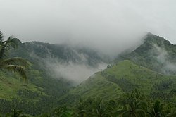
凯比兰市(英語:Municipality of Caibiran,宿霧語:Lungsod sa Caibiran,菲律賓語:Bayan ng Caibiran)是菲律宾的一个城市, 位於比利兰省,屬於第四級行政區。 地理根據菲律賓統計局資料,該市的土地面積為83.55平方公里(32.26平方英里)[2],佔比利兰省總面積536.01-平方公里-(206.95-平方英里)的15.59%。 行政區劃凯比兰下分為17個描籠涯四級行政區(相等於村)。「Ungale」、「Tuo」、「Inasuyan」三個行政區在1948年轉由卡瓦延(Kawayan)管轄。[3]
氣候根據柯本氣候分類法,凯比兰市被歸類於熱帶季風氣候,接近熱帶雨林氣候。凯比兰的氣候終年溫和,三月到五月是最熱的季節,平均高溫可達27°C。只有在冬季月份時,平均低溫可下探至17°C。[4]。年間平均降雨量約4,165毫米,最高613毫米(12月),最低134毫米(5月)。[5]
人口
截至2015年統計,該市人口為22,524,人口密度為290名居民每平方公里(750名居民每平方英里)。 參考來源
外部連結 |
||||||||||||||||||||||||||||||||||||||||||||||||||||||||||||||||||||||||||||||||||||||||||||||||||||||||||||||||||||||||||||||||||||||||||||||||||||||||||||||||||||||||||||||||||||||||||||||||||||||||||||||||||||||||||||||||||||
Index:
pl ar de en es fr it arz nl ja pt ceb sv uk vi war zh ru af ast az bg zh-min-nan bn be ca cs cy da et el eo eu fa gl ko hi hr id he ka la lv lt hu mk ms min no nn ce uz kk ro simple sk sl sr sh fi ta tt th tg azb tr ur zh-yue hy my ace als am an hyw ban bjn map-bms ba be-tarask bcl bpy bar bs br cv nv eml hif fo fy ga gd gu hak ha hsb io ig ilo ia ie os is jv kn ht ku ckb ky mrj lb lij li lmo mai mg ml zh-classical mr xmf mzn cdo mn nap new ne frr oc mhr or as pa pnb ps pms nds crh qu sa sah sco sq scn si sd szl su sw tl shn te bug vec vo wa wuu yi yo diq bat-smg zu lad kbd ang smn ab roa-rup frp arc gn av ay bh bi bo bxr cbk-zam co za dag ary se pdc dv dsb myv ext fur gv gag inh ki glk gan guw xal haw rw kbp pam csb kw km kv koi kg gom ks gcr lo lbe ltg lez nia ln jbo lg mt mi tw mwl mdf mnw nqo fj nah na nds-nl nrm nov om pi pag pap pfl pcd krc kaa ksh rm rue sm sat sc trv stq nso sn cu so srn kab roa-tara tet tpi to chr tum tk tyv udm ug vep fiu-vro vls wo xh zea ty ak bm ch ny ee ff got iu ik kl mad cr pih ami pwn pnt dz rmy rn sg st tn ss ti din chy ts kcg ve
Portal di Ensiklopedia Dunia

