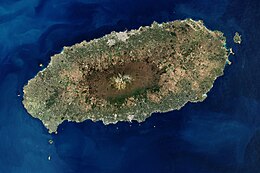
Jeju Island Native name : 제주도 Nickname: Sammu-samda-do (Island of no three kinds and many three kinds) Satellite image of Jeju Island
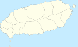
Map of Jeju Island
Location East Asia Archipelago Jeju Area 1,848 കി.m2 (714 ച മൈ) Length 73 km (45.4 mi) Width 31 km (19.3 mi) Highest elevation 1,950 m (6,400 ft) Highest point Hallasan South Korea
Special Autonomous Province Jeju Special Autonomous Province Largest settlement Jeju City (pop. 408,364)Population 621,550 (2014) Pop. density 316 /km2 (818 /sq mi) Languages Jeju , Korean Ethnic groups Korean
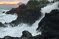
Daepo Jusangjeolli Cliff ദക്ഷിണ കൊറിയയിലെ ജെജു പ്രവിശ്യയുടെ പ്രധാന ദ്വീപും കൊറിയൻ പെനിസുലയുടെ തീരത്ത് സ്ഥിതി ചെയ്യുന്ന ഏറ്റവും വലിയ ദ്വീപും ആണ് ജെജു ദ്വീപ് (제주도 , 濟州島, ജെജുഡോ) ദക്ഷിണ ജിയോല പ്രവിശ്യയുടെ തെക്കൻ ഭാഗമായ കൊറിയ കടലിടുക്കിലാണ് ദ്വീപ് സ്ഥിതി ചെയ്യുന്നത് .ഒരു പ്രകൃതിദത്ത ലോക പൈതൃക പ്രദേശം ആയ ഈ ദ്വീപിൽ ജെജു അഗ്നിപർവ്വത ദ്വീപ് , ലാവ ട്യൂബ്സ് എന്നിവ കാണപ്പെടുന്നു.[ 1]
see also: Tamna#Historical_and_archaeological_records
Historically, the island has been called by many different names including:
Doi (കൊറിയൻ : 도이 島 夷 , literally "Island barbarian")
Dongyeongju (കൊറിയൻ : 동영주 hanja : 東瀛州)
Juho (കൊറിയൻ : 주호 州 胡 )
Tammora (탐모라, 耽牟羅)
Seomra (섭라, 涉羅)
Tangna (탁라, 乇羅)
Tamna (탐라, 耽羅)Quelpart,[ 2] [ 3] [ 4] [ 5]
Joonwonhado (준원하도, 준원下島 meaning southern part of peninsula)
Taekseungnido (കൊറിയൻ : 택승리도
Samdado (കൊറിയൻ : 삼다도 [ 6]
About 2 million years ago, the island of Jeju was formed through volcanic activity.[ 7]
About 1.2 million years ago, a magma chamber formed under the sea floor and began to erupt.
About 700 thousand years ago, the island had been formed through volcanic activity. Volcanic activity then stopped for approximately 100 thousand years.
About 300 thousand years ago, volcanic activity restarted along the coastline.
About 100 thousand years ago, volcanic activity formed Halla Mountain.
About 25 thousand years ago, lateral eruptions around Halla Mountain left multiple oreum (smaller 'parasitic' cones on the flanks of the primary cone).
Volcanic activity stopped and prolonged weathering and erosion helped shape the island.[ 8]
Jeju City, Jejudo (1981–2010) പ്രദേശത്തെ കാലാവസ്ഥ
മാസം
ജനു
ഫെബ്രു
മാർ
ഏപ്രി
മേയ്
ജൂൺ
ജൂലൈ
ഓഗ
സെപ്
ഒക്
നവം
ഡിസം
വർഷം
ശരാശരി കൂടിയ °C (°F)
8.3
9.4
12.8
17.5
21.6
24.8
29.0
29.8
25.8
21.3
16.0
11.0
18.9
പ്രതിദിന മാധ്യം °C (°F)
5.7
6.4
9.4
13.8
17.8
21.5
25.8
26.8
23.0
18.2
12.8
8.1
15.8
ശരാശരി താഴ്ന്ന °C (°F)
3.2
3.6
6.1
10.2
14.4
18.7
23.3
24.3
20.4
15.1
9.8
5.3
12.9
മഴ/മഞ്ഞ് mm (inches)
65.2
62.6
88.6
89.6
96.4
181.4
239.9
262.5
221.6
80.3
61.9
47.7
1,497.6
ശരാ. മഴ/മഞ്ഞു ദിവസങ്ങൾ (≥ 0.1 mm) 12.6
10.3
11.2
10.0
10.4
11.8
12.5
13.5
10.8
7.0
9.3
10.8
130.2
% ആർദ്രത
65.3
64.9
64.9
66.5
70.4
76.8
78.3
76.5
73.7
66.9
65.1
65.1
69.6
മാസം സൂര്യപ്രകാശം ലഭിക്കുന്ന ശരാശരി മണിക്കൂറുകൾ
70.4
105.4
158.9
194.4
211.9
170.9
195.6
195.6
161.7
178.5
126.0
84.8
1,854.1
ഉറവിടം: Korea Meteorological Administration[ 9]
Seogwipo-si, Jejudo (1981–2010) പ്രദേശത്തെ കാലാവസ്ഥ
മാസം
ജനു
ഫെബ്രു
മാർ
ഏപ്രി
മേയ്
ജൂൺ
ജൂലൈ
ഓഗ
സെപ്
ഒക്
നവം
ഡിസം
വർഷം
ശരാശരി കൂടിയ °C (°F)
10.7
11.6
14.4
18.5
22.0
24.6
28.3
30.1
27.4
23.4
18.2
13.2
20.2
പ്രതിദിന മാധ്യം °C (°F)
6.8
7.8
10.6
14.8
18.6
21.7
25.6
27.1
23.9
19.3
14.1
9.3
16.6
ശരാശരി താഴ്ന്ന °C (°F)
3.6
4.4
7.1
11.3
15.3
19.2
23.5
24.6
21.1
15.9
10.6
5.9
13.5
മഴ/മഞ്ഞ് mm (inches)
61.0
77.1
131.2
174.9
205.8
276.9
309.8
291.6
196.6
81.6
71.4
45.1
1,923
ശരാ. മഴ/മഞ്ഞു ദിവസങ്ങൾ (≥ 0.1 mm) 10.3
9.5
11.0
10.5
10.7
12.9
14.3
14.2
10.3
6.1
7.4
8.1
125.3
% ആർദ്രത
62.8
62.1
62.4
64.5
69.9
78.2
84.1
79.0
72.5
63.9
63.2
62.2
68.7
മാസം സൂര്യപ്രകാശം ലഭിക്കുന്ന ശരാശരി മണിക്കൂറുകൾ
152.2
152.6
174.0
190.9
199.0
144.2
142.1
184.2
176.1
207.1
170.5
161.8
2,054.7
ഉറവിടം: Korea Meteorological Administration[ 10]
Seongsan-eup, Jejudo (1981–2010) പ്രദേശത്തെ കാലാവസ്ഥ
മാസം
ജനു
ഫെബ്രു
മാർ
ഏപ്രി
മേയ്
ജൂൺ
ജൂലൈ
ഓഗ
സെപ്
ഒക്
നവം
ഡിസം
വർഷം
ശരാശരി കൂടിയ °C (°F)
9.0
10.2
13.4
17.8
21.6
24.2
27.9
29.5
26.5
22.0
16.6
11.4
19.2
പ്രതിദിന മാധ്യം °C (°F)
5.4
6.2
9.3
13.6
17.5
20.8
24.9
26.3
23.1
18.0
12.5
7.6
15.4
ശരാശരി താഴ്ന്ന °C (°F)
2.0
2.4
5.2
9.2
13.5
17.6
22.4
23.6
20.2
14.2
8.4
3.9
11.9
മഴ/മഞ്ഞ് mm (inches)
83.2
69.7
142.2
150.1
177.7
223.7
283.2
360.6
228.4
90.8
85.1
72.0
1,966.8
ശരാ. മഴ/മഞ്ഞു ദിവസങ്ങൾ (≥ 0.1 mm) 11.1
9.1
10.9
9.1
9.4
12.4
13.0
13.6
9.8
5.8
7.7
8.9
120.8
% ആർദ്രത
67.5
65.1
65.0
66.7
71.4
81.1
84.4
80.6
75.3
68.4
67.8
67.6
71.7
മാസം സൂര്യപ്രകാശം ലഭിക്കുന്ന ശരാശരി മണിക്കൂറുകൾ
122.5
146.9
170.1
192.9
205.3
145.6
157.4
173.4
157.2
187.8
155.5
130.3
1,944.7
ഉറവിടം: Korea Meteorological Administration[ 11]
Gosan-ri, Jejudo (1981–2010) പ്രദേശത്തെ കാലാവസ്ഥ
മാസം
ജനു
ഫെബ്രു
മാർ
ഏപ്രി
മേയ്
ജൂൺ
ജൂലൈ
ഓഗ
സെപ്
ഒക്
നവം
ഡിസം
വർഷം
ശരാശരി കൂടിയ °C (°F)
8.6
9.4
12.3
16.5
20.0
23.4
27.3
29.1
26.0
21.2
16.2
11.2
18.4
പ്രതിദിന മാധ്യം °C (°F)
6.2
6.7
9.3
13.3
16.8
20.6
24.7
26.2
23.1
18.3
13.3
8.6
15.6
ശരാശരി താഴ്ന്ന °C (°F)
3.8
4.2
6.5
10.4
14.2
18.3
22.7
23.9
20.6
15.7
10.7
6.1
13.1
മഴ/മഞ്ഞ് mm (inches)
43.9
46.9
75.8
86.4
110.2
148.7
178.0
201.8
116.2
45.7
57.4
31.7
1,142.8
ശരാ. മഴ/മഞ്ഞു ദിവസങ്ങൾ (≥ 0.1 mm) 11.4
9.1
10.9
9.3
10.1
11.8
11.9
13.4
9.3
6.1
8.0
9.7
121
% ആർദ്രത
67.0
68.4
69.5
73.2
79.5
85.1
88.4
83.2
77.2
69.0
67.1
66.0
74.5
മാസം സൂര്യപ്രകാശം ലഭിക്കുന്ന ശരാശരി മണിക്കൂറുകൾ
90.9
126.5
167.0
196.3
201.6
158.0
176.6
215.5
187.8
207.2
153.6
108.4
1,989.2
ഉറവിടം: Korea Meteorological Administration[ 12]
Witse Oreum, Jejudo (2003–2009, elevation 1,672m) പ്രദേശത്തെ കാലാവസ്ഥ
മാസം
ജനു
ഫെബ്രു
മാർ
ഏപ്രി
മേയ്
ജൂൺ
ജൂലൈ
ഓഗ
സെപ്
ഒക്
നവം
ഡിസം
വർഷം
ശരാശരി കൂടിയ °C (°F)
−1.6
0.9
3.4
10.0
14.9
18.1
20.3
20.6
18.1
13.2
6.8
0.0
10.4
പ്രതിദിന മാധ്യം °C (°F)
−5.9
−3.5
−0.8
5.2
10.3
14.0
17.4
17.4
14.2
8.2
2.2
−3.5
6.4
ശരാശരി താഴ്ന്ന °C (°F)
−9.1
−7.5
−5.1
0.7
5.7
10.4
14.7
14.5
11.0
4.3
−0.9
−6.6
2.7
മഴ/മഞ്ഞ് mm (inches)
46.9
128.0
301.2
426.1
653.1
651.9
742.3
836.4
526.7
126.5
165.8
64.6
4,669.4
ഉറവിടം: Jeju Regional Meteorological Administration[ 13]
Seongsan Ilchulbong or "Sunrise Peak"


