Nirasaki

Nirasaki-shi
韮崎市
Nirasaki
Hôtel de ville de Nirasaki.
Blason de Nirasaki-shi Drapeau de Nirasaki-shi
Drapeau
Administration
Pays Drapeau du Japon Japon
Région Chūbu
Préfecture Yamanashi
Maire Hisao Naito (ja) (depuis 2014)
Code postal 〒407-8501
Démographie
Population 28 464 hab. (avril 2022)
Densité 193 hab./km2
Géographie
Coordonnées 35° 42′ 32″ nord, 138° 26′ 47″ est
Superficie 14 773 ha = 147,73 km2
Localisation
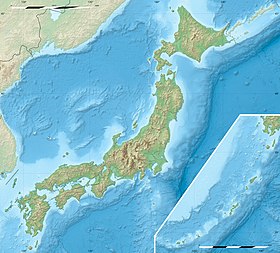
Géolocalisation sur la carte : Japon
Voir sur la carte topographique du Japon
Nirasaki-shi
Géolocalisation sur la carte : Japon
Voir sur la carte administrative du Japon
Nirasaki-shi
Géolocalisation sur la carte : préfecture de Yamanashi
Voir sur la carte topographique de la préfecture de Yamanashi
Nirasaki-shi
Liens
Site web site officiel

Nirasaki (韮崎市, Nirasaki-shi?) est une ville située dans la préfecture de Yamanashi, au Japon.

Géographie

Situation

Nirasaki est située dans le nord-ouest de la préfecture de Yamanashi.

Démographie

Lors du recensement national de 2010, la population de Nirasaki était de 32 768 habitants, répartis sur une superficie de 147,73 km2. En , la population était de 28 464 habitants[1].

Hydrographie

La ville est traversée par le fleuve Kamanashi.

Climat

La ville a un climat subtropical humide caractérisé par des étés chauds et humides et des hivers relativement doux. La température moyenne annuelle à Nirasaki est de 13,0 °C. La pluviométrie annuelle moyenne est de 1 278 mm, septembre étant le mois le plus humide[2].

Histoire

Nirasaki a obtenu le statut de ville le , après avoir fusionné avec dix municipalités du district de Kitakoma.

Transport

Nirasaki est desservie par les routes nationales 20, 52 et 141.

La ville est desservie par la ligne Chūō de la JR East. La gare de Nirasaki est la principale gare de la ville.

Jumelages

Nirasaki est jumelée avec :

Notes et références

  1. (ja) Mairie de Nirasaki, « 韮崎市の概要 » [« Vue d'ensemble de la ville de Nirasaki »] (consulté le ).
  2. (ja) « 平年値(年・月ごとの値) » [« Valeur annuelle moyenne (valeur pour chaque année/mois) »], Agence météorologique du Japon (consulté le ).

Voir aussi

Sur les autres projets Wikimedia :

Liens externes

Read other articles:

4th century Christian saint from Roman Egypt SaintSyncletica of AlexandriaMiniature depicting Syncletica of Alexandria, from the Menologion of Basil II (c. 1000 AD)Nun, Desert MotherDied4th centuryRoman EgyptVenerated inOriental Orthodox ChurchesEastern Orthodox ChurchCatholic ChurchEpiscopal ChurchFeast5 January6 January Syncletica of Alexandria (Greek: Συγκλητική, translit. Synkletikḗ) was a Christian saint, ascetic, anchorite, and Desert Mother from Roman Egypt in the 4t…

Coppa AVC per club 2000 Competizione Coppa AVC per club Sport Pallavolo Edizione II Organizzatore AVC Date dal 22 maggio 2000al 26 maggio 2000 Luogo  ThailandiaSuphanburi Partecipanti 8 Risultati Vincitore  Samsung Bluefangs(1º titolo) Secondo  Paykan Terzo  Bayi Statistiche Miglior giocatore Se-Jin Kim Miglior marcatore Behnam Mahmoudi Incontri disputati 20 Cronologia della competizione 1999 2001 Manuale La Coppa AVC per club 2000 si è svolta dal 22 …

Nikolaj ČubCosmonauta di RoscosmosNazionalità Russia StatusIn attività Data di nascita10 giugno 1984 Selezione2012 (Roscosmos 16) Primo lancio15 settembre 2023 Altre attivitàIngegnere Tempo nello spazioNello spazio Missioni Sojuz MS-24 Modifica dati su Wikidata · Manuale Nikolaj Aleksandrovič Čub (in russo: Николай Александрович Чуб; Novočerkassk, 10 giugno 1984) è un cosmonauta russo. Il 15 settembre 2023 è partito per la missione spaziale di un anno S…

此条目序言章节没有充分总结全文内容要点。 (2019年3月21日)请考虑扩充序言,清晰概述条目所有重點。请在条目的讨论页讨论此问题。 哈萨克斯坦總統哈薩克總統旗現任Қасым-Жомарт Кемелұлы Тоқаев卡瑟姆若马尔特·托卡耶夫自2019年3月20日在任任期7年首任努尔苏丹·纳扎尔巴耶夫设立1990年4月24日(哈薩克蘇維埃社會主義共和國總統) 哈萨克斯坦 哈萨克斯坦政府與…

Ethnic minority in Kazakhstan Ukrainian Kazakhstanis (Kazakh: Қазақстандағы украиндар, Qazaqstandağy ukraindar; Ukrainian: Українці в Казахстані, romanized: Ukrayintsi v Kazakhstani) are an ethnic minority in Kazakhstan that according to the 1989 census numbered 896,000 people, or 5.4% of the population.[1] Due to subsequent emigration to Russia and Ukraine, this number had declined to 796,000 by 1998 and 456,997 in the 2009 census.[2 …

Chapter of the New Testament Revelation 6← chapter 5chapter 7 →Revelation 6:5-8 on the verso side of Papyrus 24 from the 4th century.BookBook of RevelationCategoryApocalypseChristian Bible partNew TestamentOrder in the Christian part27 Revelation 6 is the sixth chapter of the Book of Revelation or the Apocalypse of John in the New Testament of the Christian Bible. The book is traditionally attributed to John the Apostle,[1][2] but the precise identity of the author …

Cave and archaeological site in Portugal Cave of SalemasLocationLoures, Lisbon District, PortugalCoordinates38°52′33″N 9°12′12″W / 38.87583°N 9.20333°W / 38.87583; -9.20333Length30 metresElevation250 metresDiscovery1959GeologyCretaceous limestoneEntrances1DifficultyeasyAccessNo restriction The Cave of Salemas is located close to the village of Lousa in the municipality of Loures in the Lisbon District of Portugal. Discovered by archaeologists during the 1950s,…

Type of insurance Health insurance or medical insurance (also known as medical aid in South Africa) is a type of insurance that covers the whole or a part of the risk of a person incurring medical expenses. As with other types of insurance, risk is shared among many individuals. By estimating the overall risk of health risk and health system expenses over the risk pool, an insurer can develop a routine finance structure, such as a monthly premium or payroll tax, to provide the money to pay for t…

FrackingShale gas drilling rig near Alvarado, TexasShale gas drilling rig near Alvarado, Texas By country Canada New Zealand South Africa Ukraine United Kingdom United States Environmental impact Additives United States Regulation U.S. federal law exemptions Technology Proppants Uses of radioactivity Politics 2012–14 Romanian protests against shale gas Anti-fracking movement FrackNation Frack Off Gasland vte Fracking in the United Kingdom started in the late 1970s with fracturing of the conven…

Al SharqiParent houseHafaitatCountryUnited Arab EmiratesFounded1879; 145 years ago (1879)FounderHamad bin Abdullah Al SharqiCurrent headHamad bin Mohammed Al SharqiTitlesEmirSheikhStyle(s)His/Her Highness The Al Sharqi (Arabic: الشرقي) family is the ruling royal family of Fujairah, one of the seven emirates that together comprise the United Arab Emirates (UAE). Founding Fujairah The name derives from the singular of Sharqiyin, long the dominant tribe along the East coast …

This article or section may have been copied and pasted from another location, possibly in violation of Wikipedia's copyright policy. Please review the source and remedy this by editing this article to remove any non-free copyrighted content and attributing free content correctly, or flagging the content for deletion. Please be sure that the supposed source of the copyright violation is not itself a Wikipedia mirror. (January 2023) United States historic placeJulien Dubuque BridgeU.S. National R…

هذه المقالة تحتاج للمزيد من الوصلات للمقالات الأخرى للمساعدة في ترابط مقالات الموسوعة. فضلًا ساعد في تحسين هذه المقالة بإضافة وصلات إلى المقالات المتعلقة بها الموجودة في النص الحالي. (مارس 2018)   لمعانٍ أخرى، طالع مقاطعة بولاسكي (توضيح). مقاطعة بولاسكي     الإحداثيات…

جزء من سلسلة مقالات سياسة لبنانلبنان الدستور الدستور اتفاق الطائف الطوائف حقوق الإنسان السلطة التنفيذية رئيس الجمهورية (قائمة) ميشال عون مجلس الوزراء رئيس الوزراء نجيب ميقاتي السلطة التشريعية مجلس النواب رئيس المجلس نبيه بري السلطة القضائية السلطة القضائية التقسيم الادا…

Halaman ini berisi artikel tentang kecamatan. Untuk satuan wilayah di atasnya, lihat Blora. Untuk kegunaan lain, lihat Blora (disambiguasi). Kecamatan BloraIbu kota kabupatenTranskripsi Bahasa Daerah • Hanacarakaꦧ꧀ꦭꦺꦴꦫ • Alfabet JawaBloraAlun-alun BloraJulukan: Kota SateKecamatan BloraLokasi Jawa dan IndonesiaTampilkan peta JawaKecamatan BloraKecamatan Blora (Indonesia)Tampilkan peta IndonesiaKoordinat: 6°57′38″S 111°25′36″E / þ…

Village and Gaeltacht in County Meath, Ireland Community in Leinster, IrelandBaile Ghib GibbstownCommunityIrish-language road sign on a road junction in Baile GhibBaile GhibCoordinates: 53°42′36″N 6°45′00″W / 53.71000°N 6.75000°W / 53.71000; -6.75000CountryIrelandProvinceLeinsterCountyCounty MeathPopulation (2016) • Total142Time zoneUTC+0 (WET) • Summer (DST)UTC-1 (IST (WEST)) Baile Ghib (anglicised as Gibbstown or Gibstown)[1&…

Stadium in Dumfries and Galloway, Scotland, UK Stair ParkStair ParkLocation in Dumfries and GallowayLocationStranraer, ScotlandCoordinates54°54′08″N 5°00′45″W / 54.90222°N 5.01250°W / 54.90222; -5.01250OwnerDumfries and Galloway CouncilCapacity4,178[1] (1,830 seated)Field size103 x 64 metresSurfaceGrassOpened1907TenantsStranraer Football Club Stair Park is a public park and football stadium in the town of Stranraer, Scotland and is the home of Stranrae…

Letak Gharb-Chrarda-Béni Hssen di Maroko Gharb-Chrarda-Béni Hssen merupakan sebuah region Maroko yang memiliki luas wilayah 8.805 km² dan populasi 1.859.540 jiwa (2004). Ibu kotanya ialah Kenitra. lbsRegion di MarokoAsy-Syawiyah Wardighah • Dukkalah 'Abdah • Fas Bulman • Gharb-Chrarda-Béni Hssen • Ad-Darul Baidha' al-Kubra • Guelmim-Es Semara* • Laâyoune-Boujdour-Sakia El Hamra • Marrakech-Tensift-El Haouz • Meknès-Tafilalet • Oriental • Wadi adz-Dzahab al-Kuwirah …

Hosea 5Naskah Komentari Kitab Hosea, 4Q166, dari antara Gulungan Laut Mati yang berasal dari abad ke-1 SM.KitabKitab HoseaKategoriNevi'imBagian Alkitab KristenPerjanjian LamaUrutan dalamKitab Kristen28← pasal 4 pasal 6 → Hosea 5 (disingkat Hos 5) adalah bagian dari Kitab Hosea dalam Alkitab Ibrani dan Perjanjian Lama di Alkitab Kristen. Kitab yang memuat nubuat yang disampaikan nabi Hosea ini termasuk dalam kumpulan kitab nabi-nabi kecil.[1][2] Teks Naskah aslinya dit…

Town in Talsi Municipality, LatviaSabileTown FlagCoat of armsSabileLocation in LatviaCoordinates: 57°03′N 22°35′E / 57.050°N 22.583°E / 57.050; 22.583Country LatviaMunicipalityTalsi MunicipalityTown rights1917Government • MayorZigmunds BrunavsArea[1] • Total5.22 km2 (2.02 sq mi) • Land5.09 km2 (1.97 sq mi) • Water0.13 km2 (0.05 sq mi)Population (2024)[…

Australian politician For the British far-right extremist, see Jack Renshaw (terrorist). The HonourableJack RenshawAC31st Premier of New South WalesIn office30 April 1964 – 13 May 1965MonarchElizabeth IIGovernorSir Eric WoodwardDeputyPat HillsPreceded byBob HeffronSucceeded byRobert AskinShire President of CoonabarabranIn office14 December 1939 – 15 May 1941Preceded byWilliam Thomas NeilsonSucceeded byS. H. ReganCouncillor of the Coonabarabran Shire Council for C Riding…