| [1]
|
Lieu patrimonial
|
Illustration
|
Municipalité
|
Adresse
|
Coordonnées
|
No
|
Constr.
|
Prot.[2]
|
Rec.
|
Notes
|
| F
|
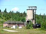
Ancienne gare du Canadien National
|
|
Hornepayne
|
West End Road (at 2nd Ave.)
|
49.22
-84.776
|
4588
|
1921
|
GFP
|
1993
|
|
| F
|
Fort Saint-Joseph
|

|
Jocelyn (en)
|
Île Saint-Joseph (en)
|
46.0847
-83.8957
|
12976
|
1799
|
LHN
|
1923
|
|
| F
|
Phare
|

Téléverser
|
Jocelyn (en)
|
Île Shoal
|
46.3133
-84.0756
|
13164
|
1910
|
ÉFP reconnu
|
2006
|
|
| M
|
Rydal Bank Church
|

Téléverser
|
Plummer Additional (en)
|
1634, Highway 638
|
46.2985
-83.7937
|
8177
|
1908
|
Municipal Heritage Designation (Part IV)
|
2006
|
|
| M
|
Rydal Bank Community Hall
|

Téléverser
|
Plummer Additional (en)
|
16, Hoath Street
|
46.2985
-83.7937
|
8176
|
|
Municipal Heritage Designation (Part IV)
|
2006
|
|
| M
|
115 Upton
|

Téléverser
|
Sault-Sainte-Marie
|
115, Upton Road
|
46.5059
-84.3138
|
7348
|
1902
|
Municipal Heritage Designation (Part IV)
|
1983
|
|
| M
|
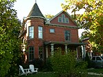
143 McGregor Avenue
|
|
Sault-Sainte-Marie
|
143 McGregor Avenue
|
46.506
-84.3114
|
6141
|
|
Municipal Heritage Designation (Part IV)
|
1991
|
|
| M
|
34-36 Herrick Street
|

|
Sault-Sainte-Marie
|
34, Herrick Street
|
46.5077
-84.3228
|
7374
|
1889
|
Municipal Heritage Designation (Part IV)
|
1995
|
|
| M
|
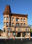
Algonquin Hotel
|
|
Sault-Sainte-Marie
|
864, Queen Street East
|
46.5064
-84.323
|
3572
|
1888
|
Municipal Heritage Designation (Part IV)
|
1983
|
|
| F
|
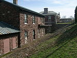
Atelier
|
|
Sault-Sainte-Marie
|
|
46.5134
-84.3498
|
11320
|
1896
|
Recognized Federal Heritage Building
|
1986
|
|
| M
|
Barnes-Fawcett Block
|

|
Sault-Sainte-Marie
|
358, Queen Street
|
46.5127
-84.3343
|
7375
|
1913
|
Municipal Heritage Designation (Part IV)
|
1989
|
|
| M
|
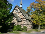
Bishop Fauquier Memorial Chapel
|
|
Sault-Sainte-Marie
|
1540, Queen Street East
|
46.4999
-84.2873
|
3313
|
1883
|
Municipal Heritage Designation (Part IV)
|
1981
|
|
| M
|
Bishop Fauquier Memorial Chapel Cemetery
|

|
Sault-Sainte-Marie
|
1540, Queen Street East
|
46.4999
-84.2867
|
3574
|
|
Municipal Heritage Designation (Part IV)
|
1981
|
|
| M
|
Buchan House
|

Téléverser
|
Sault-Sainte-Marie
|
943 Landslide Road
|
46.5932
-84.2816
|
5600
|
|
Municipal Heritage Designation (Part IV)
|
1991
|
|
| F
|
Bureau de l'administration
|

|
Sault-Sainte-Marie
|
|
46.5116
-84.3571
|
11363
|
1896
|
Recognized Federal Heritage Building
|
1986
|
|
| F
|
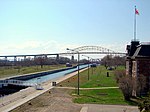
Canal de Sault Ste. Marie
|
|
Sault-Sainte-Marie
|
4 Whitefish Island / 1 Canal Drive
|
46.5121
-84.3545
|
4431
|
1895
|
LHN
|
1987
|
|
| M
|
Central United Church
|

Téléverser
|
Sault-Sainte-Marie
|
160 Spring Street
|
46.5111
-84.3295
|
5601
|
1911
|
Municipal Heritage Designation (Part IV)
|
1985
|
|
| M
|
Central United Church
|

|
Sault-Sainte-Marie
|
160, Spring Street
|
46.5111
-84.3295
|
4222
|
1911
|
Municipal Heritage Designation (Part IV)
|
1985
|
|
| F
|
Centrale
|

|
Sault-Sainte-Marie
|
Sault Ste. Marie Canal
|
46.5119
-84.3556
|
16389
|
1894
|
ÉFP classé
|
1986
|
|
| M
|
Clergue Blockhouse
|

|
Sault-Sainte-Marie
|
831 Queen Street East
|
46.506
-84.3243
|
5595
|
1819
|
Municipal Heritage Designation (Part IV)
|
1980
|
|
| M
|
Coronation Block
|

|
Sault-Sainte-Marie
|
234, Queen Street East
|
46.5147
-84.3367
|
7356
|
1902
|
Municipal Heritage Designation (Part IV)
|
1983
|
|
| M
|
Dawson Block
|

|
Sault-Sainte-Marie
|
708, Queen Street East
|
46.5077
-84.3274
|
8329
|
1894
|
Municipal Heritage Designation (Part IV)
|
1986
|
|
| M
|
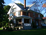
Eastbourne
|
|
Sault-Sainte-Marie
|
1048, Queen Street East
|
46.5056
-84.314
|
4056
|
1904
|
Municipal Heritage Designation (Part IV)
|
1983
|
|
| M
|
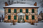
Ermatinger Old Stone House
|
|
Sault-Sainte-Marie
|
831 Queen Street East
|
46.5063
-84.3246
|
5602
|
1814
|
Municipal Heritage Designation (Part IV)
|
1993
|
|
| M
|
Forest Insect Laboratory
|

|
Sault-Sainte-Marie
|
875 Queen Street East
|
46.5056
-84.3224
|
5528
|
1958
|
Municipal Heritage Designation (Part IV)
|
2002
|
|
| M
|
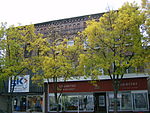
Hussey Block
|
|
Sault-Sainte-Marie
|
246, Queen Street East
|
46.5147
-84.3367
|
7685
|
1902
|
Municipal Heritage Designation (Part IV)
|
1983
|
|
| F
|
Lieu historique national du Canada de l'Île-Whitefish
|

|
Sault-Sainte-Marie
|
|
46.5101
-84.3511
|
14945
|
|
National Historic Site of Canada
|
1981
|
|
| F
|
Lieu historique national du Canada de la Maison-Ermatinger
|

|
Sault-Sainte-Marie
|
831 Queen Street East
|
46.5064
-84.3239
|
7415
|
1823
|
National Historic Site of Canada
|
1957
|
|
| F
|
Lieu historique national du Canada de la Rotonde de l'Algoma Central
|

|
Sault-Sainte-Marie
|
Sherbourne Street
|
46.5282
-84.3505
|
7352
|
1912
|
National Historic Site of Canada
|
1992
|
|
| M
|
North West Company Lock
|

|
Sault-Sainte-Marie
|
75 Huron Street
|
46.515
-84.3226
|
5529
|
1896
|
Municipal Heritage Designation (Part IV)
|
2002
|
|
| M
|
Old Post Office
|

|
Sault-Sainte-Marie
|
690 Queen Street East
|
46.508
-84.3278
|
5519
|
1906
|
Municipal Heritage Designation (Part IV)
|
1983
|
|
| M
|
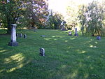
Old Town Cemetery
|
|
Sault-Sainte-Marie
|
1186 Queen Street East
|
46.5051
-84.3057
|
5550
|
|
Municipal Heritage Designation (Part IV)
|
1994
|
|
| M
|
Ontario Provincial Air Service Hangars
|

|
Sault-Sainte-Marie
|
69 Church Street
|
46.5047
-84.3238
|
5530
|
1947
|
Municipal Heritage Designation (Part IV)
|
2002
|
|
| M
|
Precious Blood Cathedral
|

|
Sault-Sainte-Marie
|
778 Queen Street East
|
46.5075
-84.3259
|
5604
|
1901
|
Municipal Heritage Designation (Part IV)
|
1981
|
|
| P
|
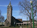
Precious Blood Cathedral
|
|
Sault-Sainte-Marie
|
778, Queen Street
|
46.5063
-84.3263
|
8185
|
1875
|
Ontario Heritage Foundation Easement
|
1983
|
|
| M
|
Rotary Welcome Cairns
|

|
Sault-Sainte-Marie
|
Russ Ramsay Way
|
46.5081
-84.3318
|
7768
|
1938
|
Municipal Heritage Designation (Part IV)
|
2005
|
|
| F
|
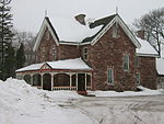
Résidence du surintendant
|
|
Sault-Sainte-Marie
|
|
46.5139
-84.3552
|
11300
|
1896
|
ÉFP reconnu
|
1986
|
[3]
|
| M
|
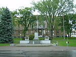
Sault Ste. Marie Cenotaph
|
|
Sault-Sainte-Marie
|
426, Queen Street East
|
46.5118
-84.3328
|
8437
|
1924
|
Municipal Heritage Designation (Part IV)
|
2005
|
|
| M
|
Sault Ste. Marie District Courthouse
|

|
Sault-Sainte-Marie
|
420 Queen Street East
|
46.512
-84.3324
|
5611
|
1922
|
Municipal Heritage Designation (Part IV)
|
2004
|
|
| M
|
Upton
|

|
Sault-Sainte-Marie
|
10, Kensington Terrace
|
46.5062
-84.3119
|
7767
|
|
Municipal Heritage Designation (Part IV)
|
1983
|
|
| M
|
Wellington Square Townhouses
|

|
Sault-Sainte-Marie
|
780, Wellington Street East
|
46.5096
-84.3207
|
7376
|
1913
|
Municipal Heritage Designation (Part IV)
|
1983
|
|
| F
|
Gare du Algoma Central Railway
|

Téléverser
|
Unorganized North Algoma District (en)
(Searchmont (en))
|
Highway 532
|
46.783
-84.054
|
4614
|
1902
|
GFP
|
1995
|
|
| F
|
Phare
|

|
Unorganized North Algoma District (en)
|
Île Parisienne
|
46.6453
-84.7239
|
11494
|
1911
|
ÉFP reconnu
|
1991
|
|
| F
|
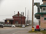
Gare du Canadien Pacifique
|
|
White River (en)
|
Winnipeg Street (between Elgin & Durham Sts.)
|
48.589
-85.285
|
4613
|
1927
|
GFP
|
1995
|
|


