|
Yuexiu, Guangzhou
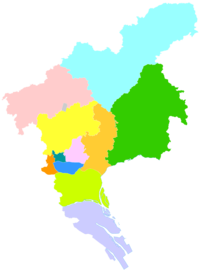
Yuexiu District is one of 11 urban districts of the prefecture-level city of Guangzhou, the capital of Guangdong Province, China, located west of the Tianhe District and east of the Liwan District. It is the commercial, political and cultural centre of Guangdong[2][better source needed] and noted for its high-quality education.[3][better source needed][needs update] The area has served as a regional administrative center for nearly 2,000 years, and assumed its current boundaries in September 2005.[4] The Guangdong provincial government and the Guangzhou city government are both located in the Yuexiu District. Yuexiu District has 18 subdistricts under its jurisdiction. The total area is 33.8 square kilometres (13.1 sq mi).[5] According to the 2020 Chinese Census, the permanent population of Yuexiu District was 1,038,643.[6] ToponymyThe name Yuexiu comes from Yuexiu Hill. HistoryHowever, according to archaeological discoveries, it has been confirmed that there were inhabitants settled in Guangzhou region at least three to four thousand years ago.[citation needed] The area of present-day Yuexiu District was once the capital of the Nanyue Kingdom.[4] Thirty-three years after the incorporation of Lingnan into the Qin Empire, Qin Shi Huang forced most of the Yue tribes out of Guangzhou and assimilated the rest.[citation needed] In 111 BCE, the area was reorganized as Panyu County, within the Nanhai Commandery.[4] The area of present-day Yuexiu District served as the capital of both.[4] The area would serve as the seat of government for numerous successive administrative divisions, including Lingnan Circuit and Xingwang Fu (Chinese: 兴王府).[4] It would continue to form part of Panyu County until 1921, when the it merged with Nanhai County to create Yuexiu District, and placed under the jurisdiction of the city of Guangzhou.[4] People's Republic of ChinaThe area came under the control of the People's Republic of China on October 14, 1949.[4] In December 1949, Guangzhou was divided into 28 different districts, with the area of present-day Yuexiu District including Xishan District (Chinese: 西山区), Dexuan District (Chinese: 德宣区), Huifu District (Chinese: 惠福区), Jinghai District (Chinese: 靖海区), Xiaobei District (Chinese: 小北区), Taiping District (Chinese: 太平区), Yonghan District (Chinese: 永汉区), Dongshan District (Chinese: 东山区) Dadong District (Chinese: 大东区), and Qianjian District (Chinese: 前鉴区).[4] In June 1950, Guangzhou consolidated its 28 districts into 16, resulting in the present-day area being including portions of Huifu District, Taiping District, Yonghan District, and Dadong District.[4] In September 1952, Guangzhou reorganized its urban area into just 6 districts: East District, West District, North District, Central District, Henan District, and Zhujiang District.[4] The former districts which once occupied present-day Yuexiu District were split between Central District, East District, and North District.[4] In July 1960, North District underwent an enlargement, and was renamed to Yuexiu District, while East District was renamed to Dongshan District.[4] In August 1961, five subdistricts from Yuexiu District were transferred to the jurisdiction of Dongshan District.[4] Slight adjustments to the border of Yuexiu District and Dongshan District would continue throughout the 1990s.[4] In September 2005, Dongshan District was abolished and merged into Yuexiu District.[4] Beginning in the late 1990s and early 2000s, a number of sub-Saharan Africans began to move to Guangzhou, many of whom settled area of Xiaobei,[7] within Yuexiu District. The area had already been inhabited by a number of Muslim internal migrants from Central and Northwest China since the 1980s.[7] Local crackdowns on visa overstays have sporadically taken place since the early 2010s.[7] GeographyYuexiu District starts from Guangzhou Avenue in the east and borders Tianhe District; it faces the Pearl River in the south and faces Haizhu District across the river; it extends to Renmin Road in the west and is adjacent to Liwan District; it reaches the foot of Baiyun Mountain in the north and is adjacent to Baiyun District and Tianhe District.[5] It is the old central city of Guangzhou. The total area of Yuexiu District is 33.8 square kilometers.[5] Administrative subdivisionsYuexiu has administrative jurisdiction over 18 subdistricts (Chinese: 街道; pinyin: jiēdào), which then in turn administer 222 residential communities (Chinese: 社区; pinyin: shèqū).[5]
GovernmentThe Guangdong Department of Education is headquartered in Yuexiu District.[9] DemographicsThe area of Xiaobei, within the district, has been a significant Muslim community in the area for decades.[7] Xiaobei, which has been nicknamed "Little Africa" and "Chocolate City" due to the number of Sub-Saharan Africans who live and work in the area, hosts a diverse population of Muslims from Central and Northwest China, Sub-Saharan Africa, the Middle East, North Africa, and the Indian subcontinent.[7] EconomyAs of 2023, Yuexiu District has a gross domestic product of 381.024 billion renminbi.[5] Creative Power Entertaining is headquartered in the Wuzi Building[note 1] in the Yuexiu District.[10][11] The Mainland China offices of Dairy Farm Group are located at the Guangdong Mechanical Sub-Building[note 2] in the district.[12] CultureDue to the notable Muslim population within the Xiaobei neighborhood, the area has attracted a cluster of Halal butchers, restaurants, and various stores.[7] TransportationMetroYuexiu is currently served by four metro lines operated by the Guangzhou Metro:
Education
The American International School of Guangzhou elementary school campus is on Ersha Island in the district.[13] Previously the École Française Internationale de Canton, the French international school of Guangzhou, was located at the GoldArch Riverdale[note 3] development on Ersha Island.[14] See alsoNotesReferences
External linksWikimedia Commons has media related to Yuexiu District. Wikivoyage has a travel guide for Guangzhou/Yuexiu.
|
||||||||||||||||||||||||||||||||||||||||||||||||||||||||||||||||||||||||||||||||||||||||||||||||||||||||||||||||||||||||||||||||||||||||||||||||||||||||||||||||||||||||||||||||||||||||||||||||||||||||||||||||||||||||||||||||||||||||||||


