Unity, Saskatchewan

Unity
Town
Town of Unity
Motto: 
A good town in a good district
Unity is located in Saskatchewan
Unity
Unity
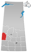
Location of Unity in Saskatchewan
Unity is located in Canada
Unity
Unity
Unity (Canada)
Coordinates: 52°26′0″N 109°10′0″W / 52.43333°N 109.16667°W / 52.43333; -109.16667
CountryCanada
ProvinceSaskatchewan
Post office Founded1909-04-01
Village established1909-06-01
Town incorporated1909-11-01
Government
 • MayorSharon Del Frari
 • Federal Electoral District Battlefords—Lloydminster MPRosemarie Falk
 • Provincial Constituency Cut Knife-Turtleford MLARyan Domotor
Area
 • Land9.77 km2 (3.77 sq mi)
Population
 (2016)
 • Total
2,573
 • Density244.6/km2 (634/sq mi)
 • Summer (DST)CST
Postal Code
S0K 4L0
Area code306-228/210
Highways Highway 14 / Highway 21
WebsiteOfficial Website
[1][2][3][4]

Unity is a town in the western part of the Canadian province of Saskatchewan[5] with a population of 2573. Unity is located at the intersection of Highway 14 and Highway 21, and the intersection of the CNR and CPR main rail lines. Unity is located 200 kilometres (125 mi) west-northwest of Saskatoon, Saskatchewan, and 375 kilometres (235 mi) southeast of Edmonton, Alberta. The town of Wilkie is located 33 kilometres (21 mi) to the east.

The town was the subject of playwright Kevin Kerr's Governor General's Award-winning play Unity (1918), which dramatizes the effect of the 1918 flu pandemic on Unity.

History

With the coming of the Grand Trunk Pacific Railway in 1908 Unity began to grow from a small settlement in 1904 to about 600 in the 1920s. By 1966 there were 2,154 residents.[6]

Demographics

In the 2021 Census of Population conducted by Statistics Canada, Unity had a population of 2,496 living in 1,042 of its 1,148 total private dwellings, a change of -3% from its 2016 population of 2,573. With a land area of 9.7 km2 (3.7 sq mi), it had a population density of 257.3/km2 (666.5/sq mi) in 2021.[7]

Canada census – Unity, Saskatchewan community profile
202120162011
Population2,496 (-3.0% from 2016)2,573 (+7.7% from 2011)2,389 (+11.3% from 2006)
Land area9.70 km2 (3.75 sq mi)9.77 km2 (3.77 sq mi)9.77 km2 (3.77 sq mi)
Population density257.3/km2 (666/sq mi)263.5/km2 (682/sq mi)244.6/km2 (634/sq mi)
Median age42.0 (M: 40.8, F: 42.8)39.6 (M: 37.8, F: 41.8)42.4 (M: 39.9, F: 44.6)
Private dwellings1,148 (total)  1,170 (total)  1,119 (total) 
Median household income$40,533
References: 2021[8] 2016[9] 2011[10]

Attractions

Unity, c. 1910–1920
Unity Express Shed

Attractions in Unity include:[11]

  • the history murals in downtown
  • Unity & District Heritage Museum
  • Unity Golf Course
  • Unity Regional Park housing the Unity Ball Diamonds
  • Unity Arena.
  • Unity Credit Union Aquatics Centre
  • Sink and Gordon Lakes are just to the west of Unity, providing wetlands for many migratory birds.
  • Muddy Lake is just south of town.

Education

Two elementary schools, St. Peter's Catholic School and Unity Public School offer kindergarten to grade 6. Unity Composite High School] includes grades 7 to 12. The two public schools are in the Living Sky School Division No. 202.[12]

The population of the elementary schools ranges at about 150 students each, while UCHS is between 250 and 300 students with a graduating class of about 30 to 45 students per year.

Transportation

The Unity railway station receives Via Rail service with The Canadian calling at Unity several times per week. Unity is on the Canadian National Railway tracks. In 1924, the Canadian Pacific Railway crossed the Canadian National Railway at Topaz just west of Unity.

Notable people

See also

References

  1. ^ National Archives, Archivia Net, Post Offices and Postmasters, archived from the original on 6 October 2006
  2. ^ Government of Saskatchewan, MRD Home, Municipal Directory System, archived from the original on 15 January 2016, retrieved 30 April 2013
  3. ^ Canadian Textiles Institute. (2005), CTI Determine your provincial constituency, archived from the original on 11 September 2007
  4. ^ Commissioner of Canada Elections, Chief Electoral Officer of Canada (2005), Elections Canada On-line, archived from the original on 21 April 2007
  5. ^ Adamson, J; et al. (23 July 2007), Online Historical Map Digitization Project
  6. ^ "Encyclopedia of Saskatchewan (Unity, Saskatchewan)". Retrieved 30 April 2013.
  7. ^ "Population and dwelling counts: Canada, provinces and territories, census divisions and census subdivisions (municipalities), Saskatchewan". Statistics Canada. 9 February 2022. Retrieved 1 April 2022.
  8. ^ "2021 Community Profiles". 2021 Canadian census. Statistics Canada. 4 February 2022. Retrieved 4 May 2022.
  9. ^ "2016 Community Profiles". 2016 Canadian census. Statistics Canada. 12 August 2021. Retrieved 4 May 2022.
  10. ^ "2011 Community Profiles". 2011 Canadian census. Statistics Canada. 21 March 2019. Retrieved 29 February 2012.
  11. ^ "Town of Unity website". Retrieved 30 April 2013.
  12. ^ "Living Sky School Division No. 202". Retrieved 30 April 2013.


Prefix: a b c d e f g h i j k l m n o p q r s t u v w x y z 0 1 2 3 4 5 6 7 8 9

Portal di Ensiklopedia Dunia