|
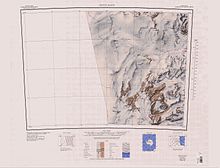
Towle ValleyTowle Valley (76°41′S 160°45′E / 76.683°S 160.750°E) is the deep valley formerly occupied by the head of Towle Glacier, lying immediately west of Towle Glacier in the Convoy Range of Victoria Land, Antarctica.[1]  Exploration and namingTowle Valley was mapped in 1957 by the New Zealand Northern Survey Party of the Commonwealth Trans-Antarctic Expedition (1956–58). It was named by them for the USNS Private John R. Towle, an American freighter which carried a large part of the New Zealand stores south in December 1956.[1] Features The glacier runs east of northeast to Fry Glacier between Elkhorn Ridge to the south and Eastwind Ridge to the north.[2] The valley is at its former head.[1] Features include Hurricane Heights76°44′S 160°40′E / 76.733°S 160.667°E. The irregular, mainly ice-free heights which rise to about 2,000 metres (6,600 ft) at the south side of the head of Towle Valley. The name was applied by a 1989-90 NZARP field party to describe the windy aspect of this upland area.[3] Mount Shadbolt76°41′S 160°28′E / 76.683°S 160.467°E. The highest summit, 2,270 metres (7,450 ft) high, in the north part of the Convoy Range, standing at the north side of the head of Towle Valley. Named by the 1976-77 Victoria University's Antarctic Expeditions (VUWAE), led by Christopher J. Burgess, after New Zealand author Maurice Shadbolt.[4] References
Sources
|
Portal di Ensiklopedia Dunia