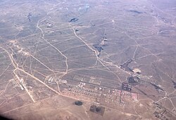
Banner in Inner Mongolia, China
Sonid Right Banner (Mongolian: ᠰᠥᠨᠡᠳ
ᠪᠠᠷᠠᠭᠤᠨ
ᠬᠣᠰᠢᠭᠤ; Chinese: 苏尼特右旗) is a banner of Inner Mongolia, China, bordering Dornogovi Province of Mongolia to the northwest. It is under the administration of Xilingol League. Sunud Mongols inhabit it.
Demographics
| The proportion of nationalities in Sonid Right Banner (2020) |
|---|
| Nationality |
|
Percentage |
| Han |
|
64.9% |
| Mongols |
|
34.1% |
| Manchus |
|
0.4% |
| Hui People |
|
0.4% |
| Daur |
|
0.1% |
| Others |
|
0.1% |
| Source of the population statistics :[2] |
|
History
 Map including modern-day Sonid Right Banner area (AMS, 1962)
For a few months in 1945, it was the capital of the Inner Mongolian People's Republic, before it was taken over by the Communist Chinese government.
Administrative divisions
Sonid Right Banner is divided into 3 towns and 4 sums.
Other: Sonid Right Banner Jurh Industrial Park (苏尼特右旗朱日和工业园)
Climate
| Climate data for Sonid Right Banner, elevation 1,105 m (3,625 ft), (1991–2020 normals)
|
| Month
|
Jan
|
Feb
|
Mar
|
Apr
|
May
|
Jun
|
Jul
|
Aug
|
Sep
|
Oct
|
Nov
|
Dec
|
Year
|
| Mean daily maximum °C (°F)
|
−7.8
(18.0)
|
−2.4
(27.7)
|
5.9
(42.6)
|
15.1
(59.2)
|
22.3
(72.1)
|
27.4
(81.3)
|
30.0
(86.0)
|
28.1
(82.6)
|
22.2
(72.0)
|
13.3
(55.9)
|
2.6
(36.7)
|
−5.8
(21.6)
|
12.6
(54.6)
|
| Daily mean °C (°F)
|
−14.3
(6.3)
|
−9.7
(14.5)
|
−1.5
(29.3)
|
7.9
(46.2)
|
15.5
(59.9)
|
21.1
(70.0)
|
24.0
(75.2)
|
21.8
(71.2)
|
15.4
(59.7)
|
6.3
(43.3)
|
−3.8
(25.2)
|
−11.8
(10.8)
|
5.9
(42.6)
|
| Mean daily minimum °C (°F)
|
−19.1
(−2.4)
|
−15.2
(4.6)
|
−7.6
(18.3)
|
1.0
(33.8)
|
8.4
(47.1)
|
14.5
(58.1)
|
17.7
(63.9)
|
15.8
(60.4)
|
9.4
(48.9)
|
0.9
(33.6)
|
−8.6
(16.5)
|
−16.4
(2.5)
|
0.1
(32.1)
|
| Average precipitation mm (inches)
|
1.8
(0.07)
|
2.2
(0.09)
|
4.1
(0.16)
|
6.7
(0.26)
|
17.6
(0.69)
|
32.5
(1.28)
|
43.2
(1.70)
|
38.2
(1.50)
|
21.8
(0.86)
|
9.5
(0.37)
|
4.6
(0.18)
|
2.2
(0.09)
|
184.4
(7.25)
|
| Average precipitation days (≥ 0.1 mm)
|
3.6
|
3.3
|
3.3
|
3.2
|
5.4
|
7.7
|
8.9
|
7.8
|
6.2
|
3.8
|
3.9
|
4.0
|
61.1
|
| Average snowy days
|
5.7
|
5.1
|
4.4
|
2.7
|
0.7
|
0
|
0
|
0
|
0.3
|
2.0
|
5.5
|
6.6
|
33
|
| Average relative humidity (%)
|
61
|
51
|
37
|
29
|
31
|
39
|
46
|
48
|
44
|
45
|
52
|
59
|
45
|
| Mean monthly sunshine hours
|
220.4
|
227.1
|
273.3
|
284.8
|
307.6
|
298.4
|
304.9
|
295.0
|
269.3
|
254.1
|
213.8
|
198.0
|
3,146.7
|
| Percent possible sunshine
|
75
|
75
|
73
|
70
|
68
|
65
|
66
|
70
|
73
|
76
|
74
|
71
|
71
|
| Source: China Meteorological Administration[3][4]
|
| Climate data for Zhurihe Town, Sonid Right Banner, elevation 1,151 m (3,776 ft), (1991–2020 normals)
|
| Month
|
Jan
|
Feb
|
Mar
|
Apr
|
May
|
Jun
|
Jul
|
Aug
|
Sep
|
Oct
|
Nov
|
Dec
|
Year
|
| Mean daily maximum °C (°F)
|
−7.2
(19.0)
|
−2.1
(28.2)
|
6.0
(42.8)
|
14.9
(58.8)
|
22.1
(71.8)
|
27.0
(80.6)
|
29.7
(85.5)
|
27.7
(81.9)
|
22.0
(71.6)
|
13.3
(55.9)
|
2.9
(37.2)
|
−5.3
(22.5)
|
12.6
(54.7)
|
| Daily mean °C (°F)
|
−13.7
(7.3)
|
−9.3
(15.3)
|
−1.4
(29.5)
|
7.8
(46.0)
|
15.3
(59.5)
|
20.7
(69.3)
|
23.4
(74.1)
|
21.4
(70.5)
|
15.1
(59.2)
|
6.3
(43.3)
|
−3.5
(25.7)
|
−11.3
(11.7)
|
5.9
(42.6)
|
| Mean daily minimum °C (°F)
|
−18.6
(−1.5)
|
−14.8
(5.4)
|
−7.4
(18.7)
|
1.0
(33.8)
|
8.3
(46.9)
|
14.1
(57.4)
|
17.3
(63.1)
|
15.4
(59.7)
|
9.1
(48.4)
|
0.9
(33.6)
|
−8.4
(16.9)
|
−16.0
(3.2)
|
0.1
(32.1)
|
| Average precipitation mm (inches)
|
1.6
(0.06)
|
2.4
(0.09)
|
3.7
(0.15)
|
7.6
(0.30)
|
18.5
(0.73)
|
36.6
(1.44)
|
51.4
(2.02)
|
36.1
(1.42)
|
28.0
(1.10)
|
11.0
(0.43)
|
5.0
(0.20)
|
2.3
(0.09)
|
204.2
(8.03)
|
| Average precipitation days (≥ 0.1 mm)
|
3.1
|
3.3
|
3.5
|
3.8
|
5.8
|
8.3
|
9.7
|
8.0
|
6.7
|
4.5
|
4.2
|
4.0
|
64.9
|
| Average snowy days
|
6.3
|
5.5
|
4.8
|
2.9
|
0.7
|
0
|
0
|
0
|
0.4
|
2.3
|
5.9
|
7.2
|
36
|
| Average relative humidity (%)
|
58
|
50
|
39
|
30
|
32
|
40
|
48
|
49
|
45
|
45
|
52
|
57
|
45
|
| Mean monthly sunshine hours
|
220.5
|
223.9
|
265.4
|
277.1
|
300.7
|
288.8
|
291.2
|
287.5
|
258.6
|
250.5
|
212.8
|
202.9
|
3,079.9
|
| Percent possible sunshine
|
75
|
74
|
71
|
69
|
66
|
63
|
63
|
68
|
70
|
74
|
74
|
72
|
70
|
| Source: China Meteorological Administration[3][5]
|
References
Websites


