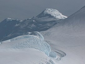
Mountain on Livingston Island, Antarctica
Simeon Peak (Bulgarian : връх Симеон , romanized : vrah Simeon IPA: [ˈvrɤx simɛˈɔn] [ 1] [ 2] Friesland Ridge , Tangra Mountains , Livingston Island in the South Shetland Islands , Antarctica . The peak is heavily glaciated, connected to St. Boris Peak to the northeast by Paril Saddle , and surmounts Huntress Glacier to the northwest, Ruen Icefall to the southwest, and Macy Glacier to the east. It was first ascended and GPS-surveyed by the Bulgarian climbers D. Boyanov, N. Petkov and N. Hazarbasanov from Nesebar Gap via the head of Huntress Glacier , Academia Peak , St. Boris Peak and Paril Saddle on 15 January 2017.
The peak is named after Czar Simeon the Great of Bulgaria , 893-927 AD.
Location
The peak is located at 62°41′27″S 60°12′25″W / 62.69083°S 60.20694°W / -62.69083; -60.20694 Mount Friesland , 1.85 km south-southwest of St. Boris Peak and 1.69 km north of St. Cyril Peak . British mapping in 1968, Argentine in 1980, Spanish in 1991, and Bulgarian in 2005 and 2009 from topographic surveys in 1995/96 (estimated elevation 1576 m) and 2004/05.
Maps
Chart of South Shetland including Coronation Island, &c. from the exploration of the sloop Dove in the years 1821 and 1822 by George Powell Commander of the same. Scale ca. 1:200000. London: Laurie, 1822South Shetland Islands. Scale 1:200000 topographic map. DOS 610 Sheet W 62 60. Tolworth, UK, 1968.Islas Livingston y Decepción. Mapa topográfico a escala 1:100000. Madrid: Servicio Geográfico del Ejército, 1991.
S. Soccol, D. Gildea and J. Bath. Livingston Island, Antarctica. Scale 1:100000 satellite map. The Omega Foundation, USA, 2004.
L.L. Ivanov et al., Antarctica: Livingston Island and Greenwich Island, South Shetland Islands (from English Strait to Morton Strait, with illustrations and ice-cover distribution), 1:100000 scale topographic map, Antarctic Place-names Commission of Bulgaria, Sofia, 2005
L.L. Ivanov. Antarctica: Livingston Island and Greenwich, Robert, Snow and Smith Islands. Scale 1:120000 topographic map. Troyan: Manfred Wörner Foundation, 2010. ISBN 978-954-92032-9-5 (First edition 2009. ISBN 978-954-92032-6-4 )
Antarctic Digital Database (ADD). Scale 1:250000 topographic map of Antarctica. Scientific Committee on Antarctic Research (SCAR). Since 1993, regularly upgraded and updated.L.L. Ivanov. Antarctica: Livingston Island and Smith Island . Scale 1:100000 topographic map. Manfred Wörner Foundation, 2017. ISBN 978-619-90008-3-0
Gallery
Notes
References
External links
This article includes information from the Antarctic Place-names Commission of Bulgaria which is used with permission.


