|
Searles Lake
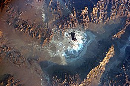
Searles Lake is an endorheic dry lake in the Searles Valley of the Mojave Desert, in northwestern San Bernardino County, California. The lake in the past was also called Slate Range Lake and Borax Lake. The mining community of Trona is on its western shore. The evaporite basin is approximately 19 km (12 mi) long and 13 km (8.1 mi) at its widest point, yielding 1.7 million tons annually of industrial minerals within the basin to the Searles Valley Minerals mining operations. Searles Lake is bounded by the Argus and Slate Mountains. Named after John Wemple Searles.[1] GeologyThe stratigraphic record at Searles Lake shows that it once held brackish water as deep as 200 m (660 ft).[citation needed] Fluctuations in lake levels correspond to the advances and retreats of glaciers in the Sierra Nevada Range.[citation needed] Thirty major lake levels occurred during the last 150,000 years, represented by a sequence of salt and mud beds. The precipitation of minerals occurred during long periods of lake evaporation.[citation needed] The lake is home to the Trona Pinnacles, a spectacular geologic tufa formation and a National Natural Landmark.
 HistoryBorax was first produced from the dry lake surface in 1873 by John Searles's San Bernardino Borax Mining Company. Searles was the first to haul borax using the famous 20 mule team wagons. In 1873, before the railroad was built to Mojave, refined borax was hauled 175 miles by 20 mule teams from Slate Range Playa (now called Searles Lake) to the harbor at San Pedro. The Searles Lake borax discovery has been designated California Historical Landmark #774, with a plaque at the roadside rest area in Trona.[2] From 1922 to 1928, the Epsom Salts Monorail crossed the Searles Lake on a wooden trestle. Mineralogy Searles Lake is a huge resource of sodium and potassium minerals of the carbonate, sulfate, borate and halide classes of mineralogy. The manufacture of industrial minerals involves a complex solution mining operation in which naturally occurring brines are pumped from wells completed in several salt beds. The brine wells range in depth from near-surface to over 330 ft (100 m) below the salt pan. A network of production wells, injection wells, solar ponds and piping are used in the production and treatment of the brines. Industrial minerals are extracted from the brines at the Argus, Trona and Westend plants. Minerals are crystallized from the brines, screened, washed, and dried. The crystals are then baked in rotary kilns to drive off water molecules locked in the crystalline structure. Some recrystallization may be required to achieve a desired composition and granular density. This complex extraction process at the three plants is generally referred to as fractional crystallization. It includes the treatment of brines through carbonation extraction, refrigeration extraction and/or solvent extraction. Salt is also harvested from the lake surface and from solar ponds. Commodities produced by Searles Valley Minerals from their Searles Lake operations include borax, V-Bor (borax with five moles of water), anhydrous borax, boric acid, soda ash, salt cake and salt. Mineral reserves exceed four billion tons. Mineral List Trona PinnaclesThe Trona Pinnacles are in the California Desert National Conservation Area managed by the Bureau of Land Management. MarkerCalifornia Historical Landmark marker reads:
 
See also
References
External linksWikimedia Commons has media related to Searles Lake.
|
||||||||||||||||||||||||||||||||||||||||||||||||||||
Portal di Ensiklopedia Dunia


