|
Rockville Air Station
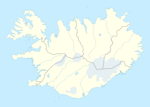
Rockville Air Station (ADC/NATO ID: H-1) is a closed United States Air Force General Surveillance Radar station. It is located 2.9 miles (4.7 km) west-northwest of Naval Air Station Keflavik, Iceland. It was closed on in 1998. HistoryRockville Air Station was established in early 1952, although its origins date to a temporary site at Keflavik Airport set up in 1951 to provide radar coverage over the airport. The permanent site was operated by the 932d Aircraft Control and Warning (later Air Defense, Later Air Control) Squadron, and was equipped with AN/TPS-1B; AN/FPS-3; AN/FPS-20 and two AN/FPS-6 height finder radars. The Greenland, Iceland and United Kingdom air defense sector, better known as the GIUK gap, was routinely utilized by the Soviet Union's long-range heavy bombers and maritime reconnaissance platforms as a transit point towards the Atlantic Ocean. From bases located at Archangelsk and Murmansk, Soviet aircraft would stream down to the North Cape in Norway towards the Gap which was use as a doorway to the vast Atlantic. Most of the Soviet missions were destined to probe United States' air defense along the North Atlantic and after 1960 in the Caribbean where Cuba, the USSR's most important satellite state outside continental Europe, was located. Such was the perceived threat from the Soviet incursions that it became a priority for NATO to demonstrate to that the strategic GIUK passage would be monitored at all times. The mission of the station was to intercept and shadow all Soviet aircraft in transit in and from the Gap which passed through the detection range of its radars and pass the information to interceptor aircraft deployed at Keflavik Airfield. Routine operations continued until 1998 until the site was closed, and a new facility was opened near NAS Keflavik.[1] After the site was closed, the facility was turned over to the Iceland government which used it for some years as the Byrgid drug rehabilitation facility. Today the site is closed, the radar towers are gone and all buildings have been removed.[1][2] See alsoReferences
External sources
External links |
||||||||||||||||||||||
Portal di Ensiklopedia Dunia


