|
Ranquil Formation
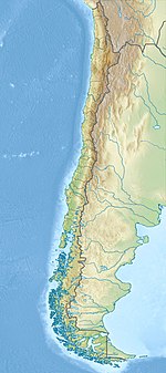
The Ranquil Formation (Spanish: Formación Ranquil) is a Miocene and Pliocene sedimentary formation located in Arauco Province in south–central Chile, including outcrops in Mocha Island. The formation has its greatest thicknesses in the south-west, where its sediments were largely deposited in marine conditions. It overlies unconformably sedimentary formations of the Paleocene-Eocene Lebu Group.[1] The formation is part of the fill of Arauco Basin which is a sedimentary basin that extends south of Concepción.[2] Macrofossils of the formation are similar to those of Navidad (34° S) and Lacui Formations (43° S), two nearby Miocene marine formations.[3] The base of the Ranquil Formation is the so-called "main unconformity", which is thought to have been formed by erosion during a period of tectonic inversion.[4] The formation was first defined in 1942 by Juan Tavera.[1] UnitsThe formation has been subdivided into five units, with the lowermost being made up of sandstone and shale, and the second lowest one being made up of a conglomerate. The middle unit is made up of mudrock and massive sandstone. At some places the middle unit is overlain by a unit made up of sandstone with thin layers of conglomerate and sandstone that has been bioturbated. The uppermost unit include a breccia and the so-called Huenteguapi sandstone.[2] The sediments of Huenteguapi sandstone evidences that a megatsunami struck the coast of south–central Chile in the Pliocene,[2] which has been linked to the hypothetical Eltanin impact. Fossil contentThe Ranquil Formation contains the following trace fossils: Zoophycos, Chondrites, Phycosiphon, Nereites missouriensis, Lockeiasiliquaria, Parataenidium, Ophiomorpha, Rhizocorallium and possibly also Psammichnites.[5] See alsoReferences
|
||||||||||||||||||||||||||||||||||||
Portal di Ensiklopedia Dunia
