|
Mueang Samut Songkhram district
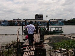
Mueang Samut Songkhram (Thai: เมืองสมุทรสงคราม, pronounced [mɯ̄a̯ŋ sā.mùt sǒŋ.kʰrāːm]) is the capital district (amphoe mueang) of Samut Songkhram province, central Thailand. HistoryThe district was established in 1897, then named Lom Thuan and controlled by Monthon Ratchaburi. In 1900 the district office was moved to a temple area in Ban Prok. The district was named accordingly in 1917.[2] The office was moved again to Mae Klong camp, Mae Klong Subdistrict, and at the same time the name changed to Mae Klong in 1925.[3] In accordance with governmental policy that the capital district name should be the same as the provincial name, Mae Klong district was renamed "Mueang Samut Songkhram" in 1938.[4] Since 1964 the district office is in Tambon Mae Klong. Thai local people still call Mueang Samut Songkhram by its old name Mae Klong. GeographyThe district is on the shore of the Bay of Bangkok, at the mouth of the Mae Klong River. Neighboring districts are (from the south clockwise) Ban Laem Phetchaburi province, Amphawa, and Bang Khonthi of Samut Songkhram, and Ban Phaeo and Mueang Samut Sakhon of Samut Sakhon province. Off the coast are the sandbanks of Don Hoi Lot famous for its endemic shell population of Solen regularis. The site has been listed as a Ramsar wetland since 2001.  AdministrationProvincial governmentThe district is divided into 11 subdistricts (tambons), which are further subdivided into 87 villages (mubans).[1] 
Local governmentAs of December 2023 there are: two municipalities (thesaban), of which Samut Songkhram itself has town status (thesaban mueang) and covers subdistrict Mae Klong and Bang Chakreng is a subdistrict municipality (thesaban tambon). There are further nine subdistrict administrative organizations - SAO (ongkan borihan suan tambon - o bo to).[1]
References
Wikimedia Commons has media related to Mueang Samut Songkhram District. |
|||||||||||||||||||||||||||||||||||||||||||||||||||||||||||||||||||||||||||||||||||||||||||||||||||||||||||||||||||||||||||||||||||||||||||||
Portal di Ensiklopedia Dunia

