Mount Ulmer

Mount Ulmer
Map
Highest point
Elevation2,776 m (9,108 ft)
Prominence1,264 m (4,147 ft)[1]
ListingRibu
Location of Sentinel Range in Western Antarctica.
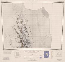
Northern Sentinel Range map.

Mount Ulmer (77°35′S 86°09′W / 77.583°S 86.150°W / -77.583; -86.150) is a prominent peak situated 2 miles north of Mount Washburn in Gromshin Heights on the east side of northern Sentinel Range in Ellsworth Mountains, Antarctica. It surmounts the head of Vicha Glacier to the east and Newcomer Glacier to the west.

The mountain was discovered by Lincoln Ellsworth in his trans-Antarctic flight on November 23, 1935, who called it "Mount Mary Louise Ulmer", after his wife. The peak was reidentified by comparing Ellsworth's photograph with those taken in 1959 by the U.S. Navy.[2]

The peak of the mountain rises to a total of 3,800 meters.[3]

Maps

  • Newcomer Glacier. Scale 1:250 000 topographic map. Reston, Virginia: US Geological Survey, 1961.
  • Antarctic Digital Database (ADD). Scale 1:250000 topographic map of Antarctica. Scientific Committee on Antarctic Research (SCAR). Since 1993, regularly updated.

References

  1. ^ "World Ribus – West Antarctica Ranges". World Ribus. Retrieved 26 December 2024.
  2. ^ "Mount Ulmer". Geographic Names Information System. United States Geological Survey, United States Department of the Interior. Retrieved 30 September 2005.
  3. ^ "Gazetteer - AADC".

Public Domain This article incorporates public domain material from "Mount Ulmer". Geographic Names Information System. United States Geological Survey.  Edit this at Wikidata


Prefix: a b c d e f g h i j k l m n o p q r s t u v w x y z 0 1 2 3 4 5 6 7 8 9

Portal di Ensiklopedia Dunia