Mohammadpur Thana

Mohammadpur Thana
মোহাম্মদপুর থানা
Map
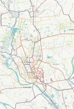
Expandable map of vicinity of Mohammadpur Thana
Mohammadpur Thana is located in Dhaka
Mohammadpur Thana
Mohammadpur Thana
Location of Mohammadpur Thana within Dhaka
Mohammadpur Thana is located in Dhaka division
Mohammadpur Thana
Mohammadpur Thana
Location of Mohammadpur Thana within Dhaka Division
Mohammadpur Thana is located in Bangladesh
Mohammadpur Thana
Mohammadpur Thana
Location of Mohammadpur Thana within Bangladesh
Coordinates: 23°45′59″N 90°21′31″E / 23.76639°N 90.35863°E / 23.76639; 90.35863
Country Bangladesh
DivisionDhaka Division
DistrictDhaka District
Established as a thana1976
Area
 • Total
8.23 km2 (3.18 sq mi)
Elevation23 m (75 ft)
Population
 • Total
527,771
 • Density47,828/km2 (123,870/sq mi)
Time zoneUTC+6 (BST)
Postal code
1207[3]
Area code02[4]

Mohammadpur (Bengali: মোহাম্মদপুর) is a thana of Dhaka, Bangladesh. Although initially Mohammadpur had grown as a residential area, subsequent commercial places have also been developed as well.

Mohammadpur
A mosque at Mohammadpur

History

Unlike some parts of Dhaka city, most parts of Mohammadpur were planned in the 1950s as relatively broad streets and avenues. [citation needed]Saat Masjid, a prominent archaeological structure in the area is part of a renowned mosque of Dhaka city called Shia Masjid.

Geography

Mohammadpur thana has an area of 8.23 km2.[5] It is connected to Sadar Ghat and Gabtali by the city protection dam. Mohammadpur borders Shyamoli and Adabor Thana to the north, Sher-E-Bangla Nagar to the east and Dhanmondi and Hazaribagh thanas to the south.

Demographics

According to 2011 Census of Bangladesh, Mohammadpur Thana has a population of 355,843 with average household size of 4.4 members, and an average literacy rate of 73.5% vs national average of 51.8% literacy.[6]

Points of interest

Shia Jame Masjid, Mohammadpur

Residential blocks

Japan Garden City, a big gated community is a part of the neighbourhood. Other well-known blocks include the Pisciculture Housing Society, Mohammadia Housing Society, Baitul Aman Housing Society, Chad Miah Housing, Probal Housing, Tajmahal road and a number of residential areas, which have all grown substantially. This has resulted in a real estate construction boom accompanied by markets and shopping complexes.[citation needed]

Kaderabad Housing is a large housing complex near Mohammadpur Bus Stand. The housing is well organized and has a college and school inside. A large apartment block developed by Assurance and Sara Builders sits near the complex. It is near the main bus stand of the Mohammadpur and the Martyred Intellectuals Memorial.

Residential neighbourhoods like Lalmatia and Bosilla, which has recently undergone rapid modernisation and urbanisation is also a part of the Mohammadpur Thana.

Geneva camp

The Geneva Camp for "Biharis" (mostly from the Indian state of Bihar and other parts of India who migrated to the then East Pakistan during the Partition of 1947) is in Mohammadpur. Biharis have been living there since the end of the 1971 War of Liberation.

Asad Gate

Asad Gate

Asad Gate is the monument of the country's liberation war. It was named after an unarmed young man named Asad was killed by the Pakistani army during protests against the erstwhile military junta of Pakistan, part of Bangladesh's independence movement.

Transportation

BRTC, Raja City, Moitri, Torongo, Torongo Plus, Malancha, Projapoti, Poristhan, Rojonighondha, Swadhin, Meshkat, 13 No, Dhaka Nagar Poribahan. and some other bus transportation companies have facilitated the communication system of the inhabitants of this area.

Education

Schools and colleges or madrasha

Universities

Culture

See also

References

  1. ^ "Geographic coordinates of Dhaka, Bangladesh". DATEANDTIME.INFO. Retrieved 7 July 2016.
  2. ^ National Report (PDF). Population and Housing Census 2022. Vol. 1. Dhaka: Bangladesh Bureau of Statistics. November 2023. p. 386. ISBN 978-9844752016.
  3. ^ "Bangladesh Postal Code". Dhaka: Bangladesh Postal Department under the Department of Posts and Telecommunications of the Ministry of Posts, Telecommunications and Information Technology of the People's Republic of Bangladesh. 19 October 2024.
  4. ^ "Bangladesh Area Code". China: Chahaoba.com. 18 October 2024.
  5. ^ Ahmed, S. S. (2012). "Mohammadpur Thana (Dhaka Metropolitan)". In Islam, Sirajul; Jamal, Ahmed A. (eds.). Banglapedia: National Encyclopedia of Bangladesh (Second ed.). Asiatic Society of Bangladesh.
  6. ^ Bangladesh Bureau of Statistics (2011). "Population & Housing Census" (PDF). Bangladesh Government. Archived from the original (PDF) on 3 September 2017. Retrieved 17 April 2015.


Index: pl ar de en es fr it arz nl ja pt ceb sv uk vi war zh ru af ast az bg zh-min-nan bn be ca cs cy da et el eo eu fa gl ko hi hr id he ka la lv lt hu mk ms min no nn ce uz kk ro simple sk sl sr sh fi ta tt th tg azb tr ur zh-yue hy my ace als am an hyw ban bjn map-bms ba be-tarask bcl bpy bar bs br cv nv eml hif fo fy ga gd gu hak ha hsb io ig ilo ia ie os is jv kn ht ku ckb ky mrj lb lij li lmo mai mg ml zh-classical mr xmf mzn cdo mn nap new ne frr oc mhr or as pa pnb ps pms nds crh qu sa sah sco sq scn si sd szl su sw tl shn te bug vec vo wa wuu yi yo diq bat-smg zu lad kbd ang smn ab roa-rup frp arc gn av ay bh bi bo bxr cbk-zam co za dag ary se pdc dv dsb myv ext fur gv gag inh ki glk gan guw xal haw rw kbp pam csb kw km kv koi kg gom ks gcr lo lbe ltg lez nia ln jbo lg mt mi tw mwl mdf mnw nqo fj nah na nds-nl nrm nov om pi pag pap pfl pcd krc kaa ksh rm rue sm sat sc trv stq nso sn cu so srn kab roa-tara tet tpi to chr tum tk tyv udm ug vep fiu-vro vls wo xh zea ty ak bm ch ny ee ff got iu ik kl mad cr pih ami pwn pnt dz rmy rn sg st tn ss ti din chy ts kcg ve 
Prefix: a b c d e f g h i j k l m n o p q r s t u v w x y z 0 1 2 3 4 5 6 7 8 9