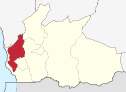
Mbinga District

Mbinga
location in Ruvuma Region
Country Tanzania
RegionRuvuma Region

Mbinga District[1] is one of the five districts of the Ruvuma Region of Tanzania. It is bordered to the north by the Njombe Region, to the east by Songea Rural District and Songea Urban District, to the south by Mozambique and to the west by Lake Nyasa. The district is partly home to the Liparamba Game Reserve. Notable people are Oscar Kambona, former minister of foreign affairs.

According to the 2002 Tanzania National Census, the population of the Mbinga District was 404,799.[2] Mbinga District covers an area of 11,396 square kilometres, about 18 percent of the land area of the Ruvuma Region and about 1% of the land mass of Tanzania.[3]


Wards

The Mbinga District is administratively divided into 37 wards:[2]

  • Chiwanda
  • Kigonsera
  • Kihagara
  • Kihangi Mahuka
  • Kilimani[4]
  • Kilosa
  • Kingerikiti
  • Kitura
  • Langiro
  • Liparamba
  • Lipingo
  • Linda
  • Litembo
  • Lituhi
  • Litumbandyosi
  • Liuli[5]
  • Maguu
  • Matiri
  • Mbaha
  • Mbamba Bay[6]
  • Mbangamao
  • Mbinga Urban
  • Mbuji
  • Mikalanga
  • Mkumbi
  • Mpapa
  • Mpepai
  • Mtipwili
  • Myangayanga
  • Ndongosi
  • Ngima
  • Ngumbo
  • Nyoni
  • Ruanda
  • Tingi
  • Ukata
  • Utiri

Kilindi

  • Mapera

References

  1. ^ Mbinga District (Approved) at GEOnet Names Server, United States National Geospatial-Intelligence Agency
  2. ^ a b "2002 Population and Housing Census General Report: Ruvuma: Mginga". Archived from the original on 20 March 2004.
  3. ^ Nhira, Calvin; Mapiki, Alfred (2008). Land and Water Management in Southern Africa: Towards Sustainable Agriculture. African Books Collective. p. 260. ISBN 978-0-7983-0214-2.
  4. ^ The English meaning of the word "kilimani" is on the hill.
  5. ^ In Liuli ward the lakeshore settlement of Liuli was the site of the first naval action of World War I. It was also the mission centre of Ruvuma during the time of William Percival Johnson.
  6. ^ Mbamba Bay is the starting point of the ferry to Itungu in the north.

10°50′S 34°50′E / 10.833°S 34.833°E / -10.833; 34.833