Name
Location
Date Listed
Grid Ref. [ note 1] Geo-coordinates
Notes
LB Number [ note 2]
Image
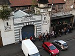
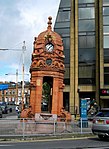
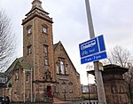
28 Tunnel Street, Glasgow Harbour Tunnel, Otherwise Known As Finnieston Tunnel, Shaft And Rotunda
55°51′31″N 4°17′00″W / 55.858473°N 4.283232°W / 55.858473; -4.283232 (28 Tunnel Street, Glasgow Harbour Tunnel, Otherwise Known As Finnieston Tunnel, Shaft And Rotunda ) Category B
33203
Upload another image
134, 136 Wellington Street, 105-113 (Odd Nos) Bath Street And 52 Bath Lane, Wellington Buildings
55°51′50″N 4°15′32″W / 55.863904°N 4.258779°W / 55.863904; -4.258779 (134, 136 Wellington Street, 105-113 (Odd Nos) Bath Street And 52 Bath Lane, Wellington Buildings ) Category B
33219
Upload Photo
91-95 (Odd Nos) West George Street And 53 West Nile Street
55°51′43″N 4°15′19″W / 55.862018°N 4.25525°W / 55.862018; -4.25525 (91-95 (Odd Nos) West George Street And 53 West Nile Street ) Category B
33222
Upload another image
213 West George Street
55°51′45″N 4°15′37″W / 55.862625°N 4.260415°W / 55.862625; -4.260415 (213 West George Street ) Category B
33228
Upload Photo
57, 61 St Vincent Street
55°51′40″N 4°15′18″W / 55.86101°N 4.254871°W / 55.86101; -4.254871 (57, 61 St Vincent Street ) Category B
33131
Upload Photo
93 St Vincent Street And 20, 22 Renfield Street, Savings Bank Of Glasgow, (Bank Of Scotland Chambers)
55°51′41″N 4°15′24″W / 55.861258°N 4.256532°W / 55.861258; -4.256532 (93 St Vincent Street And 20, 22 Renfield Street, Savings Bank Of Glasgow, (Bank Of Scotland Chambers) ) Category B
33135
Upload another image
115, 117, St Vincent Street
55°51′41″N 4°15′28″W / 55.861342°N 4.257847°W / 55.861342; -4.257847 (115, 117, St Vincent Street ) Category A
33138
Upload another image
119-123 (Odd Nos) St Vincent Street And 112-118 (Even Nos) Hope Street, Liverpool And London And Globe Insurance Buildings
55°51′41″N 4°15′29″W / 55.861373°N 4.258105°W / 55.861373; -4.258105 (119-123 (Odd Nos) St Vincent Street And 112-118 (Even Nos) Hope Street, Liverpool And London And Globe Insurance Buildings ) Category B
33139
Upload another image
84-94 (Even Nos) St Vincent Street
55°51′42″N 4°15′21″W / 55.861583°N 4.255943°W / 55.861583; -4.255943 (84-94 (Even Nos) St Vincent Street ) Category A
33153
Upload Photo
102, 104 St Vincent Street And 26, 26A And 26B Renfield Street
55°51′42″N 4°15′23″W / 55.861629°N 4.256394°W / 55.861629; -4.256394 (102, 104 St Vincent Street And 26, 26A And 26B Renfield Street ) Category B
33155
Upload another image
232-234 (Even Nos) St Vincent Street
55°51′45″N 4°15′47″W / 55.862496°N 4.262996°W / 55.862496; -4.262996 (232-234 (Even Nos) St Vincent Street ) Category B
33164
Upload another image
119-121 (Odd Nos) Sauchiehall Street, Hope Street And Bath Street And Including Arch Over Sauchiehall Lane
55°51′51″N 4°15′28″W / 55.864229°N 4.257711°W / 55.864229; -4.257711 (119-121 (Odd Nos) Sauchiehall Street, Hope Street And Bath Street And Including Arch Over Sauchiehall Lane ) Category B
33170
Upload another image
199-215 (Odd Nos) Sauchiehall Street And 289 West Campbell Street
55°51′54″N 4°15′39″W / 55.864873°N 4.260817°W / 55.864873; -4.260817 (199-215 (Odd Nos) Sauchiehall Street And 289 West Campbell Street ) Category B
33172
Upload Photo
63-77 (Odd Nos) Nelson Mandela Place, West George Street With 153-159 (Odd Nos) Buchanan Street, Former Glasgow Stock Exchange
55°51′42″N 4°15′15″W / 55.861689°N 4.25408°W / 55.861689; -4.25408 (63-77 (Odd Nos) Nelson Mandela Place, West George Street With 153-159 (Odd Nos) Buchanan Street, Former Glasgow Stock Exchange ) Category A
33089
Upload another image
201 North Street, Kent Road, And Berkeley Street, Mitchell Library
55°51′54″N 4°16′20″W / 55.865022°N 4.272221°W / 55.865022; -4.272221 (201 North Street, Kent Road, And Berkeley Street, Mitchell Library ) Category B
33095
Upload another image
100 Stobcross Road, Queen's Dock, Former Hydraulic Pumping Station
55°51′44″N 4°17′48″W / 55.862275°N 4.296768°W / 55.862275; -4.296768 (100 Stobcross Road, Queen's Dock, Former Hydraulic Pumping Station ) Category B
33098
Upload Photo
203-217 (Odd Nos) Renfrew Street, Incorporated Dental Hospital
55°51′59″N 4°15′59″W / 55.866336°N 4.266288°W / 55.866336; -4.266288 (203-217 (Odd Nos) Renfrew Street, Incorporated Dental Hospital ) Category B
33106
Upload another image
6 Rose Street
55°51′56″N 4°15′41″W / 55.865502°N 4.261333°W / 55.865502; -4.261333 (6 Rose Street ) Category B
33117
Upload Photo
6 Gordon Street, Part Of Former Commercial Bank
55°51′38″N 4°15′18″W / 55.860638°N 4.255058°W / 55.860638; -4.255058 (6 Gordon Street, Part Of Former Commercial Bank ) Category A
33030
Upload Photo
42-44 (Even Nos) Jamaica Street 5-9 (Odd Nos) Midland Street
55°51′26″N 4°15′27″W / 55.857356°N 4.2576°W / 55.857356; -4.2576 (42-44 (Even Nos) Jamaica Street 5-9 (Odd Nos) Midland Street ) Category B
33066
Upload Photo
54-64 (Even Nos) Kelvingrove Street
55°51′58″N 4°17′00″W / 55.866217°N 4.283447°W / 55.866217; -4.283447 (54-64 (Even Nos) Kelvingrove Street ) Category B
33074
Upload Photo
23, 33, 43, 53 Kent Road
55°51′52″N 4°16′25″W / 55.864432°N 4.273545°W / 55.864432; -4.273545 (23, 33, 43, 53 Kent Road ) Category B
33077
Upload Photo
69 Kent Road (Former St Vincent Church Of Scotland)
55°51′51″N 4°16′30″W / 55.864215°N 4.275051°W / 55.864215; -4.275051 (69 Kent Road (Former St Vincent Church Of Scotland) ) Category C(S)
33078
Upload Photo
91 Buchanan Street
55°51′36″N 4°15′17″W / 55.859916°N 4.254728°W / 55.859916; -4.254728 (91 Buchanan Street ) Category A
32998
Upload another image
123-129 (Odd Nos) Buchanan Street, Carron Building
55°51′39″N 4°15′16″W / 55.860758°N 4.254362°W / 55.860758; -4.254362 (123-129 (Odd Nos) Buchanan Street, Carron Building ) Category B
33001
Upload Photo
147 Buchanan Street And St Vincent Street, Former Western Club
55°51′41″N 4°15′15″W / 55.861409°N 4.25416°W / 55.861409; -4.25416 (147 Buchanan Street And St Vincent Street, Former Western Club ) Category A
33002
Upload another image See more images
1E Gilmorehill, University Of Glasgow, Department Of Botany
55°52′21″N 4°17′30″W / 55.872383°N 4.29161°W / 55.872383; -4.29161 (1E Gilmorehill, University Of Glasgow, Department Of Botany ) Category B
32917
Upload another image
1 Gilmorehill, University Of Glasgow Lion And Unicorn Staircase
55°52′17″N 4°17′24″W / 55.871363°N 4.289919°W / 55.871363; -4.289919 (1 Gilmorehill, University Of Glasgow Lion And Unicorn Staircase ) Category A
32922
Upload another image
11-13 (Odd Nos) University Gardens
55°52′23″N 4°17′29″W / 55.872937°N 4.291307°W / 55.872937; -4.291307 (11-13 (Odd Nos) University Gardens ) Category B
32930
Upload Photo
21-43 (Odd Nos) Ashton Lane, Mews Cottages Including Grosvenor Cafe
55°52′28″N 4°17′35″W / 55.874531°N 4.293079°W / 55.874531; -4.293079 (21-43 (Odd Nos) Ashton Lane, Mews Cottages Including Grosvenor Cafe ) Category C(S)
32936
Upload Photo
361-371 (Odd Nos) Argyle Street And 80 James Watt Street
55°51′31″N 4°15′49″W / 55.858718°N 4.263687°W / 55.858718; -4.263687 (361-371 (Odd Nos) Argyle Street And 80 James Watt Street ) Category B
32942
Upload Photo
1087-1119 (Odd Nos) Argyle Street
55°51′52″N 4°17′03″W / 55.86438°N 4.28409°W / 55.86438; -4.28409 (1087-1119 (Odd Nos) Argyle Street ) Category B
32943
Upload Photo
1155-1163 (Odd Nos) Argyle Street
55°51′54″N 4°17′08″W / 55.864895°N 4.285431°W / 55.864895; -4.285431 (1155-1163 (Odd Nos) Argyle Street ) Category C(S)
32945
Upload Photo
1287-1323 (Odd Nos) Argyle Street
55°52′00″N 4°17′26″W / 55.866545°N 4.290435°W / 55.866545; -4.290435 (1287-1323 (Odd Nos) Argyle Street ) Category C(S)
32947
Upload Photo
316-336 (Even Nos) Argyle Street, Blythswood Hotel Including "Duke Of Wellington" Public House
55°51′32″N 4°15′42″W / 55.859024°N 4.261708°W / 55.859024; -4.261708 (316-336 (Even Nos) Argyle Street, Blythswood Hotel Including "Duke Of Wellington" Public House ) Category B
32951
Upload Photo
181-199 (Odd Nos) Bath Street And Blythswood Street
55°51′52″N 4°15′47″W / 55.864436°N 4.263077°W / 55.864436; -4.263077 (181-199 (Odd Nos) Bath Street And Blythswood Street ) Category A
32960
Upload another image See more images
52 Partickhill Road, 9 Partickhill Court
55°52′28″N 4°18′28″W / 55.874442°N 4.30791°W / 55.874442; -4.30791 (52 Partickhill Road, 9 Partickhill Court ) Category B
32894
Upload Photo
53-63 (Odd Nos) Peel Street
55°52′24″N 4°18′39″W / 55.873271°N 4.310941°W / 55.873271; -4.310941 (53-63 (Odd Nos) Peel Street ) Category B
32899
Upload Photo
65-73 (Odd Nos) Southpark Avenue
55°52′24″N 4°17′12″W / 55.873294°N 4.286612°W / 55.873294; -4.286612 (65-73 (Odd Nos) Southpark Avenue ) Category C(S)
32906
Upload Photo
1D Gilmorehill, University Of Glasgow, Anatomical Building
55°52′17″N 4°17′13″W / 55.871492°N 4.286842°W / 55.871492; -4.286842 (1D Gilmorehill, University Of Glasgow, Anatomical Building ) Category B
32916
Upload Photo
78 Church Street, 10B Dumbarton Road, Western Infirmary, Pathological Block, And Boundary Wall
55°52′20″N 4°17′48″W / 55.872269°N 4.296751°W / 55.872269; -4.296751 (78 Church Street, 10B Dumbarton Road, Western Infirmary, Pathological Block, And Boundary Wall ) Category B
32858
Upload Photo
Kelvingrove Park Monument to Lord Kelvin
55°52′11″N 4°17′13″W / 55.869745°N 4.287043°W / 55.869745; -4.287043 (Kelvingrove Park Monument to Lord Kelvin ) Category B
32881
Upload another image
51 Wilson Street
55°51′30″N 4°14′51″W / 55.858446°N 4.247628°W / 55.858446; -4.247628 (51 Wilson Street ) Category B
32805
Upload Photo
40-50 (Even Nos) Wilson Street With 70-74 Hutcheson Street, 117 Brunswick Street, 149 Ingram Street (The Former County Buildings Or Court Houses)
55°51′34″N 4°14′51″W / 55.859493°N 4.247385°W / 55.859493; -4.247385 (40-50 (Even Nos) Wilson Street With 70-74 Hutcheson Street, 117 Brunswick Street, 149 Ingram Street (The Former County Buildings Or Court Houses) ) Category B
32807
Upload another image
52 Parson Street, St Mungo's Retreat With Retaining Walls, Piers, Gates And Railings
55°51′56″N 4°14′15″W / 55.865639°N 4.237575°W / 55.865639; -4.237575 (52 Parson Street, St Mungo's Retreat With Retaining Walls, Piers, Gates And Railings ) Category B
32813
Upload Photo
Royal Exchange Square, Royal Bank Of Scotland
55°51′37″N 4°15′13″W / 55.86027°N 4.253534°W / 55.86027; -4.253534 (Royal Exchange Square, Royal Bank Of Scotland ) Category A
32827
Upload another image
1-15 (Odd Nos) St Vincent Place With 159-161 (Odd Nos) Queen Street
55°51′39″N 4°15′08″W / 55.860806°N 4.252239°W / 55.860806; -4.252239 (1-15 (Odd Nos) St Vincent Place With 159-161 (Odd Nos) Queen Street ) Category B
32835
Upload Photo
168-182 (Even Nos) Saltmarket And 4, 6, 8 Jocelyn Square
55°51′16″N 4°14′47″W / 55.85437°N 4.246418°W / 55.85437; -4.246418 (168-182 (Even Nos) Saltmarket And 4, 6, 8 Jocelyn Square ) Category B
32843
Upload Photo
23-33 (Odd Nos) Ingram Street
55°51′32″N 4°14′32″W / 55.858992°N 4.242354°W / 55.858992; -4.242354 (23-33 (Odd Nos) Ingram Street ) Category B
32731
Upload Photo
191 Ingram Street, Lanarkshire House, Corinthian Club (Former Sheriff Court And Justice Of Peace Court)
55°51′34″N 4°14′59″W / 55.859549°N 4.249721°W / 55.859549; -4.249721 (191 Ingram Street, Lanarkshire House, Corinthian Club (Former Sheriff Court And Justice Of Peace Court) ) Category A
32735
Upload another image
158 Ingram Street, And 2 John Street, Hutcheson's Hospital
55°51′36″N 4°14′51″W / 55.859875°N 4.247615°W / 55.859875; -4.247615 (158 Ingram Street, And 2 John Street, Hutcheson's Hospital ) Category A
32744
Upload another image See more images
162-168 (Even Nos) Ingram Street
55°51′36″N 4°14′53″W / 55.859964°N 4.248163°W / 55.859964; -4.248163 (162-168 (Even Nos) Ingram Street ) Category B
32745
Upload Photo
10-26 (Even Nos) King Street And 62 Parnie Street
55°51′24″N 4°14′48″W / 55.856611°N 4.246755°W / 55.856611; -4.246755 (10-26 (Even Nos) King Street And 62 Parnie Street ) Category B
32753
Upload Photo
77-81 (Odd Nos) Miller Street, Arthur's Warehouse
55°51′34″N 4°15′04″W / 55.859433°N 4.251137°W / 55.859433; -4.251137 (77-81 (Odd Nos) Miller Street, Arthur's Warehouse ) Category A
32759
Upload Photo
16-22 (Even Nos) Montrose Street
55°51′37″N 4°14′43″W / 55.860257°N 4.245399°W / 55.860257; -4.245399 (16-22 (Even Nos) Montrose Street ) Category B
32765
Upload Photo
130-138 (Even Nos) Trongate
55°51′27″N 4°14′50″W / 55.857404°N 4.247088°W / 55.857404; -4.247088 (130-138 (Even Nos) Trongate ) Category B
32786
Upload Photo
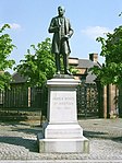
Cathedral Square, Statue Of James White Of Overtoun
55°51′46″N 4°14′11″W / 55.862783°N 4.236484°W / 55.862783; -4.236484 (Cathedral Square, Statue Of James White Of Overtoun ) Category B
32657
Upload another image
168 Clyde Street And Fox Lane, St Andrew's Roman Catholic Cathedral
55°51′20″N 4°15′10″W / 55.855672°N 4.252837°W / 55.855672; -4.252837 (168 Clyde Street And Fox Lane, St Andrew's Roman Catholic Cathedral ) Category A
32666
Upload another image See more images
Clyde Street, Victoria Bridge
55°51′14″N 4°15′04″W / 55.853778°N 4.251241°W / 55.853778; -4.251241 (Clyde Street, Victoria Bridge ) Category A
32669
Upload another image
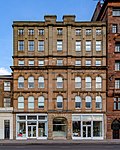
266-268 Clyde Street
55°51′22″N 4°15′20″W / 55.856064°N 4.255496°W / 55.856064; -4.255496 (266-268 Clyde Street ) Category B
32671
Upload another image See more images
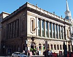
29 Cochrane Street And 18 John Street Formerly The John Street Church
55°51′36″N 4°14′51″W / 55.860104°N 4.247404°W / 55.860104; -4.247404 (29 Cochrane Street And 18 John Street Formerly The John Street Church ) Category A
32672
Upload another image
20-40 (Even Nos) Cochrane Street, 20 John Street And 233-235 (Odd Nos) George Street, Extension To The City Chambers, And Paired Screen Archways Over John Street
55°51′40″N 4°14′51″W / 55.861046°N 4.24749°W / 55.861046; -4.24749 (20-40 (Even Nos) Cochrane Street, 20 John Street And 233-235 (Odd Nos) George Street, Extension To The City Chambers, And Paired Screen Archways Over John Street ) Category A
32675
Upload another image
George Square , The Cenotaph
55°51′40″N 4°14′58″W / 55.861046°N 4.249424°W / 55.861046; -4.249424 (George Square, The Cenotaph ) Category B
32692
Upload another image
George Square, Walter Scott Memorial Column
55°51′40″N 4°15′01″W / 55.861149°N 4.250181°W / 55.861149; -4.250181 (George Square, Walter Scott Memorial Column ) Category A
32696
Upload another image See more images
George Square, James Watt Statue
55°51′40″N 4°15′04″W / 55.861022°N 4.251229°W / 55.861022; -4.251229 (George Square, James Watt Statue ) Category A
32697
Upload another image See more images
George Square, James Oswald Statue
55°51′40″N 4°15′02″W / 55.861053°N 4.250559°W / 55.861053; -4.250559 (George Square, James Oswald Statue ) Category B
32699
Upload another image
George Square, Prince Albert Statue
55°51′40″N 4°15′04″W / 55.861022°N 4.251229°W / 55.861022; -4.251229 (George Square, Prince Albert Statue ) Category A
32701
Upload another image
61-65 (Odd Nos) High Street And Bell Street, (Bows Emporium)
55°51′28″N 4°14′35″W / 55.857822°N 4.242942°W / 55.857822; -4.242942 (61-65 (Odd Nos) High Street And Bell Street, (Bows Emporium) ) Category B
32719
Upload Photo
24-26 (Even Nos) Cleveden Road
55°53′06″N 4°18′09″W / 55.885052°N 4.302399°W / 55.885052; -4.302399 (24-26 (Even Nos) Cleveden Road ) Category C(S)
32606
Upload Photo
122-132 (Even Nos) Argyle Street With 2-8 Buchanan Street
55°51′30″N 4°15′16″W / 55.858319°N 4.254572°W / 55.858319; -4.254572 (122-132 (Even Nos) Argyle Street With 2-8 Buchanan Street ) Category B
32618
Upload another image
45-51 (Odd Nos) Bell Street With 62-80 (Even Nos) Albion Street And 5-19 (Odd Nos) Walls Street Including Former Cheese Market
55°51′29″N 4°14′38″W / 55.858018°N 4.244008°W / 55.858018; -4.244008 (45-51 (Odd Nos) Bell Street With 62-80 (Even Nos) Albion Street And 5-19 (Odd Nos) Walls Street Including Former Cheese Market ) Category B
32620
Upload Photo
1-5 (Odd Nos) Blackfriars Street And 97-101 (Odd Nos) High Street
55°51′30″N 4°14′33″W / 55.858243°N 4.242487°W / 55.858243; -4.242487 (1-5 (Odd Nos) Blackfriars Street And 97-101 (Odd Nos) High Street ) Category B
32624
Upload Photo
2 Queens Place (Westdel), 10 Kinnoul Lane And 10 Crown Road North, (Royston); With Boundary Walls And Gatepiers
55°52′35″N 4°18′00″W / 55.876421°N 4.300129°W / 55.876421; -4.300129 (2 Queens Place (Westdel), 10 Kinnoul Lane And 10 Crown Road North, (Royston); With Boundary Walls And Gatepiers ) Category B
32579
Upload another image
4 And 4A Sydenham Road
55°52′45″N 4°18′12″W / 55.879283°N 4.303305°W / 55.879283; -4.303305 (4 And 4A Sydenham Road ) Category B
32586
Upload Photo
13-41 (Odd Nos) Kingsborough Gardens
55°52′40″N 4°18′19″W / 55.877862°N 4.305283°W / 55.877862; -4.305283 (13-41 (Odd Nos) Kingsborough Gardens ) Category B
32542
Upload Photo
730 Great Western Road; Botanic Gardens Glass Houses
55°52′46″N 4°17′25″W / 55.879382°N 4.290296°W / 55.879382; -4.290296 (730 Great Western Road; Botanic Gardens Glass Houses ) Category B
32512
Upload Photo
8, 9 And 10 Bowmont Gardens
55°52′38″N 4°17′54″W / 55.877085°N 4.298282°W / 55.877085; -4.298282 (8, 9 And 10 Bowmont Gardens ) Category C(S)
32479
Upload Photo
16 Cleveden Road, With Garden Walls And Gatepiers
55°53′03″N 4°18′06″W / 55.884176°N 4.301628°W / 55.884176; -4.301628 (16 Cleveden Road, With Garden Walls And Gatepiers ) Category B
32488
Upload Photo
75 Grange Road, Former Teachers' Resource And Computer Centre (Former Queen's Park School) Including Gates And Railings
55°49′40″N 4°15′54″W / 55.827774°N 4.26513°W / 55.827774; -4.26513 (75 Grange Road, Former Teachers' Resource And Computer Centre (Former Queen's Park School) Including Gates And Railings ) Category B
32433
Upload Photo
335-347 (Odd Nos) Langside Road
55°50′01″N 4°15′48″W / 55.833738°N 4.263385°W / 55.833738; -4.263385 (335-347 (Odd Nos) Langside Road ) Category B
32434
Upload another image See more images
334, 336 And 346 Langside Road
55°50′02″N 4°15′50″W / 55.833855°N 4.263887°W / 55.833855; -4.263887 (334, 336 And 346 Langside Road ) Category B
32436
Upload another image See more images
24 Queen's Drive The Knowe Including Gatepiers
55°49′53″N 4°15′34″W / 55.831446°N 4.259515°W / 55.831446; -4.259515 (24 Queen's Drive The Knowe Including Gatepiers ) Category C(S)
32446
Upload another image See more images
26, 28 Queen's Drive Including Gatepiers
55°49′54″N 4°15′35″W / 55.831531°N 4.259776°W / 55.831531; -4.259776 (26, 28 Queen's Drive Including Gatepiers ) Category B
32447
Upload another image See more images
415-447 (Odd Nos) Victoria Road
55°50′10″N 4°15′53″W / 55.835997°N 4.264698°W / 55.835997; -4.264698 (415-447 (Odd Nos) Victoria Road ) Category B
32460
Upload another image See more images
509-515 (Odd Nos) Victoria Road And 4 Albert Road
55°50′04″N 4°15′55″W / 55.834387°N 4.265243°W / 55.834387; -4.265243 (509-515 (Odd Nos) Victoria Road And 4 Albert Road ) Category B
32462
Upload another image See more images
822-830 (Even Nos) Pollokshaws Road, 2 Marywood Square And 1 Queen Square
55°50′06″N 4°16′23″W / 55.835059°N 4.27314°W / 55.835059; -4.27314 (822-830 (Even Nos) Pollokshaws Road, 2 Marywood Square And 1 Queen Square ) Category B
32405
Upload another image See more images
Albert Road, 60 Dixon Road, Holyrood Rc School Including Janitor's Lodge And Playground Walls
55°49′58″N 4°15′09″W / 55.83268°N 4.252481°W / 55.83268; -4.252481 (Albert Road, 60 Dixon Road, Holyrood Rc School Including Janitor's Lodge And Playground Walls ) Category B
32415
Upload another image See more images
47 Bankhall Street, Shoe Warehouse (Former Govanhill Picture House)
55°50′10″N 4°15′22″W / 55.836057°N 4.25603°W / 55.836057; -4.25603 (47 Bankhall Street, Shoe Warehouse (Former Govanhill Picture House) ) Category B
32425
Upload another image
318 Calder Street And Hollybrook Street, Holy Cross Primary School
55°50′10″N 4°15′18″W / 55.836033°N 4.254878°W / 55.836033; -4.254878 (318 Calder Street And Hollybrook Street, Holy Cross Primary School ) Category B
32426
Upload another image See more images
16 Algie Street, 122 Langside Avenue And Battle Place, Langside Hill Church And Boundary Walls And Gatepiers
55°49′40″N 4°16′18″W / 55.82768°N 4.271687°W / 55.82768; -4.271687 (16 Algie Street, 122 Langside Avenue And Battle Place, Langside Hill Church And Boundary Walls And Gatepiers ) Category B
32358
Upload another image See more images
54 Cleveden Drive, Boundary Walls And Gatepiers
55°53′03″N 4°18′20″W / 55.884229°N 4.305532°W / 55.884229; -4.305532 (54 Cleveden Drive, Boundary Walls And Gatepiers ) Category B
32309
Upload Photo
1103 Great Western Road, 8 Whittingehame Gardens
55°53′12″N 4°19′02″W / 55.886752°N 4.317132°W / 55.886752; -4.317132 (1103 Great Western Road, 8 Whittingehame Gardens ) Category C(S)
32329
Upload Photo
996 Great Western Road, "Glendoune", Boundary Walls And Gatepiers
55°53′00″N 4°18′16″W / 55.883298°N 4.304406°W / 55.883298; -4.304406 (996 Great Western Road, "Glendoune", Boundary Walls And Gatepiers ) Category B
32333
Upload Photo
146 Southbrae Drive
55°53′02″N 4°20′37″W / 55.883885°N 4.343745°W / 55.883885; -4.343745 (146 Southbrae Drive ) Category B
32340
Upload Photo
10 Gairbraid Avenue, Maryhill Burgh Halls (Now Maryhill Community Centre)
55°53′27″N 4°17′27″W / 55.890812°N 4.290873°W / 55.890812; -4.290873 (10 Gairbraid Avenue, Maryhill Burgh Halls (Now Maryhill Community Centre) ) Category B
32349
Upload another image
Woodside Crescent/Sauchiehall Street, Cameron Memorial Fountain
55°51′59″N 4°16′20″W / 55.866409°N 4.272094°W / 55.866409; -4.272094 (Woodside Crescent/Sauchiehall Street, Cameron Memorial Fountain ) Category B
32269
Upload another image See more images
19,21,23,25,27,29, Squire Street And 69 Northinch Street, Former Whiteinch Jordanvale Parish Church And Hall
55°52′21″N 4°20′05″W / 55.872514°N 4.334843°W / 55.872514; -4.334843 (19,21,23,25,27,29, Squire Street And 69 Northinch Street, Former Whiteinch Jordanvale Parish Church And Hall ) Category B
32282
Upload Photo
17-41 (Odd Nos) West Princes Street
55°52′12″N 4°16′11″W / 55.86995°N 4.269664°W / 55.86995; -4.269664 (17-41 (Odd Nos) West Princes Street ) Category B
32256
Upload Photo
49 West Princes Street
55°52′13″N 4°16′13″W / 55.870154°N 4.270267°W / 55.870154; -4.270267 (49 West Princes Street ) Category B
32257
Upload Photo
311 Woodlands Road, Woodside Public School
55°52′20″N 4°16′44″W / 55.872226°N 4.278796°W / 55.872226; -4.278796 (311 Woodlands Road, Woodside Public School ) Category B
32263
Upload another image
25 Lynedoch Street
Category B
32227
Upload another image
27 Lynedoch Street
55°52′06″N 4°16′32″W / 55.868203°N 4.275668°W / 55.868203; -4.275668 (27 Lynedoch Street ) Category B
32228
Upload Photo
2-8 (Even Nos) Melrose Street
55°52′17″N 4°16′14″W / 55.871399°N 4.270532°W / 55.871399; -4.270532 (2-8 (Even Nos) Melrose Street ) Category B
32229
Upload Photo
Colebrooke Street Glasgow Academy
55°52′33″N 4°16′46″W / 55.875799°N 4.279485°W / 55.875799; -4.279485 (Colebrooke Street Glasgow Academy ) Category B
32186
Upload Photo
471 Great Western Road Savings Bank, Hillhead
55°52′31″N 4°16′54″W / 55.875191°N 4.281736°W / 55.875191; -4.281736 (471 Great Western Road Savings Bank, Hillhead ) Category C(S)
32201
Upload Photo
416 And 420 Great Western Road/433 North Woodside Road Lansdowne Parish Church (Church Of Scotland)
55°52′28″N 4°16′41″W / 55.87452°N 4.278164°W / 55.87452; -4.278164 (416 And 420 Great Western Road/433 North Woodside Road Lansdowne Parish Church (Church Of Scotland) ) Category A
32205
Upload another image
24-28 (Even Nos) Herbert Street (Herbert House)
55°52′30″N 4°16′30″W / 55.875027°N 4.275044°W / 55.875027; -4.275044 (24-28 (Even Nos) Herbert Street (Herbert House) ) Category B
32207
Upload Photo
20-30 (Even Nos) Bank Street And 15-19 (Odd Nos) Glasgow Street
55°52′27″N 4°17′01″W / 55.874249°N 4.283551°W / 55.874249; -4.283551 (20-30 (Even Nos) Bank Street And 15-19 (Odd Nos) Glasgow Street ) Category B
32180
Upload Photo
Kelvingrove Park, Kelvin Way, Kelvingrove Bandstand And Amphitheatre
55°52′10″N 4°17′09″W / 55.869454°N 4.285763°W / 55.869454; -4.285763 (Kelvingrove Park, Kelvin Way, Kelvingrove Bandstand And Amphitheatre ) Category B
46592
Upload another image See more images
Carmunnock Road And Glenacre Terrace, Castlemilk West Parish Church (Church Of Scotland)
55°48′25″N 4°14′33″W / 55.807062°N 4.242367°W / 55.807062; -4.242367 (Carmunnock Road And Glenacre Terrace, Castlemilk West Parish Church (Church Of Scotland) ) Category B
48026
Upload another image
685 Alexandra Parade St Andrew's East Church Hall And Railings
55°51′47″N 4°12′30″W / 55.863005°N 4.208273°W / 55.863005; -4.208273 (685 Alexandra Parade St Andrew's East Church Hall And Railings ) Category A
48569
Upload Photo
229 Woodlands Road, Woodlands Methodist Church (Former Swedenborgian New Jerusalem Church) Including Boundary Wall And Gatepiers
55°52′15″N 4°16′37″W / 55.870784°N 4.27705°W / 55.870784; -4.27705 (229 Woodlands Road, Woodlands Methodist Church (Former Swedenborgian New Jerusalem Church) Including Boundary Wall And Gatepiers ) Category B
48629
Upload Photo
87 Renfield Street And 49 Bath Street, Former Refuge Assurance Buildings Including Railings
55°51′49″N 4°15′22″W / 55.863681°N 4.256225°W / 55.863681; -4.256225 (87 Renfield Street And 49 Bath Street, Former Refuge Assurance Buildings Including Railings ) Category C(S)
48630
Upload Photo
56 Langside Drive, Scott House
55°48′54″N 4°16′43″W / 55.814879°N 4.278667°W / 55.814879; -4.278667 (56 Langside Drive, Scott House ) Category B
49639
Upload Photo
11, 13 And 15 Bath Street, Albert Chambers
55°51′48″N 4°15′14″W / 55.863372°N 4.253954°W / 55.863372; -4.253954 (11, 13 And 15 Bath Street, Albert Chambers ) Category B
49919
Upload Photo
860 Cumbernauld Road, St Enoch Hogganfield Church Of Scotland Church Including Hall
55°52′04″N 4°11′31″W / 55.867667°N 4.191836°W / 55.867667; -4.191836 (860 Cumbernauld Road, St Enoch Hogganfield Church Of Scotland Church Including Hall ) Category C(S)
49922
Upload another image
45 South Portland Street And 100 Norfolk Street, Deaf Connections Centre (Former Gorbals Public Library)
55°51′10″N 4°15′23″W / 55.852651°N 4.256368°W / 55.852651; -4.256368 (45 South Portland Street And 100 Norfolk Street, Deaf Connections Centre (Former Gorbals Public Library) ) Category B
49979
Upload Photo
168 Renfrew Street, 18-26 Scott Street, Glasgow School Of Art, Assembly Building
55°51′59″N 4°15′51″W / 55.866503°N 4.26406°W / 55.866503; -4.26406 (168 Renfrew Street, 18-26 Scott Street, Glasgow School Of Art, Assembly Building ) Category C(S)
50513
Upload Photo
3 Tinto Road Including Water Garden, Boundary Walls And Gatepiers
55°48′57″N 4°17′27″W / 55.815837°N 4.29095°W / 55.815837; -4.29095 (3 Tinto Road Including Water Garden, Boundary Walls And Gatepiers ) Category C(S)
50820
Upload Photo
Corner Of Great George Street And Cecil Street, Edward VIII Post Box
55°52′29″N 4°17′19″W / 55.874728°N 4.288743°W / 55.874728; -4.288743 (Corner Of Great George Street And Cecil Street, Edward VIII Post Box ) Category B
51529
Upload another image
100 Elderpark Street, Craigton Road, Nimmo Drive, Elderpark Workspace (Former Galbraith Stores Bakery)
55°51′28″N 4°19′22″W / 55.85778°N 4.322661°W / 55.85778; -4.322661 (100 Elderpark Street, Craigton Road, Nimmo Drive, Elderpark Workspace (Former Galbraith Stores Bakery) ) Category C(S)
51648
Upload Photo
Victoria Park, Partick And Whiteinch War Memorial
55°52′32″N 4°19′58″W / 55.875513°N 4.332641°W / 55.875513; -4.332641 (Victoria Park, Partick And Whiteinch War Memorial ) Category C(S)
51739
Upload Photo
38 First Gardens With Boundary Walls And Fence
55°50′36″N 4°18′37″W / 55.843426°N 4.31032°W / 55.843426; -4.31032 (38 First Gardens With Boundary Walls And Fence ) Category C(S)
44601
Upload Photo
340-344 (Even Nos) Argyle Street
55°51′32″N 4°15′44″W / 55.859023°N 4.262219°W / 55.859023; -4.262219 (340-344 (Even Nos) Argyle Street ) Category B
44045
Upload Photo
583 And 585 Anniesland Road, Sherwood And Ainslea With Boundary Walls And Gates
55°53′07″N 4°21′07″W / 55.885218°N 4.352061°W / 55.885218; -4.352061 (583 And 585 Anniesland Road, Sherwood And Ainslea With Boundary Walls And Gates ) Category B
43386
Upload Photo
8-22 (Even Nos) Prospecthill Grove, Former Langside College (Main Block) And Gatepiers
55°49′38″N 4°15′44″W / 55.827088°N 4.26236°W / 55.827088; -4.26236 (8-22 (Even Nos) Prospecthill Grove, Former Langside College (Main Block) And Gatepiers ) Category B
43001
Upload another image See more images
4 Bayfield Terrace, St Pius X Roman Catholic Church With Presbytery, Boundary Walls, Gates And Railings
55°54′49″N 4°21′52″W / 55.913479°N 4.364526°W / 55.913479; -4.364526 (4 Bayfield Terrace, St Pius X Roman Catholic Church With Presbytery, Boundary Walls, Gates And Railings ) Category B
43031
Upload another image
60 Knightswood Road, Knightswood Secondary School With Railings
55°53′27″N 4°20′17″W / 55.890924°N 4.337948°W / 55.890924; -4.337948 (60 Knightswood Road, Knightswood Secondary School With Railings ) Category B
43037
Upload Photo
2025 Pollokshaws Road And Bengal Street, Pollokshaws Burgh Hall
55°49′31″N 4°17′54″W / 55.825362°N 4.298264°W / 55.825362; -4.298264 (2025 Pollokshaws Road And Bengal Street, Pollokshaws Burgh Hall ) Category A
33953
Upload another image
1120 Pollokshaws Road, Shawlands Old Parish Church Including Hall
55°49′49″N 4°16′58″W / 55.830279°N 4.282745°W / 55.830279; -4.282745 (1120 Pollokshaws Road, Shawlands Old Parish Church Including Hall ) Category B
33957
Upload Photo
Pollokshaws Road, Viaduct Over River Cart
55°49′29″N 4°18′02″W / 55.82478°N 4.300528°W / 55.82478; -4.300528 (Pollokshaws Road, Viaduct Over River Cart ) Category B
33958
Upload Photo
Pollokshaws Road, Railway Underbridge To South Of Pollockshaws West Station
55°49′23″N 4°18′09″W / 55.822921°N 4.302398°W / 55.822921; -4.302398 (Pollokshaws Road, Railway Underbridge To South Of Pollockshaws West Station ) Category B
33960
Upload Photo
71 Milnpark Street, Former Kingston Engine Works
55°51′05″N 4°16′55″W / 55.851522°N 4.281994°W / 55.851522; -4.281994 (71 Milnpark Street, Former Kingston Engine Works ) Category B
33970
Upload Photo
136, 220 Armadale Street And Alexandra Parade, Alexandra Parade Public School Including Lodge, Playground Walls And Gatepiers
55°51′48″N 4°12′58″W / 55.863332°N 4.216123°W / 55.863332; -4.216123 (136, 220 Armadale Street And Alexandra Parade, Alexandra Parade Public School Including Lodge, Playground Walls And Gatepiers ) Category B
33886
Upload Photo
22 Craigpark, Including Wall And Gatepiers
55°51′41″N 4°13′18″W / 55.861256°N 4.22155°W / 55.861256; -4.22155 (22 Craigpark, Including Wall And Gatepiers ) Category B
33894
Upload Photo
Ladywell Street, Lady Well
55°51′39″N 4°13′57″W / 55.860844°N 4.232425°W / 55.860844; -4.232425 (Ladywell Street, Lady Well ) Category B
33902
Upload Photo
12 Whitehill Street, Roslea Drive, Dennistoun Blackfriars Parish Church, Halls And Church Officer's House
55°51′32″N 4°13′07″W / 55.858848°N 4.218552°W / 55.858848; -4.218552 (12 Whitehill Street, Roslea Drive, Dennistoun Blackfriars Parish Church, Halls And Church Officer's House ) Category B
33911
Upload Photo
1 Barrhead Road, Junction With Pollokshaws Road And Nether Auldhouse Road, Toll House Formerly 1 Cross Street
55°49′16″N 4°18′12″W / 55.821085°N 4.303471°W / 55.821085; -4.303471 (1 Barrhead Road, Junction With Pollokshaws Road And Nether Auldhouse Road, Toll House Formerly 1 Cross Street ) Category B
33915
Upload Photo
14 Hector Road Including Gatepiers And Boundary Walls
55°49′39″N 4°17′25″W / 55.827471°N 4.290245°W / 55.827471; -4.290245 (14 Hector Road Including Gatepiers And Boundary Walls ) Category B
33924
Upload Photo
32 Langside Avenue And Deanston Drive, St Helen`S Rc Church And Hall
55°49′51″N 4°16′41″W / 55.830795°N 4.278192°W / 55.830795; -4.278192 (32 Langside Avenue And Deanston Drive, St Helen`S Rc Church And Hall ) Category C(S)
33929
Upload another image
81 Langside Drive, Stoneleigh
55°48′47″N 4°16′39″W / 55.813085°N 4.277476°W / 55.813085; -4.277476 (81 Langside Drive, Stoneleigh ) Category B
33932
Upload Photo
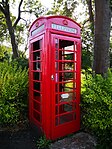
Lochlea Road, K6 Telephone Kiosk
55°49′19″N 4°17′24″W / 55.821858°N 4.289995°W / 55.821858; -4.289995 (Lochlea Road, K6 Telephone Kiosk ) Category B
33937
Upload another image
141 Merrylee Road, Telephone Exchange
55°48′52″N 4°16′04″W / 55.814324°N 4.267828°W / 55.814324; -4.267828 (141 Merrylee Road, Telephone Exchange ) Category B
33939
Upload Photo
18 Moss-Side Road, Frankfort Street, Bertram Street, Former Waverley Cinema
55°49′52″N 4°16′54″W / 55.831214°N 4.281762°W / 55.831214; -4.281762 (18 Moss-Side Road, Frankfort Street, Bertram Street, Former Waverley Cinema ) Category A
33941
Upload another image
25 Greenhead Street, 3-23 (Odd Nos) Macphail Street
55°50′56″N 4°13′56″W / 55.848866°N 4.232297°W / 55.848866; -4.232297 (25 Greenhead Street, 3-23 (Odd Nos) Macphail Street ) Category B
33844
Upload Photo
67-73 (Odd Nos) Greenhead Street Including Gatepiers And Railings
55°50′52″N 4°13′53″W / 55.847715°N 4.231337°W / 55.847715; -4.231337 (67-73 (Odd Nos) Greenhead Street Including Gatepiers And Railings ) Category C(S)
33848
Upload Photo
15-23 (Odd Nos) London Road And 26 Gallowgate, Mercat Building
55°51′23″N 4°14′35″W / 55.856326°N 4.243127°W / 55.856326; -4.243127 (15-23 (Odd Nos) London Road And 26 Gallowgate, Mercat Building ) Category A
33851
Upload Photo
92-106 (Even Nos) Tobago Street
55°51′08″N 4°13′49″W / 55.852243°N 4.230414°W / 55.852243; -4.230414 (92-106 (Even Nos) Tobago Street ) Category B
33859
Upload Photo
826 Cumbernauld Road, Smithycroft Road, St Thomas The Apostle Rc Church
55°52′01″N 4°11′33″W / 55.866956°N 4.192403°W / 55.866956; -4.192403 (826 Cumbernauld Road, Smithycroft Road, St Thomas The Apostle Rc Church ) Category B
33867
Upload Photo
Alexandra Parade, Fountain At Gate To Alexandra Park
55°51′47″N 4°12′35″W / 55.863143°N 4.209592°W / 55.863143; -4.209592 (Alexandra Parade, Fountain At Gate To Alexandra Park ) Category B
33881
Upload another image
368 Alexandra Parade, Wd & Ho Wills Tobacco Factory
55°51′49″N 4°13′23″W / 55.863709°N 4.223112°W / 55.863709; -4.223112 (368 Alexandra Parade, Wd & Ho Wills Tobacco Factory ) Category B
33883
Upload Photo


