|
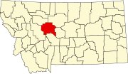
List of lakes of Cascade County, Montana
There are at least 15 named lakes and reservoirs in Cascade County, Montana.
Lakes
- Benton Lake, 47°39′56″N 111°19′39″W / 47.66556°N 111.32750°W / 47.66556; -111.32750 (Benton Lake), el. 3,625 feet (1,105 m),[1] location of Benton Lake National Wildlife Refuge
- Black Horse Lake, 47°36′29″N 111°13′06″W / 47.60806°N 111.21833°W / 47.60806; -111.21833 (Black Horse Lake), el. 3,415 feet (1,041 m)[2]
- Cannon Lake, 46°59′33″N 111°38′52″W / 46.99250°N 111.64778°W / 46.99250; -111.64778 (Cannon Lake), el. 4,872 feet (1,485 m)[3]
- Horseshoe Lake, 47°30′53″N 111°26′14″W / 47.51472°N 111.43722°W / 47.51472; -111.43722 (Horseshoe Lake), el. 3,320 feet (1,010 m)[4]
- Schrammeck Lake, 47°14′20″N 111°32′03″W / 47.23889°N 111.53417°W / 47.23889; -111.53417 (Schrammeck Lake), el. 3,730 feet (1,140 m)[5]
Reservoirs
- Cascade Reservoir, 47°16′33″N 111°42′48″W / 47.27583°N 111.71333°W / 47.27583; -111.71333 (Cascade Reservoir), el. 3,570 feet (1,090 m)[6]
- Dick Golie Fish Pond, 47°38′48″N 111°10′57″W / 47.64667°N 111.18250°W / 47.64667; -111.18250 (Dick Golie Fish Pond), el. 3,517 feet (1,072 m)[7]
- Elizabeth Reservoir, 47°22′24″N 111°42′02″W / 47.37333°N 111.70056°W / 47.37333; -111.70056 (Elizabeth Reservoir), el. 3,392 feet (1,034 m)[8]
- Gollaher Reservoir, 47°13′19″N 111°37′14″W / 47.22194°N 111.62056°W / 47.22194; -111.62056 (Gollaher Reservoir), el. 3,540 feet (1,080 m)[9]
- Hound Creek Reservoir, 47°00′33″N 111°41′30″W / 47.00917°N 111.69167°W / 47.00917; -111.69167 (Hound Creek Reservoir), el. 5,082 feet (1,549 m)[10]
- Middle Creek Lake, 46°56′21″N 111°40′47″W / 46.93917°N 111.67972°W / 46.93917; -111.67972 (Middle Creek Lake), el. 5,538 feet (1,688 m)[11]
- Morony Reservoir, 47°34′54″N 111°03′39″W / 47.58167°N 111.06083°W / 47.58167; -111.06083 (Morony Reservoir), el. 2,848 feet (868 m)[12]
- Neihart Reservoir, 46°54′53″N 110°43′56″W / 46.91472°N 110.73222°W / 46.91472; -110.73222 (Neihart Reservoir), el. 5,912 feet (1,802 m)[13]
- Rocky Reef Reservoir, 47°22′44″N 111°44′43″W / 47.37889°N 111.74528°W / 47.37889; -111.74528 (Rocky Reef Reservoir), el. 3,409 feet (1,039 m)[14]
- Spring Creek Reservoir, 47°01′26″N 111°40′13″W / 47.02389°N 111.67028°W / 47.02389; -111.67028 (Spring Creek Reservoir), el. 5,125 feet (1,562 m)[15]
See also
Notes
- ^ "Benton Lake". Geographic Names Information System. United States Geological Survey, United States Department of the Interior.
- ^ "Black Horse Lake". Geographic Names Information System. United States Geological Survey, United States Department of the Interior.
- ^ "Cannon Lake". Geographic Names Information System. United States Geological Survey, United States Department of the Interior.
- ^ "Horseshoe Lake". Geographic Names Information System. United States Geological Survey, United States Department of the Interior.
- ^ "Schrammeck Lake". Geographic Names Information System. United States Geological Survey, United States Department of the Interior.
- ^ "Cascade Reservoir". Geographic Names Information System. United States Geological Survey, United States Department of the Interior.
- ^ "Dick Golie Fish Pond". Geographic Names Information System. United States Geological Survey, United States Department of the Interior.
- ^ "Elizabeth Reservoir". Geographic Names Information System. United States Geological Survey, United States Department of the Interior.
- ^ "Gollaher Reservoir". Geographic Names Information System. United States Geological Survey, United States Department of the Interior.
- ^ "Hound Creek Reservoir". Geographic Names Information System. United States Geological Survey, United States Department of the Interior.
- ^ "Middle Creek Lake". Geographic Names Information System. United States Geological Survey, United States Department of the Interior.
- ^ "Morony Reservoir". Geographic Names Information System. United States Geological Survey, United States Department of the Interior.
- ^ "Neihart Reservoir". Geographic Names Information System. United States Geological Survey, United States Department of the Interior.
- ^ "Rocky Reef Reservoir". Geographic Names Information System. United States Geological Survey, United States Department of the Interior.
- ^ "Spring Creek Reservoir". Geographic Names Information System. United States Geological Survey, United States Department of the Interior.
|
