In the past, Khüiten Peak was also officially known in Mongolia as the "Friendship Peak" (Mongolian: Найрамдал уул, pronounced[ˈnæe̯ɾə̆mtɬˈoːɬ]).[4]
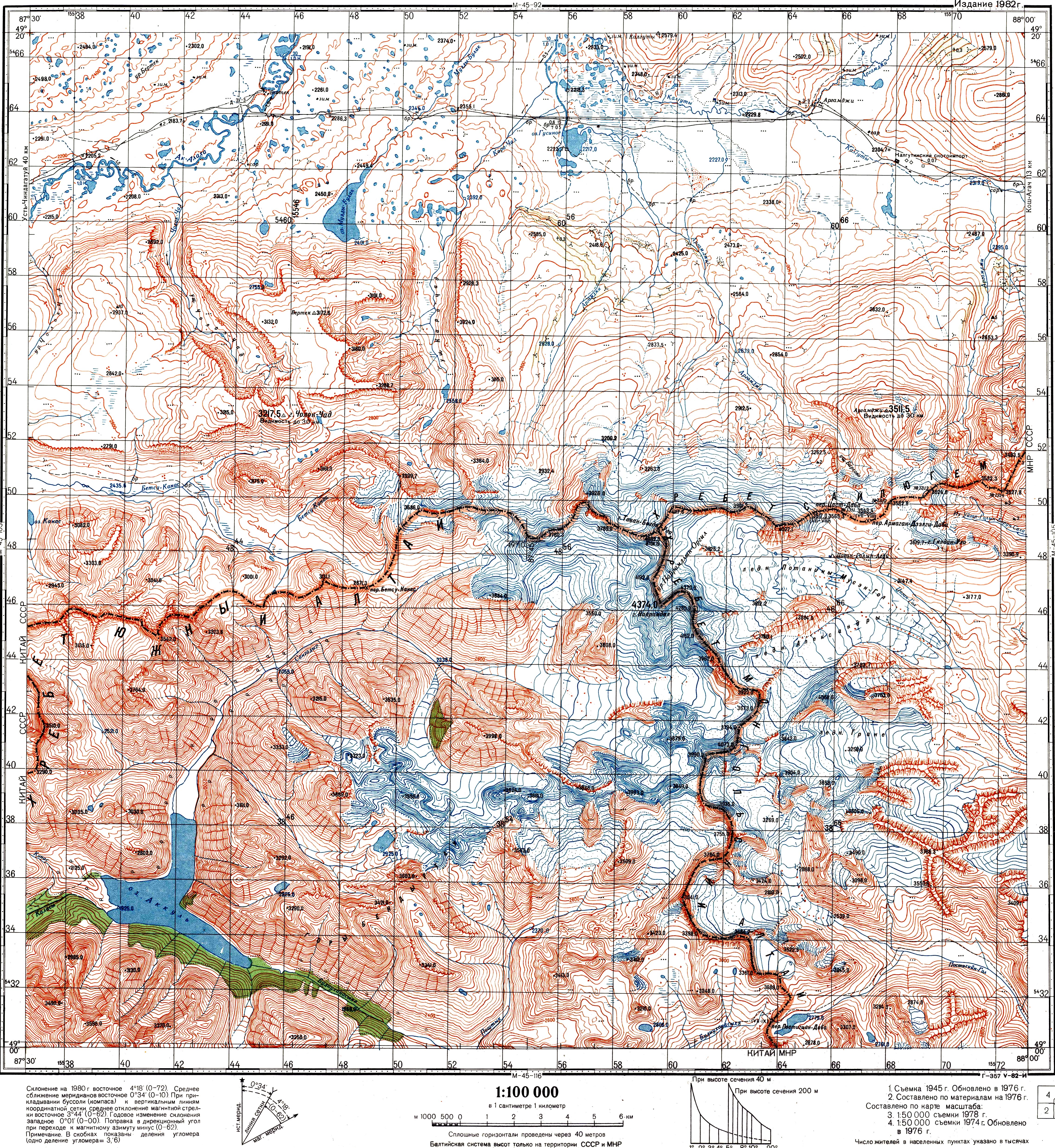
Khüiten Peak is one of five peaks of Tavan Bogd. Another peak, which is about 2.5 km north of it, marks the border tripoint between Russia, Mongolia, and China; the name of that peak is given in international agreements and on maps as Tavan Bogd Peak (Russian: Таван-Богдо-Ула, Tavan-Bogdo-Ula; Mongolian: Таван богд уул, Tabhan bogd uul), or Mount Kuitun (Chinese: 奎屯山; pinyin: Kuítún shān).[5][6][7]
Some sources, however, associate the name Nairamdal Peak (Friendship Peak) with the peak at the border tripoint.[citation needed]
The first known ascent of Khüiten Peak was in 1963 by Mongolian mountaineers sponsored by the government.
^See e.g. the index in Krumwiede et al. 2014; or see the Soviet Topo map M45-104, scale 1:100,000, where the name Mt. Nairamdal (г. Найрамдал) is associated with the peak whose elevation is 4374.0 m. The highest peak is also referred to as Nairamdal in Chistyakov & Ganiushkin 2015, p. 209
^中华人民共和国和俄罗斯联邦关于中俄国界西段的协定 (Agreement between the PRC and RF in regard to the western section of the China-Russia border), 1994-09-03 (in Chinese)
Krumwiede, Brandon S.; Kamp, Ulrich; Leonard, Gregory J.; Kargel, Jeffrey S.; Dashtseren, Avirmed; Walther, Michael (2014), "Recent Glacier Changes in the Mongolian Altai Mountains: Case Studies from Munkh Khairkhan and Tavan Bogd", in Kargel, Jeffrey Stuart (ed.), Global Land Ice Measurements from Space, Springer-Praxis series in geophysics, Springer, pp. 481–509, ISBN978-3540798187

