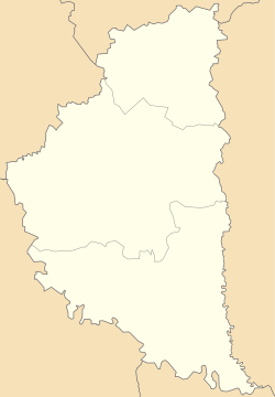
Kalne, Zboriv urban hromada, Ternopil Raion, Ternopil Oblast

Kal'ne
Кальне
Village
Kal'ne is located in Ternopil Oblast
Kal'ne
Kal'ne
Coordinates: 49°37′49″N 24°58′37″E / 49.63028°N 24.97694°E / 49.63028; 24.97694
Country Ukraine
ProvinceTernopil Oblast Ternopil Oblast
DistrictTernopil Raion
Established1492
Area
 • Total
2.400 km2 (0.927 sq mi)
Elevation
299 m (981 ft)
Population
 • Total
537
 • Density220/km2 (580/sq mi)
Time zoneUTC+2 (EET)
 • Summer (DST)UTC+3 (EEST)
Postal code
47270
Area code+380 3540
Websiteсело Кальне/райцентр Зборів (in Ukrainian)

Kalne (Ukrainian: Кальне́) is a village (selo) located in Ternopil Raion (district), Ternopil Oblast (province of Western Ukraine). It belongs to Zboriv urban hromada, one of the hromadas of Ukraine.[1]

The area of the village is 6,295 km2 and it has a population of 537 people. [2] Local government is administered by Kalnenska village council, which consists of two villages: Kalne and Zhabynia. [3]

Geography

The village is located on the banks of the river Zvarych (basin of the Dniester) at an altitude of 299 metres (980 ft) above sea level.
It is situated 53 kilometres (33 mi) from the regional center Ternopil, 16 kilometres (9.9 mi) from the district center Zboriv and 4 kilometres (2.5 mi) from an urban-type settlement Pomoryany.

History and Attractions

The first written mention of the village dates back to year 1492. In 1811 in the village been constructed a wooden church. It is a Church of the Resurrection (1811). [4] [5]

Until 18 July 2020, Kalne belonged to Zboriv Raion. The raion was abolished in July 2020 as part of the administrative reform of Ukraine, which reduced the number of raions of Ternopil Oblast to three. The area of Zboriv Raion was merged into Ternopil Raion.[6][7]

The priest Luka Demchuk (1873–1929)[8][9] has been headed the parish of the village Kal'ne from 1909 to 1929. He has been grandfather of the UGCC of Cardinal Lubomyr Husar.

Religion

References

  1. ^ "Зборовская громада" (in Russian). Портал об'єднаних громад України.
  2. ^ Село Кальне (Тернопільська обл., Зборівський р-н): карта вулиць, фото (in Ukrainian)
  3. ^ Кальненська сільська рада (in Ukrainian)
  4. ^ Церква Воскресіння Христового (с.Кальне, Тернопільська обл.): карта, фото (in Ukrainian)
  5. ^ Кальне, Церква Воскресіння Господнього 1811 (in Ukrainian)
  6. ^ "Про утворення та ліквідацію районів. Постанова Верховної Ради України № 807-ІХ". Голос України (in Ukrainian). 2020-07-18. Retrieved 2020-10-03.
  7. ^ "Нові райони: карти + склад" (in Ukrainian). Міністерство розвитку громад та територій України.
  8. ^ Демчук, родовід (in Ukrainian)
  9. ^ [1] (in Ukrainian)

Literature


Prefix: a b c d e f g h i j k l m n o p q r s t u v w x y z 0 1 2 3 4 5 6 7 8 9

Portal di Ensiklopedia Dunia