|
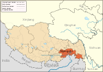
Galongla MountainGalongla Mountain (Chinese: 嘎隆拉山, Tibetan: དགའ་ལུང་ལ་), elevation 5,106 meters, straddles Bomi County and Medog County in Tibet Autonomous Region, forming a critical segment of the eastern Himalayan syntaxis.[1][2][3] GeographyIts glaciated slopes (ice coverage: 3.8 km²) feed the Parlung Tsangpo River and the Yarlung Tsangpo basin. The mountain's thrust-fold structure, exposed in 200-meter-high rock faces, reveals Precambrian gneiss overlying Cretaceous granites due to ongoing tectonic compression (convergence rate: 18 mm/year).[4][5] The Galongla Tunnel (China National Highway 318), completed in 2010 at 3,700 meters, eased access but increased black carbon deposition on the glacier (0.8 μg/g ice core measurements).[6][7] Protected under China's National Ecological Security Barrier Project, the area sustains rare species like the Mishmi takin (Budorcas taxicolor) and Rhododendron galactinum, a cloud-forest shrub endemic to its 3,800–4,200 m slopes.[8][9] UNESCO designated it part of the Yarlung Tsangpo Grand Canyon Biosphere Reserve in 2021. Infrared camera traps (2020–2023) recorded 14 snow leopard transits annually. Permitted trekking routes (May–October) avoid calving icefalls, with mandatory local guides.[10] References
|
Portal di Ensiklopedia Dunia
