Eismeer railway station

Eismeer
General information
LocationEismeer
Grindelwald, Bern
Switzerland
Coordinates46°34′20″N 08°00′37″E / 46.57222°N 8.01028°E / 46.57222; 8.01028
Elevation3,159 m (10,364 ft)[1]
Owned byJungfrau Railway (JB)
Operated byJB
Line(s)Jungfraubahn
History
Opened25 July 1905; 119 years ago (1905-07-25)
Services
Preceding station Jungfraubahn AG Following station
Eigergletscher Jungfrau Railway Jungfraujoch
Terminus
Location
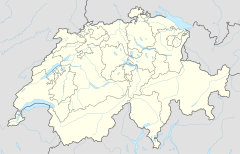
Eismeer is located in Switzerland
Eismeer
Eismeer
Location in Switzerland
View of the Ischmeer (lit.: Ice Sea) from the station

Eismeer railway station (German for Ice Sea) is an underground railway station bored into the mountain Eiger on the Jungfrau Railway, which runs to the Jungfraujoch from Kleine Scheidegg. It lies at an altitude of 3,159 metres above sea level, which makes it the second highest railway station in Europe. Located just behind the south-east face of the Eiger, the station's principal purpose is to allow passengers to observe the view of the glacier Ischmeer (lit.: Ice Sea, formerly called Grindelwald-Fiescher Glacier). To that end, uphill trains stop at the station for five minutes.[1][2][3][4]

The station opened on 25 July 1905, with the extension of the Jungfraubahn from its previous terminus at the now-closed Eigerwand station. The building of the line this far had depleted the railway company's finances, and for the next seven years, Eismeer was to remain the upper terminus. After further fund-raising and an extended construction period, the line was extended to Jungfraujoch station in 1912 and Eismeer became an intermediate stop.[2][5]

The station also enables access of the Mittellegi Hut via a tunnel that leads out onto the Challifirn glacier.[6] As a consequence, it is also a frequent starting point for ascents of the Eiger via the Mittellegi Ridge.[7][8]

Administratively, the station is in the municipality of Grindelwald in the canton of Bern.[3]

The following passenger trains operate:

Operator Train type Route Typical frequency Notes
Jungfraubahn Kleine Scheidegg - Eigergletscher - Eismeer - Jungfraujoch 2 per hour Uphill trains only

See also

References

  1. ^ a b Eisenbahnatlas Schweiz. Verlag Schweers + Wall GmbH. 2012. p. 82. ISBN 978-3-89494-130-7.
  2. ^ a b Allen, Cecil J. (1958). Switzerland's Amazing Railways. London: Thomas Nelson and Sons. p. 141.
  3. ^ a b "2520 - Jungfrau Region" (Map). Eismeer (2016 ed.). 1:25 000. National Maps 1:25'000. Federal Office of Topography - swisstopo. ISBN 978-3-302-02520-9. Retrieved 2017-06-07 – via map.geo.admin.ch.
  4. ^ "The Jungfrau Railway – A Pioneering Work". Jungfraubahn. Archived from the original on 2013-02-02. Retrieved 2013-02-07.
  5. ^ "The Jungfrau Railway – History". Jungfraubahn. Archived from the original on 2013-04-07. Retrieved 2013-02-08.
  6. ^ https://www.mittellegi.ch/en/mittellegi-hut/routes [bare URL]
  7. ^ https://www.thebmc.co.uk/how-to-climb-the-eiger [bare URL]
  8. ^ https://verticalfrontiers.com/traverse-of-the-eiger-mittellegi-ridge/ [bare URL]


Prefix: a b c d e f g h i j k l m n o p q r s t u v w x y z 0 1 2 3 4 5 6 7 8 9

Portal di Ensiklopedia Dunia