Berloi Waterfall

Berloi Waterfall
The waterfall in March 2016
Location of waterfall
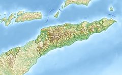
Map
LocationFatisi, Laulara, Aileu, East Timor
Coordinates8°38′43″S 125°31′30″E / 8.6453°S 125.525°E / -8.6453; 125.525
Elevationc. 541–545 m (1,775–1,788 ft) AMSL
WatercourseBerloi / Berloi-Fatisi River

The Berloi Waterfall (Portuguese: Cascata de Berloi, Tetum: Be Tuda Berloi) is a small waterfall in the municipality of Aileu, East Timor. It forms part of a minor tributary of the Comoro River.

Geography

The waterfall is located within the suco of Fatisi and the Laulara administrative post in the Aileu municipality, a short distance from Dili, the capital city.[1]: ff [2][3] The stream that passes over the waterfall is sometimes referred to as the Berloi River or the Berloi-Fatisi River,[3] and is a minor tributary of the Comoro River.[2][4]

From the base of the waterfall, the stream flows initially in a southwesterly direction for a short distance. It then turns northwest to mark the border between the municipalities of Aileu and Ermera for about 3 km (1.9 mi), until it flows into the Comoro River about 5 km (3.1 mi) downstream of the village of Railaco [de].[2][4]

History

On 19 August 1975, during the East Timorese Civil War, a member of Unetim, the Fretilin youth wing, killed a man who was being detained by Fretilin at the detention centre in Unmenlau, in the then sub-district of Laulara. His body was thrown into the stream near the waterfall. The following day, 20 August 1975, a group of eight men, who were being detained by Fretilin in Fatisi on suspicion of being spies for the Timorese Democratic Union (Portuguese: União Democrática Timorense (UDT)), were taken outside. Five of them were killed at the stream, and the remaining three were killed near Fatisi.[3]

Ecology

The waterfall is a habitat, and has been a site for observation and recording, of both rare and abundant species of dragonfly.[1]

See also

References

  1. ^ a b Seehausen, Malte; Pinto, Rui Miguel da Silva; Trainor, Colin Richard; Lopes, Jafet Potenzo (30 December 2018). "Further records of Odonata from Timor Island, with the first photographs of living Nososticta impercepta (Odonata: Platycnemididae) and additional records from Rote and Romang Islands". Faunistic Studies in South-east Asian and Pacific Island Odonata, Journal of the International Dragonfly Fund (25): 1–75. ISSN 2195-4534. Retrieved 10 April 2022.
  2. ^ a b c Município Aileu: Esboços Mapa Suco no Aldeia Timor-Leste (PDF) (in Tetum). Dili: Ministério das Finanças / Direcção Geral de Estatística / Direcção Nacional Cartografia Estatísticas. 2019. p. 27. Archived from the original (PDF) on 12 November 2020. Retrieved 10 April 2022.
  3. ^ a b c "Part 7.2: Unlawful Killings and Enforced Disappearances" (PDF). Chega! The Report of the Commission for Reception, Truth, and Reconciliation Timor-Leste. Dili: Commission for Reception, Truth and Reconciliation in East Timor. 2005. p. 20. Retrieved 10 April 2022.
  4. ^ a b Município Ermera: Esboços Mapa Suco no Aldeia Timor-Leste (PDF) (in Tetum). Dili: Ministério das Finanças / Direcção Geral de Estatística / Direcção Nacional Cartografia Estatísticas. 2019. p. 74. Archived from the original (PDF) on 19 November 2020. Retrieved 10 April 2022.


Prefix: a b c d e f g h i j k l m n o p q r s t u v w x y z 0 1 2 3 4 5 6 7 8 9

Portal di Ensiklopedia Dunia