Ang Green Hill ngalan niining mga mosunod:
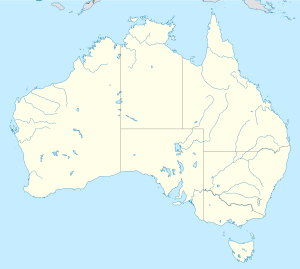
Awstralya
Mga dapit nga gitawag Green Hill sa
Awstralya .
Green Hill (bungtod sa Awstralya, State of South Australia, lat -35,10, long 137,47) , 35°06′00″S 137°28′00″E / 35.1°S 137.46667°E / -35.1; 137.46667 (Green Hill (bungtod sa Awstralya, State of South Australia, lat -35,10, long 137,47) ) Green Hill (bungtod sa Awstralya, State of Western Australia, Dandaragan) , 30°34′29″S 115°08′27″E / 30.57461°S 115.1409°E / -30.57461; 115.1409 (Green Hill (bungtod sa Awstralya, State of Western Australia, Dandaragan) ) Green Hill (bungtod sa Awstralya, State of Western Australia, Augusta-Margaret River Shire) , 34°19′00″S 115°06′00″E / 34.31667°S 115.1°E / -34.31667; 115.1 (Green Hill (bungtod sa Awstralya, State of Western Australia, Augusta-Margaret River Shire) ) Green Hill (lungsod sa Awstralya, State of New South Wales, Kempsey) , 31°03′32″S 152°48′06″E / 31.05902°S 152.80174°E / -31.05902; 152.80174 (Green Hill (lungsod sa Awstralya, State of New South Wales, Kempsey) ) Green Hill (bukid sa Awstralya, State of Tasmania, Central Highlands) , 42°23′S 147°07′E / 42.38°S 147.11°E / -42.38; 147.11 (Green Hill (bukid sa Awstralya, State of Tasmania, Central Highlands) ) Green Hill (bungtod sa Awstralya, State of New South Wales, Liverpool Plains) , 31°43′54″S 150°31′04″E / 31.7318°S 150.5179°E / -31.7318; 150.5179 (Green Hill (bungtod sa Awstralya, State of New South Wales, Liverpool Plains) ) Green Hill (bungtod sa Awstralya, State of Queensland, Isaac) , 21°41′00″S 149°27′00″E / 21.68333°S 149.45°E / -21.68333; 149.45 (Green Hill (bungtod sa Awstralya, State of Queensland, Isaac) ) Green Hill (bungtod sa Awstralya, State of Queensland, Hope Vale) , 15°16′00″S 145°18′00″E / 15.26667°S 145.3°E / -15.26667; 145.3 (Green Hill (bungtod sa Awstralya, State of Queensland, Hope Vale) ) Green Hill (bungtod sa Awstralya, State of Queensland, Cairns) , 17°03′S 145°48′E / 17.05°S 145.8°E / -17.05; 145.8 (Green Hill (bungtod sa Awstralya, State of Queensland, Cairns) ) Green Hill (bungtod sa Awstralya, State of Queensland, Torres) , 10°35′02″S 142°12′41″E / 10.58394°S 142.21136°E / -10.58394; 142.21136 (Green Hill (bungtod sa Awstralya, State of Queensland, Torres) ) Green Hill (bukid sa Awstralya, State of Victoria, Southern Grampians) , 37°20′08″S 142°23′00″E / 37.3355°S 142.38341°E / -37.3355; 142.38341 (Green Hill (bukid sa Awstralya, State of Victoria, Southern Grampians) ) Green Hill (bungtod sa Awstralya, State of New South Wales, Bega Valley) , 37°14′29″S 150°00′21″E / 37.24143°S 150.00586°E / -37.24143; 150.00586 (Green Hill (bungtod sa Awstralya, State of New South Wales, Bega Valley) ) Green Hill (bungtod sa Awstralya, State of New South Wales, Yass Valley) , 35°00′55″S 149°05′05″E / 35.0152°S 149.0846°E / -35.0152; 149.0846 (Green Hill (bungtod sa Awstralya, State of New South Wales, Yass Valley) ) Green Hill (bungtod sa Awstralya, State of New South Wales, Upper Lachlan Shire, lat -34,22, long 149,61) , 34°12′55″S 149°36′35″E / 34.2152°S 149.6096°E / -34.2152; 149.6096 (Green Hill (bungtod sa Awstralya, State of New South Wales, Upper Lachlan Shire, lat -34,22, long 149,61) ) Green Hill (bungtod sa Awstralya, State of New South Wales, Upper Lachlan Shire, lat -34,38, long 149,87) , 34°22′34″S 149°52′12″E / 34.376°S 149.8701°E / -34.376; 149.8701 (Green Hill (bungtod sa Awstralya, State of New South Wales, Upper Lachlan Shire, lat -34,38, long 149,87) ) Green Hill (bungtod sa Awstralya, State of New South Wales, Lithgow, lat -33,10, long 150,40) , 33°05′55″S 150°24′04″E / 33.0985°S 150.4012°E / -33.0985; 150.4012 (Green Hill (bungtod sa Awstralya, State of New South Wales, Lithgow, lat -33,10, long 150,40) ) Green Hill (bungtod sa Awstralya, State of New South Wales, Upper Lachlan Shire, lat -34,52, long 149,70) , 34°30′55″S 149°42′04″E / 34.5152°S 149.7012°E / -34.5152; 149.7012 (Green Hill (bungtod sa Awstralya, State of New South Wales, Upper Lachlan Shire, lat -34,52, long 149,70) ) Green Hill (bungtod sa Awstralya, State of New South Wales, Dungog) , 32°31′25″S 151°39′04″E / 32.5235°S 151.6512°E / -32.5235; 151.6512 (Green Hill (bungtod sa Awstralya, State of New South Wales, Dungog) ) Green Hill (bungtod sa Awstralya, State of New South Wales, Lithgow, lat -33,22, long 149,98) , 33°13′25″S 149°58′34″E / 33.2235°S 149.9762°E / -33.2235; 149.9762 (Green Hill (bungtod sa Awstralya, State of New South Wales, Lithgow, lat -33,22, long 149,98) ) Green Hill (bungtod sa Awstralya, State of New South Wales, Clarence Valley) , 29°30′55″S 153°12′35″E / 29.5152°S 153.2096°E / -29.5152; 153.2096 (Green Hill (bungtod sa Awstralya, State of New South Wales, Clarence Valley) ) Green Hill (bungtod sa Awstralya, State of New South Wales, Berrigan) , 35°41′55″S 145°51′04″E / 35.6985°S 145.8512°E / -35.6985; 145.8512 (Green Hill (bungtod sa Awstralya, State of New South Wales, Berrigan) ) Green Hill (bungtod sa Awstralya, State of South Australia, Lower Eyre Peninsula, lat -34,40, long 135,71) , 34°24′16″S 135°42′52″E / 34.40445°S 135.71435°E / -34.40445; 135.71435 (Green Hill (bungtod sa Awstralya, State of South Australia, Lower Eyre Peninsula, lat -34,40, long 135,71) ) Green Hill (bungtod sa Awstralya, State of South Australia, Lower Eyre Peninsula, lat -34,09, long 135,38) , 34°05′07″S 135°22′50″E / 34.08523°S 135.38045°E / -34.08523; 135.38045 (Green Hill (bungtod sa Awstralya, State of South Australia, Lower Eyre Peninsula, lat -34,09, long 135,38) ) Green Hill (bungtod sa Awstralya, State of Tasmania, Southern Midlands) , 42°19′S 147°26′E / 42.32°S 147.44°E / -42.32; 147.44 (Green Hill (bungtod sa Awstralya, State of Tasmania, Southern Midlands) ) Green Hill (bungtod sa Awstralya, State of Victoria, Loddon) , 36°46′56″S 143°41′43″E / 36.78236°S 143.69514°E / -36.78236; 143.69514 (Green Hill (bungtod sa Awstralya, State of Victoria, Loddon) ) Green Hill (bungtod sa Awstralya, State of Victoria, Moorabool) , 37°30′53″S 143°58′05″E / 37.51486°S 143.96792°E / -37.51486; 143.96792 (Green Hill (bungtod sa Awstralya, State of Victoria, Moorabool) ) Green Hill (bungtod sa Awstralya, State of Victoria, Ballarat North, lat -37,56, long 143,75) , 37°33′42″S 143°45′01″E / 37.56153°S 143.75014°E / -37.56153; 143.75014 (Green Hill (bungtod sa Awstralya, State of Victoria, Ballarat North, lat -37,56, long 143,75) ) Green Hill (bungtod sa Awstralya, State of Victoria, Pyrenees) , 37°36′16″S 143°36′12″E / 37.60458°S 143.60347°E / -37.60458; 143.60347 (Green Hill (bungtod sa Awstralya, State of Victoria, Pyrenees) ) Green Hill (bungtod sa Awstralya, State of Victoria, Ballarat North, lat -37,63, long 143,90) , 37°37′51″S 143°54′08″E / 37.63097°S 143.90236°E / -37.63097; 143.90236 (Green Hill (bungtod sa Awstralya, State of Victoria, Ballarat North, lat -37,63, long 143,90) ) Green Hill (bungtod sa Awstralya, State of Victoria, Wangaratta) , 36°24′23″S 146°29′22″E / 36.40625°S 146.48931°E / -36.40625; 146.48931 (Green Hill (bungtod sa Awstralya, State of Victoria, Wangaratta) ) Green Hill (bungtod sa Awstralya, State of Victoria, Benalla) , 36°45′42″S 145°52′55″E / 36.76153°S 145.88208°E / -36.76153; 145.88208 (Green Hill (bungtod sa Awstralya, State of Victoria, Benalla) ) Green Hill (bungtod sa Awstralya, State of Victoria, Alpine) , 36°47′53″S 146°47′17″E / 36.79819°S 146.78819°E / -36.79819; 146.78819 (Green Hill (bungtod sa Awstralya, State of Victoria, Alpine) ) Green Hill (bungtod sa Awstralya, State of Victoria, Strathbogie) , 36°58′38″S 145°21′47″E / 36.97736°S 145.36319°E / -36.97736; 145.36319 (Green Hill (bungtod sa Awstralya, State of Victoria, Strathbogie) ) Green Hill (bungtod sa Awstralya, State of Victoria, Mount Alexander) , 37°09′11″S 144°25′58″E / 37.15292°S 144.43264°E / -37.15292; 144.43264 (Green Hill (bungtod sa Awstralya, State of Victoria, Mount Alexander) ) Green Hill (bungtod sa Awstralya, State of Victoria, Mitchell) , 37°25′23″S 144°59′07″E / 37.42319°S 144.98514°E / -37.42319; 144.98514 (Green Hill (bungtod sa Awstralya, State of Victoria, Mitchell) ) Green Hill (bungtod sa Awstralya, State of Victoria, Melton) , 37°33′50″S 144°36′11″E / 37.56375°S 144.60319°E / -37.56375; 144.60319 (Green Hill (bungtod sa Awstralya, State of Victoria, Melton) ) Green Hill (bungtod sa Awstralya, State of Victoria, Surf Coast) , 38°17′01″S 144°09′20″E / 38.28375°S 144.15542°E / -38.28375; 144.15542 (Green Hill (bungtod sa Awstralya, State of Victoria, Surf Coast) ) Green Hill (bungtod sa Awstralya, State of Western Australia, Victoria Plains) , 31°00′45″S 116°11′55″E / 31.01238°S 116.1987°E / -31.01238; 116.1987 (Green Hill (bungtod sa Awstralya, State of Western Australia, Victoria Plains) )
Canada
Mga dapit nga gitawag Green Hill sa
Canada .
Green Hill (bungtod sa Canada, Newfoundland and Labrador, lat 49,53, long -56,86) , 49°32′00″N 56°51′54″W / 49.5333°N 56.86496°W / 49.5333; -56.86496 (Green Hill (bungtod sa Canada, Newfoundland and Labrador, lat 49,53, long -56,86) ) Green Hill (bungtod sa Canada, Newfoundland and Labrador, lat 51,48, long -55,51) , 51°29′00″N 55°30′53″W / 51.48338°N 55.51466°W / 51.48338; -55.51466 (Green Hill (bungtod sa Canada, Newfoundland and Labrador, lat 51,48, long -55,51) ) Green Hill (bungtod sa Canada, Newfoundland and Labrador, lat 47,27, long -52,95) , 47°16′00″N 52°56′53″W / 47.26659°N 52.94806°W / 47.26659; -52.94806 (Green Hill (bungtod sa Canada, Newfoundland and Labrador, lat 47,27, long -52,95) ) Green Hill (bungtod sa Canada, Newfoundland and Labrador, lat 47,28, long -52,85) , 47°16′59″N 52°50′53″W / 47.28319°N 52.84805°W / 47.28319; -52.84805 (Green Hill (bungtod sa Canada, Newfoundland and Labrador, lat 47,28, long -52,85) ) Green Hill (bungtod sa Canada, Newfoundland and Labrador, lat 48,64, long -53,88) , 48°38′20″N 53°52′33″W / 48.6388°N 53.8759°W / 48.6388; -53.8759 (Green Hill (bungtod sa Canada, Newfoundland and Labrador, lat 48,64, long -53,88) ) Green Hill (bungtod sa Canada, Newfoundland and Labrador, lat 49,41, long -57,94) , 49°24′35″N 57°56′14″W / 49.40971°N 57.93723°W / 49.40971; -57.93723 (Green Hill (bungtod sa Canada, Newfoundland and Labrador, lat 49,41, long -57,94) ) Green Hill (bungtod sa Canada, Newfoundland and Labrador, lat 47,09, long -55,17) , 47°05′29″N 55°10′09″W / 47.09134°N 55.1691°W / 47.09134; -55.1691 (Green Hill (bungtod sa Canada, Newfoundland and Labrador, lat 47,09, long -55,17) ) Green Hill (bungtod sa Canada, Nova Scotia, lat 46,02, long -61,57) , 46°01′01″N 61°33′55″W / 46.01684°N 61.56525°W / 46.01684; -61.56525 (Green Hill (bungtod sa Canada, Nova Scotia, lat 46,02, long -61,57) ) Green Hill (bungtod sa Canada, Nova Scotia, lat 45,58, long -62,80) , 45°35′00″N 62°47′55″W / 45.58345°N 62.79864°W / 45.58345; -62.79864 (Green Hill (bungtod sa Canada, Nova Scotia, lat 45,58, long -62,80) ) Green Hill (bungtod sa Canada, Nova Scotia, lat 44,44, long -63,73) , 44°26′34″N 63°43′42″W / 44.44268°N 63.72843°W / 44.44268; -63.72843 (Green Hill (bungtod sa Canada, Nova Scotia, lat 44,44, long -63,73) ) Green Hill (bungtod sa Canada, Ontario) , 44°18′00″N 78°20′58″W / 44.30012°N 78.34953°W / 44.30012; -78.34953 (Green Hill (bungtod sa Canada, Ontario) )
Tinipong Bansa
Green Hill (bukid sa Tinipong Bansa, Georgia, Chattahoochee County) , 32°21′16″N 84°54′44″W / 32.35431°N 84.91215°W / 32.35431; -84.91215 (Green Hill (bukid sa Tinipong Bansa, Georgia, Chattahoochee County) ) Green Hill (bukid sa Tinipong Bansa, Georgia, Upson County) , 32°56′42″N 84°26′11″W / 32.94513°N 84.43631°W / 32.94513; -84.43631 (Green Hill (bukid sa Tinipong Bansa, Georgia, Upson County) ) Green Hill (bukid sa Tinipong Bansa, Kentucky, Caldwell County) , 37°13′00″N 87°53′56″W / 37.21672°N 87.8989°W / 37.21672; -87.8989 (Green Hill (bukid sa Tinipong Bansa, Kentucky, Caldwell County) ) Green Hill (bukid sa Tinipong Bansa, Missouri) , Crawford County, 37°48′51″N 91°11′22″W / 37.81421°N 91.18958°W / 37.81421; -91.18958 (Green Hill (bukid sa Tinipong Bansa, Missouri) ) Green Hill (bukid sa Tinipong Bansa, Tennessee, Williamson County) , 35°57′12″N 86°52′24″W / 35.9534°N 86.87333°W / 35.9534; -86.87333 (Green Hill (bukid sa Tinipong Bansa, Tennessee, Williamson County) ) Green Hill (lungsod sa Tinipong Bansa, Tennessee, Wilson County) , 36°13′22″N 86°32′58″W / 36.22283°N 86.54944°W / 36.22283; -86.54944 (Green Hill (lungsod sa Tinipong Bansa, Tennessee, Wilson County) ) Green Hill (bukid sa Tinipong Bansa, Tennessee, Maury County) , 35°40′48″N 87°01′43″W / 35.68007°N 87.02862°W / 35.68007; -87.02862 (Green Hill (bukid sa Tinipong Bansa, Tennessee, Maury County) ) Green Hill (bukid sa Tinipong Bansa, Texas, Kleberg County) , 27°22′05″N 97°21′09″W / 27.3681°N 97.35249°W / 27.3681; -97.35249 (Green Hill (bukid sa Tinipong Bansa, Texas, Kleberg County) ) Green Hill (bukid sa Tinipong Bansa, Texas, Willacy County) , 26°29′30″N 97°24′31″W / 26.49173°N 97.40859°W / 26.49173; -97.40859 (Green Hill (bukid sa Tinipong Bansa, Texas, Willacy County) ) Green Hill (bukid sa Tinipong Bansa, Virginia, Rockbridge County) , 37°45′35″N 79°38′57″W / 37.75985°N 79.64921°W / 37.75985; -79.64921 (Green Hill (bukid sa Tinipong Bansa, Virginia, Rockbridge County) ) Green Hill (bukid sa Tinipong Bansa, Virginia, Rockingham County) , 38°32′59″N 78°53′26″W / 38.54984°N 78.89058°W / 38.54984; -78.89058 (Green Hill (bukid sa Tinipong Bansa, Virginia, Rockingham County) ) Green Hill (bukid sa Tinipong Bansa, Virginia, Warren County, lat 38,92, long -78,15) , 38°54′59″N 78°08′46″W / 38.9165°N 78.14611°W / 38.9165; -78.14611 (Green Hill (bukid sa Tinipong Bansa, Virginia, Warren County, lat 38,92, long -78,15) ) Green Hill (bukid sa Tinipong Bansa, West Virginia) , Braxton County, 38°46′06″N 80°27′35″W / 38.76843°N 80.45981°W / 38.76843; -80.45981 (Green Hill (bukid sa Tinipong Bansa, West Virginia) ) Green Hill (bukid sa Tinipong Bansa, Connecticut, Hartford County) , 41°46′51″N 72°29′14″W / 41.78093°N 72.48731°W / 41.78093; -72.48731 (Green Hill (bukid sa Tinipong Bansa, Connecticut, Hartford County) ) Green Hill (bukid sa Tinipong Bansa, Connecticut, New Haven County) , 41°17′53″N 72°36′51″W / 41.29815°N 72.61426°W / 41.29815; -72.61426 (Green Hill (bukid sa Tinipong Bansa, Connecticut, New Haven County) ) Green Hill (bukid sa Tinipong Bansa, Connecticut, New London County) , 41°20′16″N 72°11′41″W / 41.33788°N 72.1948°W / 41.33788; -72.1948 (Green Hill (bukid sa Tinipong Bansa, Connecticut, New London County) ) Green Hill (bukid sa Tinipong Bansa, Massachusetts, Barnstable County) , 42°00′55″N 70°02′28″W / 42.01538°N 70.04113°W / 42.01538; -70.04113 (Green Hill (bukid sa Tinipong Bansa, Massachusetts, Barnstable County) ) Green Hill (bukid sa Tinipong Bansa, Massachusetts, Essex County, lat 42,55, long -70,89) , 42°33′05″N 70°53′23″W / 42.55148°N 70.88977°W / 42.55148; -70.88977 (Green Hill (bukid sa Tinipong Bansa, Massachusetts, Essex County, lat 42,55, long -70,89) ) Green Hill (bukid sa Tinipong Bansa, Massachusetts, Hampden County) , 42°13′50″N 72°56′41″W / 42.23065°N 72.94482°W / 42.23065; -72.94482 (Green Hill (bukid sa Tinipong Bansa, Massachusetts, Hampden County) ) Green Hill (bukid sa Tinipong Bansa, Massachusetts, Middlesex County) , 42°22′00″N 71°24′30″W / 42.36676°N 71.40839°W / 42.36676; -71.40839 (Green Hill (bukid sa Tinipong Bansa, Massachusetts, Middlesex County) ) Green Hill (bukid sa Tinipong Bansa, Massachusetts, Plymouth County) , 42°16′00″N 70°49′43″W / 42.26677°N 70.82866°W / 42.26677; -70.82866 (Green Hill (bukid sa Tinipong Bansa, Massachusetts, Plymouth County) ) Green Hill (bukid sa Tinipong Bansa, Massachusetts, Suffolk County) , 42°18′10″N 71°07′57″W / 42.30288°N 71.13255°W / 42.30288; -71.13255 (Green Hill (bukid sa Tinipong Bansa, Massachusetts, Suffolk County) ) Green Hill (bukid sa Tinipong Bansa, Massachusetts, Worcester County, lat 42,26, long -71,68) , 42°15′30″N 71°40′58″W / 42.25843°N 71.68285°W / 42.25843; -71.68285 (Green Hill (bukid sa Tinipong Bansa, Massachusetts, Worcester County, lat 42,26, long -71,68) ) Green Hill (bukid sa Tinipong Bansa, Massachusetts, Worcester County, lat 42,37, long -71,71) , 42°22′24″N 71°42′46″W / 42.37343°N 71.71285°W / 42.37343; -71.71285 (Green Hill (bukid sa Tinipong Bansa, Massachusetts, Worcester County, lat 42,37, long -71,71) ) Green Hill (bukid sa Tinipong Bansa, Massachusetts, Worcester County, lat 42,29, long -71,78) , 42°17′15″N 71°46′58″W / 42.28759°N 71.78285°W / 42.28759; -71.78285 (Green Hill (bukid sa Tinipong Bansa, Massachusetts, Worcester County, lat 42,29, long -71,78) ) Green Hill (bukid sa Tinipong Bansa, Maine, Cumberland County) , 44°05′54″N 70°46′54″W / 44.09837°N 70.78153°W / 44.09837; -70.78153 (Green Hill (bukid sa Tinipong Bansa, Maine, Cumberland County) ) Green Hill (bukid sa Tinipong Bansa, Maine, Franklin County) , 44°39′43″N 70°24′08″W / 44.662°N 70.40229°W / 44.662; -70.40229 (Green Hill (bukid sa Tinipong Bansa, Maine, Franklin County) ) Green Hill (bukid sa Tinipong Bansa, Maine, Somerset County) , 44°37′53″N 69°45′50″W / 44.63134°N 69.76377°W / 44.63134; -69.76377 (Green Hill (bukid sa Tinipong Bansa, Maine, Somerset County) ) Green Hill (bukid sa Tinipong Bansa, Maine, Washington County, lat 45,03, long -67,39) , 45°01′55″N 67°23′39″W / 45.03198°N 67.39416°W / 45.03198; -67.39416 (Green Hill (bukid sa Tinipong Bansa, Maine, Washington County, lat 45,03, long -67,39) ) Green Hill (bukid sa Tinipong Bansa, New Hampshire, Carroll County) , 44°08′06″N 71°13′31″W / 44.13507°N 71.22535°W / 44.13507; -71.22535 (Green Hill (bukid sa Tinipong Bansa, New Hampshire, Carroll County) ) Green Hill (bukid sa Tinipong Bansa, New Hampshire, Hillsborough County) , 43°04′42″N 71°41′58″W / 43.07841°N 71.69952°W / 43.07841; -71.69952 (Green Hill (bukid sa Tinipong Bansa, New Hampshire, Hillsborough County) ) Green Hill (bukid sa Tinipong Bansa, New Hampshire, Merrimack County) , 43°18′11″N 71°53′51″W / 43.30313°N 71.89758°W / 43.30313; -71.89758 (Green Hill (bukid sa Tinipong Bansa, New Hampshire, Merrimack County) ) Green Hill (bukid sa Tinipong Bansa, New Hampshire, Strafford County) , 43°13′21″N 70°58′12″W / 43.22258°N 70.97006°W / 43.22258; -70.97006 (Green Hill (bukid sa Tinipong Bansa, New Hampshire, Strafford County) ) Green Hill (bukid sa Tinipong Bansa, New Jersey) , Bergen County, 41°05′51″N 74°11′08″W / 41.0976°N 74.18542°W / 41.0976; -74.18542 (Green Hill (bukid sa Tinipong Bansa, New Jersey) ) Green Hill (bukid sa Tinipong Bansa, New York, Chemung County) , 42°01′40″N 76°49′20″W / 42.02785°N 76.82218°W / 42.02785; -76.82218 (Green Hill (bukid sa Tinipong Bansa, New York, Chemung County) ) Green Hill (bukid sa Tinipong Bansa, New York, Columbia County) , 42°02′56″N 73°42′48″W / 42.04898°N 73.71346°W / 42.04898; -73.71346 (Green Hill (bukid sa Tinipong Bansa, New York, Columbia County) ) Green Hill (bukid sa Tinipong Bansa, New York, Essex County, lat 44,20, long -73,55) , 44°12′12″N 73°33′13″W / 44.20338°N 73.55374°W / 44.20338; -73.55374 (Green Hill (bukid sa Tinipong Bansa, New York, Essex County, lat 44,20, long -73,55) ) Green Hill (bukid sa Tinipong Bansa, New York, Warren County, lat 43,76, long -73,85) , 43°45′46″N 73°51′06″W / 43.76284°N 73.8518°W / 43.76284; -73.8518 (Green Hill (bukid sa Tinipong Bansa, New York, Warren County, lat 43,76, long -73,85) ) Green Hill (bukid sa Tinipong Bansa, Pennsylvania, Berks County) , 40°25′40″N 75°45′53″W / 40.42787°N 75.76464°W / 40.42787; -75.76464 (Green Hill (bukid sa Tinipong Bansa, Pennsylvania, Berks County) ) Green Hill (bukid sa Tinipong Bansa, Pennsylvania, Northampton County) , 40°37′21″N 75°19′23″W / 40.6226°N 75.32296°W / 40.6226; -75.32296 (Green Hill (bukid sa Tinipong Bansa, Pennsylvania, Northampton County) ) Green Hill (bukid sa Tinipong Bansa, Rhode Island) , Washington County, 41°22′23″N 71°35′48″W / 41.37316°N 71.59673°W / 41.37316; -71.59673 (Green Hill (bukid sa Tinipong Bansa, Rhode Island) ) Green Hill (bukid sa Tinipong Bansa, Vermont) , Rutland County, 43°27′26″N 72°57′49″W / 43.45729°N 72.96372°W / 43.45729; -72.96372 (Green Hill (bukid sa Tinipong Bansa, Vermont) ) Green Hill (bukid sa Tinipong Bansa, California) , Marin County, 37°59′51″N 122°40′19″W / 37.99742°N 122.67193°W / 37.99742; -122.67193 (Green Hill (bukid sa Tinipong Bansa, California) ) Green Hill (bukid sa Tinipong Bansa, Nevada, Churchill County) , 39°48′25″N 118°55′55″W / 39.80686°N 118.93183°W / 39.80686; -118.93183 (Green Hill (bukid sa Tinipong Bansa, Nevada, Churchill County) ) Green Hill (bukid sa Tinipong Bansa, Nevada, Washoe County) , 39°40′05″N 119°25′14″W / 39.66797°N 119.42045°W / 39.66797; -119.42045 (Green Hill (bukid sa Tinipong Bansa, Nevada, Washoe County) ) Green Hill (bukid sa Tinipong Bansa, Utah) , Garfield County, 38°04′39″N 112°28′38″W / 38.07747°N 112.47716°W / 38.07747; -112.47716 (Green Hill (bukid sa Tinipong Bansa, Utah) ) Green Hill (bukid sa Tinipong Bansa, Oregon) , Tillamook County, 45°33′45″N 123°55′56″W / 45.56246°N 123.93218°W / 45.56246; -123.93218 (Green Hill (bukid sa Tinipong Bansa, Oregon) ) Green Hill (bukid sa Tinipong Bansa, Washington, Jefferson County) , 47°43′12″N 122°54′48″W / 47.72009°N 122.91322°W / 47.72009; -122.91322 (Green Hill (bukid sa Tinipong Bansa, Washington, Jefferson County) ) Green Hill (bukid sa Tinipong Bansa, Washington, Thurston County) , 46°47′41″N 122°24′34″W / 46.79483°N 122.40956°W / 46.79483; -122.40956 (Green Hill (bukid sa Tinipong Bansa, Washington, Thurston County) ) Green Hill (bukid sa Tinipong Bansa, Wyoming, Crook County, lat 44,47, long -104,82) , 44°28′03″N 104°49′08″W / 44.46748°N 104.81886°W / 44.46748; -104.81886 (Green Hill (bukid sa Tinipong Bansa, Wyoming, Crook County, lat 44,47, long -104,82) ) Green Hill (bukid sa Tinipong Bansa, Wyoming, Crook County, lat 44,41, long -104,08) , 44°24′41″N 104°05′05″W / 44.41137°N 104.08466°W / 44.41137; -104.08466 (Green Hill (bukid sa Tinipong Bansa, Wyoming, Crook County, lat 44,41, long -104,08) ) Green Hill (bukid sa Tinipong Bansa, Wyoming, Campbell County) , 44°27′47″N 105°21′54″W / 44.46304°N 105.365°W / 44.46304; -105.365 (Green Hill (bukid sa Tinipong Bansa, Wyoming, Campbell County) ) Green Hill (bukid sa Tinipong Bansa, Alaska) , Valdez-Cordova Census Area, 60°24′54″N 144°04′23″W / 60.415°N 144.07306°W / 60.415; -144.07306 (Green Hill (bukid sa Tinipong Bansa, Alaska) ) Green Hill (bukid sa Tinipong Bansa, Kentucky, Oldham County) , 38°28′41″N 85°27′16″W / 38.47795°N 85.45436°W / 38.47795; -85.45436 (Green Hill (bukid sa Tinipong Bansa, Kentucky, Oldham County) )
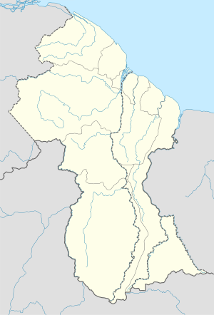
Guyana
Mga dapit nga gitawag Green Hill sa
Guyana .
Green Hill (bungtod sa Guyana) , Barima-Waini Region, 7°35′00″N 60°21′00″W / 7.58333°N 60.35°W / 7.58333; -60.35 (Green Hill (bungtod sa Guyana) )
Habagatang Aprika
Green Hill (bungtod sa Habagatang Aprika, Province of KwaZulu-Natal, UThukela District Municipality, lat -28,68, long 29,64) , 28°40′45″S 29°38′34″E / 28.67921°S 29.64285°E / -28.67921; 29.64285 (Green Hill (bungtod sa Habagatang Aprika, Province of KwaZulu-Natal, UThukela District Municipality, lat -28,68, long 29,64) ) Green Hill (bungtod sa Habagatang Aprika, Province of KwaZulu-Natal, UThukela District Municipality, lat -28,64, long 29,51) , 28°38′29″S 29°30′19″E / 28.64138°S 29.50522°E / -28.64138; 29.50522 (Green Hill (bungtod sa Habagatang Aprika, Province of KwaZulu-Natal, UThukela District Municipality, lat -28,64, long 29,51) ) Green Hill (bungtod sa Habagatang Aprika, Free State) , Fezile Dabi District Municipality, 27°33′03″S 27°00′06″E / 27.55077°S 27.0018°E / -27.55077; 27.0018 (Green Hill (bungtod sa Habagatang Aprika, Free State) ) Green Hill (bungtod sa Habagatang Aprika, Province of the Western Cape) , 46°58′03″S 37°50′39″E / 46.96758°S 37.84413°E / -46.96758; 37.84413 (Green Hill (bungtod sa Habagatang Aprika, Province of the Western Cape) )
Hiniusang Emiratong Arabo
Green Hill (bungtod sa Hiniusang Emiratong Arabo) , Abū Z̧aby, 25°13′36″N 54°13′04″E / 25.22667°N 54.21778°E / 25.22667; 54.21778 (Green Hill (bungtod sa Hiniusang Emiratong Arabo) )
Hiniusang Gingharian
Green Hill (bukid sa Hiniusang Gingharian) , Scotland, Angus, 56°51′00″N 3°04′00″W / 56.85°N 3.06667°W / 56.85; -3.06667 (Green Hill (bukid sa Hiniusang Gingharian) )
Indonesia
Mga dapit nga gitawag Green Hill sa
Indonesia .
Green Hill (bungtod sa Indonesia) , 0°53′00″N 122°56′00″E / 0.88333°N 122.93333°E / 0.88333; 122.93333 (Green Hill (bungtod sa Indonesia) )
Ireland
Mga dapit nga gitawag Green Hill sa
Irlanda .
Green Hill (bungtod sa Ireland) , Munster, County Cork, 51°48′07″N 8°54′55″W / 51.80194°N 8.91528°W / 51.80194; -8.91528 (Green Hill (bungtod sa Ireland) )
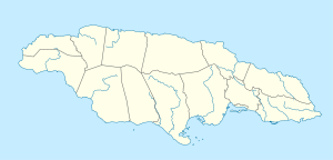
Jamaica
Mga dapit nga gitawag Green Hill sa
Jamaica .
Green Hill (bungtod sa Jamaica, Parish of Portland) , 18°08′00″N 76°38′00″W / 18.13333°N 76.63333°W / 18.13333; -76.63333 (Green Hill (bungtod sa Jamaica, Parish of Portland) ) Green Hill (bungtod sa Jamaica, Parish of Saint Catherine) , 17°59′00″N 77°05′00″W / 17.98333°N 77.08333°W / 17.98333; -77.08333 (Green Hill (bungtod sa Jamaica, Parish of Saint Catherine) )
Liberya
Mga dapit nga gitawag Green Hill sa
Liberya .
Green Hill (bungtod sa Liberya) , Bong County, 6°51′00″N 9°11′00″W / 6.85°N 9.18333°W / 6.85; -9.18333 (Green Hill (bungtod sa Liberya) )
New Zealand
Green Hill (bukid sa New Zealand, Otago, lat -45,75, long 170,47) , 45°45′00″S 170°28′00″E / 45.75°S 170.46667°E / -45.75; 170.46667 (Green Hill (bukid sa New Zealand, Otago, lat -45,75, long 170,47) ) Green Hill (bukid sa New Zealand, Otago, lat -45,32, long 168,75) , 45°19′00″S 168°45′00″E / 45.31667°S 168.75°E / -45.31667; 168.75 (Green Hill (bukid sa New Zealand, Otago, lat -45,32, long 168,75) ) Green Hill (bukid sa New Zealand, Canterbury, lat -44,32, long 170,87) , 44°19′00″S 170°52′00″E / 44.31667°S 170.86667°E / -44.31667; 170.86667 (Green Hill (bukid sa New Zealand, Canterbury, lat -44,32, long 170,87) ) Green Hill (bukid sa New Zealand, Canterbury, lat -42,87, long 171,83) , 42°52′00″S 171°50′00″E / 42.86667°S 171.83333°E / -42.86667; 171.83333 (Green Hill (bukid sa New Zealand, Canterbury, lat -42,87, long 171,83) ) Green Hill (bukid sa New Zealand, Canterbury, lat -42,78, long 172,67) , 42°47′00″S 172°40′00″E / 42.78333°S 172.66667°E / -42.78333; 172.66667 (Green Hill (bukid sa New Zealand, Canterbury, lat -42,78, long 172,67) ) Green Hill (bukid sa New Zealand, Canterbury, lat -42,10, long 173,87) , 42°06′00″S 173°52′00″E / 42.1°S 173.86667°E / -42.1; 173.86667 (Green Hill (bukid sa New Zealand, Canterbury, lat -42,10, long 173,87) ) Green Hill (bungtod sa New Zealand, Wellington) , 40°46′00″S 176°04′00″E / 40.76667°S 176.06667°E / -40.76667; 176.06667 (Green Hill (bungtod sa New Zealand, Wellington) ) Green Hill (bungtod sa New Zealand, Manawatu-Wanganui) , 40°31′00″S 176°25′00″E / 40.51667°S 176.41667°E / -40.51667; 176.41667 (Green Hill (bungtod sa New Zealand, Manawatu-Wanganui) ) Green Hill (bungtod sa New Zealand, Otago, lat -45,75, long 170,46) , 45°44′54″S 170°27′36″E / 45.74838°S 170.4601°E / -45.74838; 170.4601 (Green Hill (bungtod sa New Zealand, Otago, lat -45,75, long 170,46) ) Green Hill (bungtod sa New Zealand, Canterbury, lat -44,31, long 170,87) , 44°18′30″S 170°52′12″E / 44.30835°S 170.87009°E / -44.30835; 170.87009 (Green Hill (bungtod sa New Zealand, Canterbury, lat -44,31, long 170,87) ) Green Hill (bungtod sa New Zealand, Canterbury, lat -44,81, long 171,03) , 44°48′30″S 171°01′48″E / 44.80836°S 171.03009°E / -44.80836; 171.03009 (Green Hill (bungtod sa New Zealand, Canterbury, lat -44,81, long 171,03) ) Green Hill (bungtod sa New Zealand, Canterbury, lat -42,87, long 171,81) , 42°52′06″S 171°48′36″E / 42.8683°S 171.81013°E / -42.8683; 171.81013 (Green Hill (bungtod sa New Zealand, Canterbury, lat -42,87, long 171,81) ) Green Hill (bungtod sa New Zealand, Canterbury, lat -42,78, long 172,67) , 42°46′42″S 172°40′13″E / 42.7783°S 172.67014°E / -42.7783; 172.67014 (Green Hill (bungtod sa New Zealand, Canterbury, lat -42,78, long 172,67) ) Green Hill (bungtod sa New Zealand, Marlborough, lat -41,81, long 173,45) , 41°48′30″S 173°27′01″E / 41.80828°S 173.45017°E / -41.80828; 173.45017 (Green Hill (bungtod sa New Zealand, Marlborough, lat -41,81, long 173,45) ) Green Hill (bungtod sa New Zealand, Marlborough, lat -42,09, long 173,87) , 42°05′18″S 173°52′13″E / 42.08829°S 173.87016°E / -42.08829; 173.87016 (Green Hill (bungtod sa New Zealand, Marlborough, lat -42,09, long 173,87) )
Pilipinas
Mga dapit nga gitawag Green Hill sa
Pilipinas .
Green Hill (bungtod sa Pilipinas) , Mimaropa, Province of Palawan, 10°48′00″N 119°26′00″E / 10.8°N 119.43333°E / 10.8; 119.43333 (Green Hill (bungtod sa Pilipinas) )
Saint Helena
Green Hill (bungtod sa Saint Helena, Saint Helena) , 15°59′00″S 5°42′00″W / 15.98333°S 5.7°W / -15.98333; -5.7 (Green Hill (bungtod sa Saint Helena, Saint Helena) ) Green Hill (bungtod sa Saint Helena, Tristan da Cunha, lat -37,07, long -12,28) , 37°04′00″S 12°17′00″W / 37.06667°S 12.28333°W / -37.06667; -12.28333 (Green Hill (bungtod sa Saint Helena, Tristan da Cunha, lat -37,07, long -12,28) ) Green Hill (tahud sa bukid) , Tristan da Cunha, 40°20′00″S 9°55′00″W / 40.33333°S 9.91667°W / -40.33333; -9.91667 (Green Hill (tahud sa bukid) )
Trinidad ug Tobago
Green Hill (bungtod sa Trinidad ug Tobago) , 10°03′N 61°51′W / 10.05°N 61.85°W / 10.05; -61.85 (Green Hill (bungtod sa Trinidad ug Tobago) )
