Pratapgarh (Uttar Pradesh)

Pratapgarh
Consiglio di Frazione (Nagar Panchayat)
प्रतापगढ़
Localizzazione
StatoIndia (bandiera) India
Stato federato Uttar Pradesh
DivisioneAllahabad
DistrettoPratapgarh
Territorio
Coordinate25°53′44″N 81°56′25″E
Altitudine79[1] m s.l.m.
Superficie7,53 km²
Abitanti12 339 (2001)
Densità1 638,65 ab./km²
Altre informazioni
Linguehindi, inglese
Cod. postale230001[2]
Prefisso5342[3]
Fuso orarioUTC+5:30
Cartografia
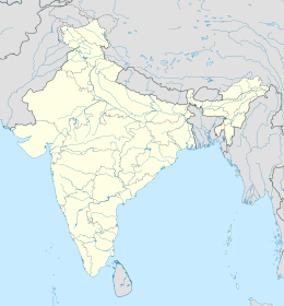
Mappa di localizzazione: India
Pratapgarh
Pratapgarh

Pratapgarh (o Pratapgarh City) è una suddivisione dell'India, classificata come nagar panchayat, di 12.339 abitanti, capoluogo del distretto di Pratapgarh, nello stato federato dell'Uttar Pradesh. In base al numero di abitanti la città rientra nella classe IV (da 10.000 a 19.999 persone)[4].

Geografia fisica

La città è situata a 25° 53' 60 N e 81° 57' 0 E e ha un'altitudine di 79 m s.l.m.[1].

Transport

From Pratapgarh you can easily get vehicles to go to the following places like- Allahabad, Sultanpur, Jaunpur, Varanasi, Raebareli, [[Lucknow] ]], Capital Delhi,Faizabad, Ambedkar Nagar, Chitrakoot, Kaushambi, Bhadohi , Gonda, Mirzapur, Basti, Bahraich, Gorakhpur etc.

Highway
  1. Prayagraj Faizabad National Highway-96
  2. Lucknow Varanasi Highway-31
  3. Delhupur Raniganj Patti Akbarpur Marg-SH128
  4. Pratapgarh Jagdishpur National Highway 931
  5. Bypass Pratapgarh National Highway 31

(The bypass originating from Arjunpur village located near Rampur Tiai of Lalganj tehsil will cross the Prayagraj-Faizabad highway near Jethwara police station and join the highway at Chirakutty Bazaar ahead of Raniganj tehsil.) under construction

Società

Evoluzione demografica

Al censimento del 2001 la popolazione di Pratapgarh assommava a 12.339 persone, delle quali 6.407 maschi e 5.932 femmine. I bambini di età inferiore o uguale ai sei anni assommavano a 2.212, dei quali 1.108 maschi e 1.104 femmine. Infine, coloro che erano in grado di saper almeno leggere e scrivere erano 6.380, dei quali 3.979 maschi e 2.401 femmine.[5]

Note

  1. ^ a b (EN) Falling Rain Genomics, Inc, Pratapgarh, India Page, su fallingrain.com. URL consultato l'11-07-2008.
  2. ^ (EN) India Post, Pincode search - Pratapgarh [collegamento interrotto], su indiapost.gov.in. URL consultato il 28-07-2008.
  3. ^ (EN) Bharat Sanchar Nigam Ltd, STD Codes for cities in Uttar Pradesh [collegamento interrotto], su bsnl.co.in. URL consultato il 28-07-2008.
  4. ^ (EN) Census of India, Alphabetical list of towns and their population - Uttar Pradesh (PDF), su censusindia.gov.in. URL consultato il 21-05-2008.
  5. ^ (EN) Census of India 2001, Population, population in the age group 0-6 and literates by sex - Cities/Towns (in alphabetic order): 2001, su censusindia.net. URL consultato il 20-06-2008 (archiviato dall'url originale il 16 giugno 2004).
Controllo di autoritàVIAF (EN242724361 · GND (DE4453076-6
  Portale India: accedi alle voci di Wikipedia che parlano dell'India