In 1283, during the hudna ("truce") between the Crusaders based in Acre and the Mamluk sultan al-Mansur Qalawun, this location was named el Harathiyah and was described as part of the domain of the Crusaders.[6]
Ottoman rule
During the Ottoman era, a Muslim village at the site was named el Hâritheh.[7] The village appeared as El Harti on the map of Pierre Jacotin compiled in 1799.[8] In 1859, the population was recorded as 120 with tillable land of 12 feddans.[9] In 1875, Victor Guérin reported about 40 houses.[10] In 1882, the Palestine Exploration Fund's Survey of Western Palestine described it as an adobe hamlet.[9]
A population list from about 1887 showed that Harithiyeh had about 120 inhabitants; all Muslims.[11]
The area was acquired by the Jewish community as part of the Sursock Purchase. In 1925 a Zionist organisation purchased 50 feddans in Hartieh from the Sursock family of Beirut. At the time, there were 60 families living there.[13] In the 1931 census, the Arab Zubeidat was counted under the Shefa-'Amr suburbs.[14]
From 1931, and lasting several years, the Jewish Agency struggled to evict the Arab El Zubeidat, who were tenant farmers at Hartiya.[15][16][17][18] According to Avneri, Hartiya land was to become Sha'ar HaAmakim.[15]
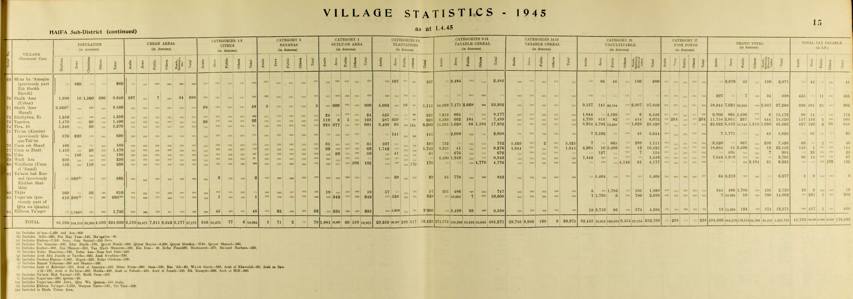
According to the Department of Statistics, however, Sha'ar HaAmakim had previously been part of Sheikh Bureik.[19][20]
Sha'ar HaAmakim hosted volunteers from around the world, including France and the United States, who worked at the kibbutz and participated in cultural exchanges.[23] In the 1960s, there were up to 100 volunteers each year.[24]Bernie Sanders spent time at the kibbutz for several months in 1963.[25][24]
Economy
According to a 2016 report, the kibbutz derives most of its income from its solar water heater factory. Additional sources of income include agriculture, such as dairy farming.[23] For over five decades, the kibbutz has produced and processed sunflower seeds which it markets under its name both in Israel and for export.[26] It also has a fish pond and orchards producing apples, peaches, and pears.[24]
^Segal, Arthur; Młynarczyk, Jolanta; Burdajewicz, Mariusz; Bar-Oz, Guy (2009). Excavations of the Hellenistic site in Kibbutz Sha'ar-Ha'Amakim. Haifa: Zinman Institute of Archaeology, University of Haifa. ISBN9789659041879.
Dvorjetski, Esti (2009), "Between the Valley of Zebulun and the Valley of Jezreel: the Historical Geography of Geva-Geba-Gaba-Jaba'", Excavations of the Hellenistic site in Kibbutz Sha'ar-Ha'Amakim (Gaba) 1984-1998, Haifa: Zinman Institute of Archaeology: University of Haifa


