|
Kem (river)
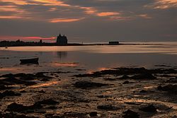
The Kem (Russian: Кемь, Finnish: Kemijoki) is a river in Republic of Karelia, Russia. It starts from Lake Lower Kuyto and flows through a number of lakes into the White Sea. It is 191 kilometres (119 mi) long, and has a drainage basin of 27,700 square kilometres (10,700 sq mi).[1] There is a cascade of 5 hydroelectric power plants. The town of Kem is located in the mouth of the Kem. Tributaries: Chirka-Kem, Okhta, Kepa, Shomba.[2] See alsoReferences
|
||||||||||||||||||||||||||||||

