Biya (river)

Biya
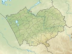
Biya (river) is located in Altai Krai
Biya (river)
Mouth location in Altai Krai, Russia
Location
CountryRussia
Physical characteristics
SourceLake Teletskoye
 • coordinates51°47′10″N 87°14′46″E / 51.786°N 87.246°E / 51.786; 87.246
MouthOb
 • coordinates
52°25′54″N 85°01′26″E / 52.43167°N 85.02389°E / 52.43167; 85.02389
Length301 km (187 mi)
Basin size37,000 km2 (14,000 sq mi)
Discharge 
 • locationBiysk
 • average477 m3/s (16,800 cu ft/s)
Basin features
ProgressionObKara Sea
Tributaries 
 • rightLebed

The Biya (Russian: Би́я; Altay: Бий, Biy) is a river in the Altai Republic and Altai Krai in Russia. At its confluence with the Katun, downstream of the city Biysk, the Ob is formed.[1] The Biya is 301 km long; the area of its drainage basin is 37,000 km2.[2] It flows out of the Lake Teletskoye. The river freezes up in mid-November to early December (some parts of the river freeze over on a year-to-year basis). It breaks up in early or mid-April. The Biya is navigable on its entire length.[3]

The maximum depth of river is 28 feet (8.5 m).

References

  1. ^ Бия, Great Soviet Encyclopedia
  2. ^ "Река Бия in the State Water Register of Russia". textual.ru (in Russian).
  3. ^ "Biya river Altai". travel-altai.com. Retrieved 2018-07-23.