Kano State (Hausa: Jihar Kanoجِهَرْ كَنُوَ; Fula: 𞤤𞤫𞤴𞤣𞤭 𞤳𞤢𞤲𞤮𞥅, romanized: Leydi Kano) is one of the 36 states of Nigeria, located in the northern region of the country.[5] According to the national census done in 2006, Kano State is the most populous state in Nigeria. The recent official estimates taken in 2016 by the National Bureau of Statistics found that Kano State was still the largest state by population in Nigeria.[6][7] Created in 1967 out of the former Northern Region, Kano State borders on Katsina State to the northwest for about 210 km (130 miles), Jigawa State to the northeast for 355 km (221 miles), Bauchi State to the southeast for 131 km (82 miles), and Kaduna State to the southwest for 255 km.[5] The state's capital and largest city is the city of Kano, the second most populous city in Nigeria after Lagos.[5] The incumbent governor of the state is Abba Kabir Yusuf. He was sworn in on 29 May 2023.[8]
Modern day Kano State was the site of a number of prior kingdoms and empires, including the Kingdom of Kano, which was centered in Dala Hill (Dutsen Dala) and existed from prior to 1000 AD to 1349.[9] In 1349, the Sultanate of Kano was established with Yaji I as its first Sultan.[10] In the 15th century, Kurmi Market was opened, which helped Kano become a center of commercial activity in Hausaland;[11] the market remains open in the 21st century and its historic importance is reflected in the state's nickname, the Centre of Commerce.[12] During the 16th and 17th centuries, the Sultanate of Kano established itself as the most powerful of the Hausa Kingdoms.[13] In 1903, the British Empireconquered the Kano Emirate, incorporating it region into the Northern Nigeria Protectorate.[14] The major ethnic groups in pre-colonial Kano City were the Hausa, Fulani, Barebari (Kanuri), Tuareg, Arab, Nupe and some tribes from the southern Nigeria. Most of the people in Kano city have come to use the Hausa language as a first language and some have accepted Hausa as an ethnic identification.[15]
An important early center of commerce in the region was Kurmi Market, founded by the Habe Emir of KanoMuhammadu Rumfa in 1463 CE.[17] Subsequent leaders made contributions to the emergence of Kano as a leading commercial centre in Sudanic Africa.[29] During the time of the Kano Emirate, Emir Ibrahim Dabo made a number of administrative reforms, seeking to increase commerce in the region.[30]
Leaders during this time encouraged traders to move from Katsina, capitalising on raids from the HausaSultanate of Maradi.[citation needed] The Jihad leaders of the Caliphate encouraged the Kola nut trade, and Kano was the greatest beneficiary with an annual turnover of about $30 million.[citation needed]Craft industries also evolved in the pre-colonial period contributing to the prosperity of the province.[citation needed]
The climate of Kano state is characterised by variability in rainfall between the 70s and 80s, with drought and near drought conditions. Between the 90s and the year 2015, the moisture conditions have improved considerably but for fluctuations in rainfall in the state.[32] However, since 2015 till date, there has been an increase in rainfall in the state, which has helped increase agricultural production in this northern Nigerian state considerably.[33] Based on the report of the Nigerian Meteorological Agency (NIMET), the amount of rainfall varies between years with a mean value of 897.7mm.[34]
In the first quarter of 2022, the Nigerian Meteorological Agency sounded an early warning of floods in some states, including Kano state. The agency asserted that their warning was based on the amount and distribution of rainfall that had been observed in the nation during the rainy season. According to the Kano State Emergency Management Agency (SEMA), 25 local government districts experienced flooding as a result of the extreme rain's aftermath.[35]
Temperature
The temperature of Kano has been on the rise since the 60s and this is highly remarkable.[36] The annual temperature of the state is between 26°C to 30°C of dumal temperature, which is high, and measurable between the range of 13.1%, with the relative humidity of between 17% and 90% respectively.[37][38]
Economy
Many large markets exist within Kano today, such as Kurmi Market, Kantin Kwari Market,[39]Sabon Gari Market, Dawanau Market [40] Kofar Wanbai Market, Galadima Market, Yankura Market and Bata Market.[17] Many of these markets specialize in a certain product, such as textiles or grain.[17]
Agriculture
Subsistence and commercial agriculture is mostly practised in the outlying districts of the state. Some of the food crops cultivated are millet, cowpeas, sorghum, maize and rice for local consumption while groundnuts and cotton are produced for export and industrial purposes. During the colonial period and several years after the country's independence, the groundnuts produced in the state constituted one of the major sources revenue of the country. Kano State is a major producer of hides and skins, sesame, soybean, cotton, garlic, gum arabic and chili pepper.[41]
A 2018 study of Tudun Wada found that both temperature and rainfall were likely to increase with climate change, causing increased stress on crops, and would require increased climate change adaptation for agricultural practices.[42]
A9 (part of the Dakar-Ndjamena Trans-Sahelian Highway or TAH 5) northwest from A2 at Bankaura (14 km north of Kano) for 71 km via Bichi, Dan Zabuwa and Tsanyawa as IBB Way to Katsina State at Yan Kamaye,
A237 continuing TAH5 east from A2 in Kano for 110 km across the Hadejia River at Wudil via Takai and Kachako to Jigawa State as the Kano Rd.
Other major roads
the Kunya-Mutum Rd northeast from A2 to Jigawa State at Duma,
the Kano-Gumel Rd northeast via Dosai, Gezawa, Kirazare and Dadin Diniya to Jigawa State near Magama,
the Kano-Ringim Rd east from Dosai via Gwandu, Wangara, Zugachi and Zakirai to Jigawa State at Gorshinsi,
the Gaya-Wudil Rd east from A237 to Jigawa at Dundubis as the Gaya-Azare Rd,
south from A2 at Karfi Ruga as the Kano-Kumbotso-Rano or Rano-Karfin Ruga Rd via Bunkure, Rano, Kibiya, Tarai, Burunburum, Sitti and Masu to Bauchi State at Gwanda as the Sabon Gari-Gwanda-Kafin-Birgi Rd,
Kano State is home to five universities: one federal university, one regimented federal university, two states universities, and one private university.
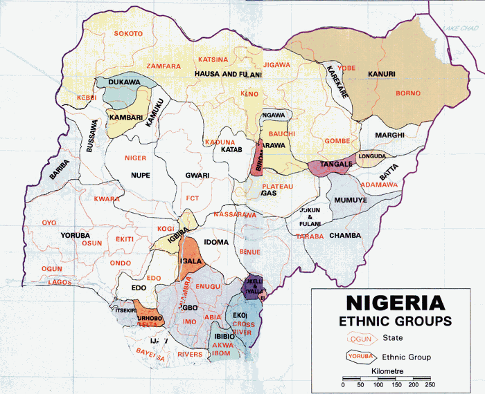
According to the 2006 PON census figures from Nigeria Kano State had a population totaling 9,401,288. Based on the official data by the National Bureau of Statistics,[63] Kano State is the most populous state in the country followed by Lagos State.[64] The state is mostly populated by the Hausa and Fulani people.[19]
Ibrahim Shekarau (born 1955), former Governor and former Minister of Education (2003-2011).
Yusuf Babangida Suleiman (born 1976), politician in the 7th, 8th and 9th Kano State House of Assembly
Abdullahi Aliyu Sumaila former Secretary to the Kano State Executive Council, rtd Permanent Secretary, former Principal Secretary to the Kano State Governor, former Board Chairman Hadejia-Jama'are River Basin Development Authority and Kano State Television Corporation.
Abba Kabir Yusuf (born 1963). Kano State Governor since May 2023.
Politics
The state government is led by a democratically elected governor who works closely with the state house of assembly. The capital city of the state is Kano.[77]
Electoral system
The governor of each state is selected using a modified two-round system. To be elected in the first round, a candidate must receive the plurality of the vote and over 25% of the vote in at least two -third of the State local government Areas. If no candidate passes threshold, a second round will be held between the top candidate and the next candidate to have received a plurality of votes in the highest number of local government Areas.[77]
^Ujorha, Tadaferua (9 May 2003). "Kano's 500-year-old market". Daily Trust. Biafra Nigeria World. Archived from the original on 7 August 2021. Retrieved 1 November 2007.
^"CAPTURE OF KANO". West Gippsland Gazette (Warragul, Vic. : 1898 – 1930). 19 May 1903. p. 6. Archived from the original on 13 December 2019. Retrieved 19 May 2020.
^Buba, L. F. (2010). Spatio-temporal rainfall and temperature variation in northern Nigeria. A Ph.D. Thesis submitted to the Geography Department, Bayero University, Kano.
^Badamasi, M.M. (2014). Vegetation and Forestry in Tank, A.I. & Morale, S.B. (Eds.) Kano Government, Society and Development. London & Abuja: Adonis and Abbey Publishers.
^"Kano my state". www.kanodashboard.ng. Retrieved 4 October 2023.
^Badamosi, M.M. (2014). Vegetation and Forestry in Tank A.I., Momale, S.B. (eds.) Kano Government, Society and Development. London & Abuja: Adonis and Abbey Publishers.
^Kowal & Knabe, J.M. & D.T. (1972). An agroclimatological atlas of northern states of Nigeria with explanatory notes. Zaria: ABU Press.
^Olofin, E.A. (1987). Some aspects of the physical geographies of the Kano region and related human responses: Departmental lecture notes. Kano, Nigeria: Denis Standaerd Printers.
^Garba, J.I. (2018). "AWARENESS AND ADAPTATION STRATEGIES TO CLIMATE CHANGE IN TUDUN WADA LOCAL GOVERNMENT AREA OF KANO STATE". Zaria Geographer. 25 (1): 63–75. ISSN2782-7739.
^"Archived copy"(PDF). Archived(PDF) from the original on 9 September 2021. Retrieved 21 February 2021.{{cite web}}: CS1 maint: archived copy as title (link)
1969 filmSpider-ManSet photo of Donald F. Glut and Donna ShannonDirected byDonald F. GlutWritten byDonald F. GlutBased onSpider-Manby Stan LeeSteve DitkoProduced byDonald F. GlutStarringDonald F. GlutDonna ShaneBob RosenJim HormonRick MitchellBill ObbargeNarrated byDonald F. GlutRelease date 1969 (1969) Running time12 minutesCountryNorth AmericaLanguageEnglish Spider-Man is a 1969 American superhero short film that was directed by Donald F. Glut. It is an unauthorized fan film, one of sever…
Association football club in Accra For other uses, see Hearts of Oak (disambiguation). Football clubHearts of OakFull nameAccra Hearts of Oak Sporting ClubNickname(s)PhobiaFounded11 November 1911; 112 years ago (1911-11-11)GroundAccra Sports StadiumCapacity40,000ChairmanTogbe Afede XIVManagerSlavko MaticLeagueGhana Premier League2022–2312thWebsiteClub website Home colours Away colours Current season Accra Hearts of Oak Sporting Club, commonly referred to as Hearts of Oak or j…
Partai Generasi Aceh Beusaboh Tha'at dan Taqwa Ketua umumTgk. H. Ahmad Tajuddin, Ab.[1][2]Sekretaris JenderalTgk. Bahaudin, S.Pd.Dibentuk2007Kantor pusatJalan Tgk. Abdulrahman MM No.1A, Dusun Bungong Teubee Gampong Emperom, Kec. Jaya Baru, Banda Aceh, AcehKeanggotaan (2017)3.136[3]IdeologiIslamismePolitik IndonesiaPartai politikPemilihan umum Partai Generasi Aceh Bersatu Taat dan Takwa (Aceh: Peureute Geuneurasi Atjeh Beusaboh Thaat dan Taqwa, Akronim: Gabthat) adalah sat…
Artikel ini sebatang kara, artinya tidak ada artikel lain yang memiliki pranala balik ke halaman ini.Bantulah menambah pranala ke artikel ini dari artikel yang berhubungan atau coba peralatan pencari pranala.Tag ini diberikan pada Februari 2023. Taman Negara Bagian Air Terjun Blackwater Taman Negara Bagian Virginia Barat Air Terjun Blackwater Negara Amerika Serikat Provinsi Virginia Barat County Tucker Elevasi 2.897 ft (883 m) Area 2.358 acres (954,2 ha) [1] …
This article needs additional citations for verification. Please help improve this article by adding citations to reliable sources. Unsourced material may be challenged and removed.Find sources: Bteddine El Loqch – news · newspapers · books · scholar · JSTOR (August 2013) (Learn how and when to remove this message) City in South Lebanon GovernorateBteddine El Loqch بتدين اللقشCityBteddine Town from RoofBteddine El LoqchLocation within LebanonCoo…
PDS 70, première protoplanète directement photographiée. Une protoplanète est un embryon de planète de type planétoïde qui se forme dans le disque protoplanétaire[1]. Formation des protoplanètes Les protoplanètes se forment à cause des collisions qui se produisent entre les différents corps planétésimaux pouvant aller jusqu'à 1 kilomètre de diamètre qui s’attirent en raison de la gravité (ou tombent l'un vers l'autre, d'après la théorie de la relativité générale). S…
U.S. political event held in Chicago, Illinois This article needs additional citations for verification. Please help improve this article by adding citations to reliable sources. Unsourced material may be challenged and removed.Find sources: 1932 Democratic National Convention – news · newspapers · books · scholar · JSTOR (June 2008) (Learn how and when to remove this message) 1932 Democratic National Convention1932 presidential election NomineesRoosevelt…
This section tabulates the heads of qualification in a form suitable to be filled in as events progress. The full qualification rules[1] for basketball published by FIBA contain intricate conditions too lengthy for inclusion in Wikipedia. Basketball at the2024 Summer OlympicsBasketballQualificationmenwomenTournamentmenwomenRostersmenwomen3x3 basketballQualificationmenwomenTournamentmenwomenvte The women's 3x3 qualification for the Olympic basketball tournament occured between November 20…
Controversy in Islam For the book by Wilferd Madelung, see The Succession to Muhammad. Part of a series onIslam Beliefs Oneness of God Angels Revealed Books Prophets Day of Resurrection Predestination Practices Profession of Faith Prayer Almsgiving Fasting Pilgrimage TextsFoundations Quran Sunnah (Hadith, Sirah) Tafsir (exegesis) Aqidah (creed) Qisas al-Anbiya (Stories of the Prophets) Mathnawi (Poems) Fiqh (jurisprudence) Sharia (law) History Timeline Muhammad Ahl al-Bayt Sahabah Rashidun Calip…
Frekuensi dasar suatu senar dan enam frekuensi di atasnya. Frekuensi dasar adalah frekuensi terendah suatu bentuk gelombang periodik. Frekuensi dasar biasanya disingkat f0 (or FF), menunjukkan frekuensi terendah dihitung dari nol.[1][2][3] Dalam konteks lain, frekuensi dasar disingkat f1, harmonik yang pertama.[4][5][6][7][8] (harmonik yang kedua adalah f2 = 2⋅f1, dll. Dalam konteks ini, harmoni nol adalah 0 Hz.) Kita dapat m…
تحتاج هذه المقالة إلى تهذيب لتتناسب مع دليل الأسلوب في ويكيبيديا. فضلاً، ساهم في تهذيب هذه المقالة من خلال معالجة مشكلات الأسلوب فيها. (أكتوبر 2015) هذه المقالة يتيمة إذ تصل إليها مقالات أخرى قليلة جدًا. فضلًا، ساعد بإضافة وصلة إليها في مقالات متعلقة بها. (مارس_2014) تحوي هذه المقا…
Questa voce o sezione sull'argomento lingue non cita le fonti necessarie o quelle presenti sono insufficienti. Puoi migliorare questa voce aggiungendo citazioni da fonti attendibili secondo le linee guida sull'uso delle fonti. Segui i suggerimenti del progetto di riferimento. Lingue retoromanzeParlato in Italia Svizzera RegioniFriuli Venezia Giulia, Veneto, Trentino-Alto Adige, Cantone Grigioni LocutoriTotaleIntervallo fra i 900.000 e 2.000.000 persone TassonomiaFilogenesiLingue i…
Marvel Comics fictional character Comics character ElectroTextless variant cover art of The Amazing Spider-Man Vol. 3 #2 (May 2014).Art by Humberto RamosPublication informationPublisherMarvel ComicsFirst appearanceThe Amazing Spider-Man #9 (Feb. 1964)[1][2]Created byStan LeeSteve DitkoIn-story informationAlter egoMaxwell Max DillonSpeciesHuman mutatePlace of originEndicott, New YorkTeam affiliationsSinister SixEmissaries of EvilFrightful FourExterminators[3]Sinister Twelv…
لمعانٍ أخرى، طالع ييل (توضيح). ييل الإحداثيات 43°07′49″N 82°47′52″W / 43.130277777778°N 82.797777777778°W / 43.130277777778; -82.797777777778 [1] تاريخ التأسيس 1851 تقسيم إداري البلد الولايات المتحدة[2] التقسيم الأعلى مقاطعة سانت كلير خصائص جغرافية المساحة 3.601938 ك…
South Korean chemical company For construction company, see Orascom Construction Industries. OCI Company Ltd.Native name오씨아이 주식회사FormerlyDC ChemicalCompany typePublicTraded asKRX: 010060IndustryChemicalFounded5 August 1959; 64 years ago (1959-08-05)FounderLee Hoi-rimHeadquartersSeoul, South KoreaKey peopleKim Teak-joung (President & CEO) Websitewww.oci.co.kr/en/Footnotes / references[1] OCI Company Ltd. (OCI; Korean: 오씨아이 �…
Ruta CH-255 Región de Magallanes y de la Antártica Chilena, Chile Vista de la Ruta CH-255.Datos de la rutaTipo CarreteraLongitud 142,12 kmOrientaciónInicio Paso Fronterizo Integración Austral (ARG)Fin Gobernardor PhillipiCruces Ruta CH-257 en Kimiri AikeRuta CH-9 en Gobernador Philippi[editar datos en Wikidata] La Ruta CH-255 es una carretera chilena que abarca la Región de Magallanes y Antártica Chilena en el sur de Chile. La ruta se inicia en el Paso Fronterizo Integració…


.jpg)


")


")
")
