|
Donnellan Glacier
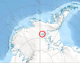
 Donnellan Glacier (78°36′S 85°48′W / 78.600°S 85.800°W) is a steep valley glacier fed by highland ice adjacent to Opalchenie Peak and Fukushima Peak on Vinson Plateau, the summit plateau of Vinson Massif, in the Sentinel Range of the Ellsworth Mountains, Antarctica. The glacier flows west-southwestward from Opalchenie Peak along the northwest side of Mount Slaughter into Nimitz Glacier. The glacier was named by the Advisory Committee on Antarctic Names in 2006 after Andrea Donnellan of the Satellite Geodesy and Geodynamics Systems Group at the Jet Propulsion Laboratory, California Institute of Technology, who was involved from the mid-1990s in research projects involving the use of GPS in studies of earth crustal deformation in Southern California and also in Antarctica.[1] See alsoMaps
References
External links
|
||||||||||||||||||

