|
Bullaun, County Galway
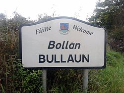
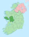
Bullaun (Irish: An Bollán) is a village in east County Galway, Ireland. It lies 6 km northeast of Loughrea on the R350 regional road. It shares its parish with a village called New Inn. The townland of Lakafinna, to the south of Bullaun, contains the local water scheme and an old castle. According to local folklore, an unused tunnel runs from the castle to a point close to a house in Ballyara.[citation needed] The river which flows through Bullaun previously contained quantities of fresh water salmon.[citation needed] These salmon stocks have, however, been impacted by overfishing and pollution.[citation needed] The village also contains St Patrick's church, a pub called the Harbour Bar and is home to the Corcoran's Turoe stone. The home ground for the Sarsfields GAA team is in Bullaun.[citation needed] See alsoReferences
|
||||||||||||||||||||||||||||||


