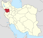
Village in Kurdistan province, Iran
For other places with the same name, see
Baharestan .
Village in Kurdistan, Iran
Baharestan (Persian : بهارستان )[ a] Hoseynabad-e Shomali Rural District of Hoseynabad District , Sanandaj County , Kurdistan province, Iran .[ 5]
Demographics
Ethnicity
The village is populated by Kurds .[ 6]
Population
At the time of the 2006 National Census, the village's population was 485 in 98 households, when it was in Saral District of Divandarreh County .[ 7] [ 8] [ 2] [ 9]
See also
Iran portal
Notes
References
^ OpenStreetMap contributors (28 December 2024). "Baharestan, Sanandaj County" (Map). OpenStreetMap . Retrieved 28 December 2024 . ^ a b Census of the Islamic Republic of Iran, 1395 (2016): Kurdistan Province . amar.org.ir (Report) (in Persian). The Statistical Center of Iran. Archived from the original (Excel) on 8 May 2022. Retrieved 19 December 2022 .^ "INCSGN Search" . Iranian National Committee for Standardization of Geographical Names (in Persian). Tehran: National Cartographic Center of Iran. Archived from the original on 2 May 2019.^ Habibi, Hassan (28 December 2013) [Approved 22 September 1377]. Changing the names of several villages in Torbat-e Jam, Nishapur, Mashhad, Tabas, Gonabad, Sabzevar, Urmia, Dashtestan and Bardaskan . rc.majlis.ir (Report) (in Persian). Ministry of the Interior, Council of Ministers. Proposal 1.4.42.16197. Archived from the original on 19 March 2014. Retrieved 23 January 2024 – via Research Center of the System of Laws of the Islamic Council of the Farabi Library of Mobile Users. ^ Creation and formation of 21 rural districts including villages, farms and places in Sanandaj County under Kurdistan province . rc.majlis.ir (Report) (in Persian). Ministry of the Interior, Council of Ministers. 20 May 2014 [Approved 18 May 1366]. Proposal 5.3.1.1405. Archived from the original on 10 May 2015. Retrieved 23 January 2024 – via Islamic Parliament Research Center.^ "Language distribution: Kordestan Province" . Iran Atlas . 2015. Archived from the original on 4 December 2017. Retrieved 22 March 2021 .^ Census of the Islamic Republic of Iran, 1385 (2006): Kurdistan Province . amar.org.ir (Report) (in Persian). The Statistical Center of Iran. Archived from the original (Excel) on 20 September 2011. Retrieved 25 September 2022 .^ Census of the Islamic Republic of Iran, 1390 (2011): Kurdistan Province . irandataportal.syr.edu (Report) (in Persian). The Statistical Center of Iran. Archived from the original (Excel) on 19 January 2023. Retrieved 19 December 2022 – via Iran Data Portal, Syracuse University.^ "Three new cities were added to the map of the country's divisions; with some changes in the geography of four provinces" . dolat.ir (in Persian). Ministry of the Interior, Political and Defense Commission. 6 October 2011. Archived from the original on 12 April 2018. Retrieved 15 November 2023 – via Secretariat of the Government Information Council.


