|
Appin, New South Wales
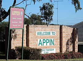
Appin is a town on the south-west fringe of Sydney in the Macarthur Region in Tharawal country near its boundary with Gandangara country, New South Wales, Australia in Wollondilly Shire. It is situated about 16 kilometres (9.9 mi) south of Campbelltown and 35 kilometres (22 mi) northwest of Wollongong. HistoryEarly historyAppin is in the lands of the Dharawal people.
European settlement in the Appin district was prohibited for some years; Appin was part of the 'Cowpastures' where a small herd of cattle had established themselves, having escaped from the Sydney Cove settlement. To protect these and help feed the colony, Governor Macquarie ordered 'No person to hunt or travel into the Cowpastures without licence under penalty of death'.[3][4] Naturalist George Caley had visited the area in 1807 exploring 'from Prospect to the upper waters of George's River and the Cataract and Cordeaux Rivers' and reporting his findings.[5] Settlement began in 1811 with a 1,000-acre (4.0 km2) land grant by Governor Macquarie to William Broughton, who had arrived with the First Fleet.[n. 1] For the next five years, smaller grants of 40 to 150 acres (0.61 km2) were made to a score or so of others, former soldiers and emancipated convicts. Governor Macquarie was pleased to give 'The District of Appin' its name, after Appin, in the Scottish West Highlands where his wife, Elizabeth, was born.[6] Mrs. Allan McPherson, visiting circa 1856, wrote:
The Appin MassacreIn March 1816, a punitive expedition of a group of settlers was surprised and ambushed at Silverdale by a group of Aboriginal people armed with muskets and spears that killed four settlers. Governor Lachlan Macquarie ordered an armed reprisal.[8] In the early morning of 17 April, Wallis led a surprise attack on this camp, which resulted in the deaths of at least fourteen Aboriginal people.[8][9] Appin mine disasterOccurred approximately 600 metres underground at the Appin coal mine on the night of 24 July 1979, killing 14 people. An explosion that was caused by sparks from a fan control box which ignited a buildup of flammable and poisonous methane gas ripped apart the busiest pit. A subsequent judicial inquiry led to the imposition of stricter safety rules for all mines. It was recommended that automatic devices be installed in mines to give continuous reading of gases, that a special officer supervise ventilation, and that the number of mine inspectors be increased. Heritage listingsAppin has a number of heritage-listed sites, including:
Notable citizensAmong Appin's free settlers was one Andrew Hamilton Hume, father of the explorer Hamilton Hume. Hamilton Hume and his brother John were tireless investigators of the local countryside, often journeying in the company of Duall, a Dharawal man. Hamilton Hume became an expert bushman, and was well-prepared for major exploration when he set out in 1824 from 'Humewood',[12] in the company of William Hovell, to explore the land between the Sydney settlements and Port Phillip, at the request of Governor Brisbane. [n. 2] Appin is the birthplace of John Fuller, better known as the bushranger Dan 'Mad Dog' Morgan. Rachel Henning spent several months at Elladale Cottage in Appin. Of the area, she wrote the following.[13]
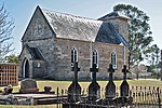
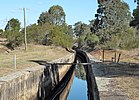
Agriculture and industryAppin was for decades a major wheat-growing, and dairy-farming area, but wheat rust, and new railways reaching other primary producing areas of the State, reduced its importance. From 1869, however, the district became the major supplier of Sydney's water, when construction commenced on the Upper Nepean Scheme: four major dams and an associated 40 miles (64 km) of canals and tunnels supplying Prospect Reservoir.[14] The Appin Colliery, exploiting the Bulli Seam by longwall mining opened in 1962. The West Cliff Colliery opened in 1976. InfrastructureA town plan was completed in 1834. Several of the proposed street names are in use today, including Toggerai, the Dharawal name for the Upper reaches of the Georges River. A track from Campbelltown was in use from 1815; as settlement advanced along coastal Illawarra, routes to Sydney found their way up the escarpment, and through Appin; the resulting traffic increased the town's prosperity.[15] Appin had a permanent Post Office by 1841, and a telephone line was connected to it in 1888. Appin had to wait until 1945 for an electricity supply. Despite its proximity to several large dams, Appin did not receive a reticulated water supply until 1961.[16] As of 2010, a town sewerage scheme is in its planning stages.[17] Several examples of early sandstone buildings remain in Appin's commercial centre on Appin Road. These include the former Courthouse and Gaol (1860s), the derelict Appin Inn (1826), a stone cottage used as offices, built circa 1840, the Headmaster's residence at the primary school, and St. Bede's Roman Catholic Church, 1834–7. Other buildings of heritage value include the disused motor garage at Darcy's Corner (1955), the Appin Hotel (1840), and St Mark The Evangelist Church (1843) The town todayAt the 2021 census, Appin had a population of 3,213.
Community facilitiesThe Wollondilly Mobile Library visits the township weekly.[18] Appin has a Playgroup; a Mobile PreSchool; a Community Hall, two sportsgrounds, and an off-leash area for companion animals near Wonson Oval. The Appin Volunteer Bush Fire Brigade (now known as the Appin Rural Fire Service) was formed in 1944; Joe D'Arcy was its first Captain. The current Fire Shed was opened in 2002. In the surrounding areaThe 16th World Scout Jamboree was held at the nearby Cataract Scout Camp,[19] the first such Jamboree held in the Southern Hemisphere. Numerous Australian Scout Jamborees have also been held at Cataract Scout Camp. The Dharawal State Recreation Area and Nature Reserve[20] is located to the east. Appin is part of the Upper Georges River Catchment.[21] The Bureau of Meteorology operates a Weather Watch radar station at Bulli, known as the "Sydney (Appin) radar" 34°15′36″S 150°52′12″E / 34.26000°S 150.87000°E. Its coverage extends to Newcastle, Bathurst, Lake George and Ulladulla.[22] Industries and employmentThe coal mines continue to be a major employer. Inghams Enterprises operate several factory farms. An industrial area has been established to the south of Appin. Here also is the Macarthur Water Treatment Plant. Completed in 1995, which supplies the Camden, Campbelltown and Wollondilly areas.[23] EducationAppin Public School was opened in 1867.[24] Before this, Catholic and Anglican Denominational Schools had been conducted in the district, but both had closed by 1870. Secondary school students today attend high schools in Campbelltown and other areas. Tertiary education is available from institutions in adjacent towns: the Western Sydney University at Campbelltown, the University of Wollongong and Campbelltown TAFE [25] Sport
Gallery
Notes and references
Bibliography and further reading
External links
Appin massacre
Heritage linksOther links |
||||||||||||||||||||||||||||||||||||||||


