|
Albrechtice nad Vltavou
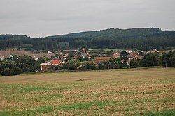
Albrechtice nad Vltavou (German: Albrechtitz) is a municipality and village in Písek District in the South Bohemian Region of the Czech Republic. It has about 1,000 inhabitants. Administrative partsThe villages of Chřešťovice, Hladná, Jehnědno, Údraž and Újezd are administrative parts of Albrechtice nad Vltavou. GeographyAlbrechtice nad Vltavou is located about 12 kilometres (7 mi) southeast of Písek and 32 km (20 mi) north of České Budějovice. It lies in the Tábor Uplands. The highest point is the hill Na Skalce at 533 m (1,749 ft) above sea level. The entire eastern municipal border is formed by the Vltava River. HistoryThe first written mention of Albrechtice is from 1352, the church was first mentioned in 1360. In the second half of the 16th century, Albrechtice was owned by the knights Oudražský of Kestřany. After the Battle of White Mountain in 1620, Albrechtice was acquired by Baltasar Marradas and joined to the Hluboká estate. Albrechtice was then a market town, but it was destroyed during the Thirty Years' War and in 1635, Albrechtice ceased to be a market town and became a village. In the following centuries, it was owned by various lower nobles.[2] Demographics
TransportThere are no railways or major roads passing through the municipality. SightsThe main landmark of Albrechtice nad Vltavou is the Church of Saints Peter and Paul It is a Romanesque church from the late 12th century with a churchyard. The walls of the churchyard have a unique arcade decoration with paintings and moralizing verses from the 19th century.[5] Notable people
Twin towns – sister citiesAlbrechtice nad Vltavou is twinned with:[6]
References
External linksWikimedia Commons has media related to Albrechtice nad Vltavou. |
||||||||||||||||||||||||||||||||||||||||||||||||||||||||||||||||||||||||||||||||||||||||||||||||||||


