|
Beita, Nablus
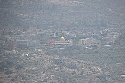
Beita (bahasa Arab: بيتا, terjemahan: "Rumah") adalah sebuah kota Palestina di Kegubernuran Nablus, utara Tepi Barat, yang berjarak 13 kilometer (8,1 mi) dari tenggara Nablus. Menurut Biro Pusat Statistik Palestina, kota tersebut memiliki populasi 9.709 pada 2007.[2] Kota tersebut terdiri dari lima klan yang bercabang menjadi tiga puluh keluarga. Terdapat banyak rumah yang telah ada sejak zaman Romawi.[3] Walikota saat ini, yang terpilih pada 2004 adalah Arab ash-Shurafa.[4]
Kota tersebut terdiri dari empat masjid dan tiga klinik.[5] Sejak 1967, di bawah pendudukan Tepi Barat oleh Israel, lebih dari 77 penduduk desa Beita ditembak mati oleh pasukan Israel, kebanyakan pada saat unjuk rasa.[6]
Referensi
Daftar pustaka
- Barron, J.B., ed. (1923). Palestine: Report and General Abstracts of the Census of 1922. Government of Palestine.
- Barzilai, G. (2002). Wars, Internal Conflicts, and Political Order: A Jewish Democracy in the Middle East. SUNY Press. ISBN 0791495906.
- Chomsky, N. (1999). Fateful Triangle - The United States, Israel, and the Palestinians (edisi ke-Updated). London: Pluto Press. ISBN 0-7453-1530-5.
- Cockburn, A. (1988). Corruptions of Empire: Life Studies & the Reagan Era
 . Verso. ISBN 0860919404. . Verso. ISBN 0860919404.
- Conder, C.R.; Kitchener, H.H. (1882). The Survey of Western Palestine: Memoirs of the Topography, Orography, Hydrography, and Archaeology. 2. London: Committee of the Palestine Exploration Fund.
- Conroy, John (2001). Unspeakable Acts, Ordinary People: The Dynamics of Torture. California: University of California Press. ISBN 0-520-23039-6.
- Finkelstein, I.; Lederman, Zvi, ed. (1997). Highlands of many cultures. Tel Aviv: Institute of Archaeology of Tel Aviv University Publications Section. ISBN 965-440-007-3.
- Frankel, G. (1996). Beyond the Promised Land: Jews and Arabs on the Hard Road to a New Israel
 . Simon and Schuster. ISBN 0684823470. . Simon and Schuster. ISBN 0684823470.
- Government of Jordan, Department of Statistics (1964). First Census of Population and Housing. Volume I: Final Tables; General Characteristics of the Population (PDF).
- Government of Palestine, Department of Statistics (1945). Village Statistics, April, 1945.
- Hadawi, S. (1970). Village Statistics of 1945: A Classification of Land and Area ownership in Palestine. Palestine Liberation Organization Research Center.
- Hütteroth, Wolf-Dieter; Abdulfattah, Kamal (1977). Historical Geography of Palestine, Transjordan and Southern Syria in the Late 16th Century. Erlanger Geographische Arbeiten, Sonderband 5. Erlangen, Germany: Vorstand der Fränkischen Geographischen Gesellschaft. ISBN 3-920405-41-2.
- Kelly, Robert J.; Maghan, Jess (1998). Hate Crime: The Global Politics of Polarization
 . SIU Press. ISBN 0809322102. . SIU Press. ISBN 0809322102.
- Lockman, Zackary; Beinin, J., ed. (1989). Intifada: The Palestinian Uprising Against Israeli Occupation
 . South End Press. ISBN 0-89608-363-2. . South End Press. ISBN 0-89608-363-2.
- Mills, E., ed. (1932). Census of Palestine 1931. Population of Villages, Towns and Administrative Areas. Jerusalem: Government of Palestine.
- Palmer, E.H. (1881). The Survey of Western Palestine: Arabic and English Name Lists Collected During the Survey by Lieutenants Conder and Kitchener, R. E. Transliterated and Explained by E.H. Palmer. Committee of the Palestine Exploration Fund.
- Robinson, E.; Smith, E. (1841). Biblical Researches in Palestine, Mount Sinai and Arabia Petraea: A Journal of Travels in the year 1838. 2. Boston: Crocker & Brewster.
Pranala luar
|
|


