|
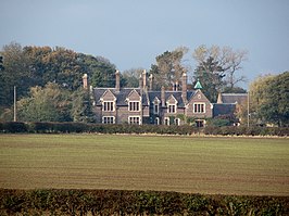
Thorpe Constantine
Thorpe Constantine is een civil parish in het bestuurlijke gebied Lichfield, in het Engelse graafschap Staffordshire. Geplaatst op:
5-8-2010 Dit artikel is een beginnetje over landen & volken. U wordt uitgenodigd om op bewerken te klikken om uw kennis aan dit artikel toe te voegen.
|
||||||||||||||||||||||||||||||||||||||||||

