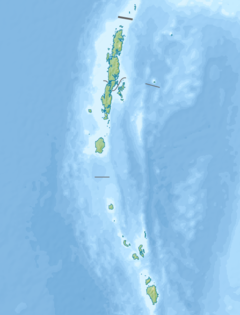
ポートブレア(英語: Port Blair)は、インドのアンダマン諸島とニコバル諸島からなるインド連邦直轄地域、アンダマン・ニコバル諸島最大の都市。アンダマン・ニコバル諸島連邦直轄地の行政府所在地であり、アンダマン諸島の南アンダマン島、その南東岸にある。2001年における人口は、99,984人。
概要
地名は、イギリス東インド会社のArchibald Blairにちなんで命名された。イギリスは1858年にここを発見し、刑務所などに使用していた。1942年から1945年にかけては日本軍が占領し、自由インド仮政府の統治下に置かれた。1947年以降はインド領である。
2004年のスマトラ島沖地震によって、被害を受けた。
 アンダマン諸島およびポートブレアの地図
気候
ケッペンの気候区分では熱帯モンスーン気候(Am)に属する。
| ポートブレア(1981–2010年、極値1901年–)の気候
|
| 月 |
1月 |
2月 |
3月 |
4月 |
5月 |
6月 |
7月 |
8月 |
9月 |
10月 |
11月 |
12月 |
年
|
| 最高気温記録 °C (°F)
|
32.7
(90.9)
|
34.6
(94.3)
|
35.4
(95.7)
|
36.4
(97.5)
|
36.4
(97.5)
|
35.6
(96.1)
|
32.8
(91)
|
32.5
(90.5)
|
35.4
(95.7)
|
35.6
(96.1)
|
34.0
(93.2)
|
35.4
(95.7)
|
36.4
(97.5)
|
| 平均最高気温 °C (°F)
|
29.5
(85.1)
|
30.2
(86.4)
|
31.3
(88.3)
|
32.3
(90.1)
|
31.2
(88.2)
|
29.8
(85.6)
|
29.4
(84.9)
|
29.2
(84.6)
|
29.2
(84.6)
|
29.7
(85.5)
|
29.8
(85.6)
|
29.5
(85.1)
|
30.1
(86.2)
|
| 日平均気温 °C (°F)
|
26.0
(78.8)
|
26.3
(79.3)
|
27.2
(81)
|
28.2
(82.8)
|
27.7
(81.9)
|
26.9
(80.4)
|
26.6
(79.9)
|
26.5
(79.7)
|
26.2
(79.2)
|
26.4
(79.5)
|
26.8
(80.2)
|
26.4
(79.5)
|
26.77
(80.18)
|
| 平均最低気温 °C (°F)
|
22.4
(72.3)
|
22.1
(71.8)
|
22.7
(72.9)
|
24.1
(75.4)
|
24.2
(75.6)
|
23.9
(75)
|
23.8
(74.8)
|
23.6
(74.5)
|
23.0
(73.4)
|
23.0
(73.4)
|
23.3
(73.9)
|
23.0
(73.4)
|
23.3
(73.9)
|
| 最低気温記録 °C (°F)
|
14.8
(58.6)
|
15.9
(60.6)
|
16.2
(61.2)
|
17.3
(63.1)
|
17.1
(62.8)
|
14.6
(58.3)
|
18.0
(64.4)
|
17.4
(63.3)
|
16.8
(62.2)
|
17.8
(64)
|
17.3
(63.1)
|
16.2
(61.2)
|
14.6
(58.3)
|
| 雨量 mm (inch)
|
32.1
(1.264)
|
16.8
(0.661)
|
32.5
(1.28)
|
75.8
(2.984)
|
368.8
(14.52)
|
448.2
(17.646)
|
442.5
(17.421)
|
446.4
(17.575)
|
458.3
(18.043)
|
301.4
(11.866)
|
242.4
(9.543)
|
103.2
(4.063)
|
2,968.3
(116.862)
|
| 平均降雨日数
|
1.4
|
1.0
|
1.6
|
4.1
|
15.9
|
18.8
|
18.6
|
19.1
|
18.8
|
15.5
|
11.6
|
4.5
|
130.8
|
| % 湿度
|
74
|
72
|
72
|
74
|
81
|
84
|
84
|
85
|
87
|
85
|
82
|
75
|
80
|
| 平均月間日照時間
|
266.6
|
265.6
|
266.6
|
237.0
|
158.1
|
90.0
|
102.3
|
99.2
|
117.0
|
167.4
|
189.0
|
241.8
|
2,200.6
|
| 平均日照時間
|
8.6
|
9.4
|
8.6
|
7.9
|
5.1
|
3.0
|
3.3
|
3.2
|
3.9
|
5.4
|
6.3
|
7.8
|
6.0
|
| 出典1:India Meteorological Department[2][3][4][5]
|
| 出典2:Tokyo Climate Center (mean temperatures 1981–2010)[6]
|
交通
港湾都市であり、インド本土とのフェリーが就航している。空港としてはヴィール・サーヴァルカル国際空港がある。
脚注
関連項目
外部リンク
ウィキメディア・コモンズには、
ポートブレアに関連するカテゴリがあります。


