|
Liste des phares d'Afrique du Sud Il s'agit d'une liste des phares d'Afrique du Sud. Elle contient les phares actifs ainsi que ceux déclassés mais d'importance historique.
| Nom
|
Lieu
|
Coordonnées
|
Mise en service
|
Image
|
| Phare de Bird Island |
Bird Island
|
33° 50′ 29,72″ S, 26° 17′ 13,55″ E |
1852- |
|
| Phare de Bluff |
Durban, KZN
|
29° 52′ 40″ S, 31° 03′ 50″ E |
1867 |
|
| Phare du cap des Aiguilles |
Cap des Aiguilles (pointe extrême de l'Afrique)
|
34° 49′ 45″ S, 20° 00′ 32″ E |
1848- |

|
| Phare de Cape Columbine |
Cape Columbine Paternoster
|
32° 48′ 39″ S, 17° 51′ 23″ E |
1936- |
|
| Phare de Cape Hangklip |
Baie False
|
34° 23′ 11,4″ S, 18° 49′ 42,3″ E |
1960- |
|
| Phare de Cape Hermes
|
Port St. Johns
|
31° 38′ 06″ S, 29° 33′ 23″ E
|
1903-1904 |
|
| Phare de Cape Infanta
|
Cap Infanta (en)
|
34° 28′ 18,76″ S, 20° 50′ 47,09″ E
|
1979- |
|
| Phare de Cape Morgan
|
Morgan's Bay
|
32° 42′ 26″ S, 28° 21′ 55″ E
|
1964 |
|
| Phare de Cape Point
|
Simon's Bay
|
34° 21′ 24″ S, 18° 30′ 00″ E
|
1860 - 1919 |
|
| Phare de Cape Recife
|
Baie d'Algoa
|
34° 01′ 43,97″ S, 25° 42′ 03,9″ E
|
1851- |
|
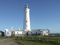
| Phare de Cape Seal
|
Plettenberg Bay
|
34° 06′ 27,6″ S, 23° 24′ 22,83″ E
|
1950- |
|
| Phare du cap St. Blaize
|
Mossel Bay
|
34° 11′ 09,45″ S, 22° 09′ 25,14″ E
|
1864- |

|
| Phare de Cape St. Lucia
|
Cap Sainte Lucia
|
28° 30′ 54″ S, 32° 24′ 00″ E
|
1906-1915 |
|
| Phare de Cape St. Martin
|
St Helena Bay
|
32° 42′ 53″ S, 17° 55′ 18,53″ E
|
1977- |
|
| Phare de Cape Vidal
|
Cape Vidal Forestry Reserve
|
28° 08′ 51,98″ S, 32° 33′ 10,77″ E
|
1985- |
|
| Phare de Castle Point
|
East London, CC
|
|
1860- |
|
| Phare de Cooper Light
|
Brighton Beach, Durban
|
29° 56′ 05″ S, 31° 00′ 15″ E
|
1953- |
|
| Phare de Danger Point
|
Gansbaai
|
34° 37′ 48,8″ S, 19° 18′ 10,9″ E
|
1895- |

|
| Phare de Dassen Island
|
Dassen Island
|
33° 25′ 54″ S, 18° 05′ 22″ E
|
1893- |
|
| Phare Deal Light
|
Papenkuils river mouth
|
33° 54′ 56″ S, 25° 36′ 52″ E
|
1973- |
|
| Phare Doringbaai
|
Doringbaai
|
31° 49′ 00″ S, 18° 14′ 00″ E
|
1963- |
|
| Phare Durnford
|
Port Durnford Forestry Reserve
|
28° 55′ 00″ S, 31° 55′ 30″ E
|
1916- |
|
| Phare Great Fish
|
Port Alfred
|
33° 31′ 10″ S, 27° 06′ 34″ E
|
1898- |
|
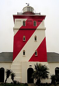
| Phare Green Point
|
Green Point
|
33° 54′ 04″ S, 18° 24′ 02″ E
|
1824- |

|
| Phare Green Point (Umzinto)
|
Umzinto
|
30° 14′ 56,1″ S, 30° 46′ 38,9″ E
|
1905 - |
|
| Phare Groenriviermond
|
Parc national Namaqua
|
30° 51′ 53″ S, 17° 34′ 49″ E
|
1988- |
|
| Phare The Hill
|
Port Elizabeth
|
|
1861- |

|
| Phare Hondeklipbaai
|
Hondeklip Bay
|
30° 18′ 30,7″ S, 17° 16′ 17,8″ E
|
1936-1956 |
|
| Phare Hood Point
|
East London
|
33° 02′ 25,96″ S, 27° 53′ 55″ E
|
1895- |
|
| Phare Ifafa Beach
|
Ifafa Beach
|
30° 27′ 46,7″ S, 30° 39′ 08,4″ E
|
1980- |
|
| Phare Jesser Point
|
Baie de Sodwana
|
27° 32′ 41,35″ S, 32° 33′ 40,81″ E
|
1986- |
|
| Phare M'bashe Point
|
Mbhashe
|
32° 14′ 27,1″ S, 28° 54′ 54″ E
|
1926- |
|
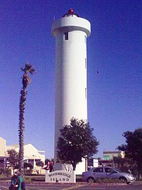
| Phare Milnerton
|
Milnerton
|
33° 52′ 53,47″ S, 18° 29′ 18,52″ E
|
1960- |

|
| Phare Mouille Point
|
Mouille Point
|
33° 54′ 00″ S, 18° 25′ 19″ E
|
1842-1921 |
|
| Phare North Head
|
Baie de Saldagne
|
33° 03′ 00″ S, 17° 54′ 42″ E
|
1939-1969 |
|
| Phare North Sand
|
Port Edward
|
31° 03′ 24″ S, 30° 13′ 33″ E
|
1968- |
|
| Phare Port Nolloth
|
Port Nolloth, NC
|
29° 14′ 58,36″ S, 16° 52′ 08,48″ E
|
1909- |
|
| Phare Port Shepstone
|
Umzinkulu River
|
30° 44′ 30,1″ S, 30° 27′ 33″ E
|
1895 - ~1905 |
|
| Phare Quoin Point
|
Quoin Point
|
34° 46′ 49,77″ S, 19° 38′ 24,91″ E
|
1955-1990 |
|
| Phare Richards Bay
|
Richards Bay
|
28° 46′ 30,3″ S, 32° 07′ 41,1″ E
|
1979- |
|
| Phare Robben Island
|
Robben Island
|
33° 48′ 52,2″ S, 18° 22′ 29,25″ E
|
1865- |
|
| Phare de Roman Rock
|
Simon's Town
|
34° 10′ 54″ S, 18° 27′ 42″ E
|
1845 - |
|
| Phare Seal Point
|
Cape St. Francis
|
34° 12′ 44,79″ S, 24° 50′ 11,92″ E
|
1878- |

|
| Phare Slangkop
|
Kommetjie
|
34° 08′ 54,59″ S, 18° 19′ 11,89″ E
|
1919- |

|
| Phare South Head
|
Baie de Saldagne
|
33° 06′ 19,44″ S, 17° 57′ 18,01″ E
|
1969- |
|
| Phare South Sand
|
à proximité de la Réserve Mkambati
|
31° 19′ 38,1″ S, 29° 57′ 41,11″ E
|
1931- |
|
| Phare Tugela
|
Tugela
|
29° 13′ 19,8″ S, 31° 30′ 15,9″ E
|
1972 |
|
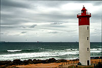
| Phare Umhlanga Rocks
|
Durban
|
29° 43′ 41,57″ S, 31° 05′ 18,2″ E
|
1954- |

|
| Phare Ystervarkpunt
|
Réserve Gouriqua
|
34° 23′ 26″ S, 21° 43′ 05″ E
|
1964- |
|
Références
- (en) Lighthouses of South Africa - édition : Portnet (1991) - (ISBN 0-620-16367-4)
- (en) South African List of Lights and Radio Signals - édition : South African Navy (2008) -
- (en) Southern lights: lighthouses of Southern Africa - Williams Harold A. - édition : William Waterman publications (1993) - (ISBN 0-9583751-1-9)
Liens externes
Sur les autres projets Wikimedia :
|