Hoffman Island

Hoffman Island
Sur la gauche, Hoffman Island ; à droite, Swinburne Island vue depuis South Beach, Staten Island en 2007.
Sur la gauche, Hoffman Island ; à droite, Swinburne Island vue depuis South Beach, Staten Island en 2007.
Géographie
Pays Drapeau des États-Unis États-Unis d'Amérique
Localisation Lower New York Bay
Coordonnées 40° 34′ 43″ N, 74° 03′ 14″ O
Superficie 0,045 km2
Administration
Statut Aire protégée

État Drapeau de l'État de New York New York
Ville Drapeau de New York New York City
Arrondissement Staten Island
Démographie
Population Aucun habitant
Autres informations
Découverte 1873
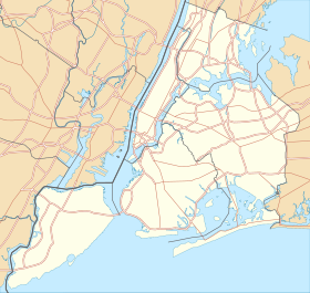
Géolocalisation sur la carte : New York
(Voir situation sur carte : New York)
Hoffman Island
Hoffman Island
Géolocalisation sur la carte : États-Unis
(Voir situation sur carte : États-Unis)
Hoffman Island
Hoffman Island
Géolocalisation sur la carte : État de New York
(Voir situation sur carte : État de New York)
Hoffman Island
Hoffman Island
Île aux États-Unis par État

La Hoffman Island est une île artificielle de 4,5 ha située dans la partie inférieure de la baie de New York, au large de South Beach Staten Island, New York. L'île Swinburne, plus petite (1,6 ha), se trouve immédiatement au sud. Créée en 1873 sur l'Orchard Shoal [1] par l'ajout d'un site d'enfouissement, l'île a été nommée en l'honneur de John Thompson Hoffman (en), ancien maire de New York (1866 – 1868) et gouverneur de New York (1869 – 1871).

Histoire

Personnes mises en quarantaine sur l'île Hoffman entre 1910 et 1915

À la fin des années 1800 et au début des années 1900, les îles Hoffman et Swinburne ont été utilisées comme station de quarantaine, abritant des immigrants qui, à leur arrivée au poste d'inspection des immigrants à Ellis Island, présentaient des symptômes de maladie(s) contagieuse(s)[2].

La Seconde Guerre mondiale

À partir de 1938 et pendant la Seconde Guerre mondiale, la marine marchande des États-Unis a utilisé les îles Hoffman et Swinburne comme site d'entraînement[3]. Les huttes Quonset construites pendant cette période ne sont plus évidentes sur l'île Hoffman, mais à partir de 2017, leurs vestiges sont toujours visibles sur l'île Swinburne. Pendant la Seconde Guerre mondiale, les îles ont également servi de points d'ancrage pour les filets anti-sous-marins destinés à protéger la baie de New York contre les sous-marins ennemis entrant de l'océan Atlantique.

Après la Seconde Guerre mondiale

Depuis la Seconde Guerre mondiale, plusieurs propositions d'utilisation des îles Hoffman et Swinburne ont été présentées. Dans les années 1950, l'urbaniste Robert Moses et le consultant politique Bernard Baruch préconisaient de transformer les îles en parc de la ville, mais ce projet n'a pas été réalisé[4]. En 1961, tous les bâtiments existants sur l'île Hoffman ont été rasés[5]. Dans les années 1980, en réponse aux projets de la ville de New York d'ouvrir de nouveaux lieux pour sans-abri au milieu des quartiers résidentiels de Staten Island, certains des résidents potentiellement touchés ont proposé un plan pour construire un refuge sur Hoffman Island, Swinburne Island ou les deux[6]. Ce projet ne sera jamais mis en œuvre.

Utilisation actuelle

Les îles Hoffman et Swinburne sont actuellement gérées par le National Park Service dans le cadre de la Staten Island Unit of Gateway National Recreation Area . Pour protéger les habitants aviaires des îles, qui comprennent la grande aigrette, l' aigrette neigeuse, le héron nocturne à couronne noire, l' ibis brillant, le cormoran à aigrettes et le goéland marin, l'île est interdite au public. À partir de 2001, des phoques communs ont été observés hivernant sur les îles et à proximité[7].

Références

  1. « Chart of Orchard Shoal, Lower Bay, New York », Library of Congress (consulté le )
  2. « Quarantine At New York », Harper's Weekly,‎ (lire en ligne, consulté le ) :

    « April 23, 1863, what is now known as the General Quarantine Act was passed, defining the quarantine establishment, authorizing its construction, creating the permanent office of Quarantine Commissioner, defining the duties and powers of the Commissioners and Health Officer, and establishing a general system of quarantine for the port. Additional powers were conferred by amendments made to this general act in 1864, 1865, 1866, and 1867, under which two small steamers were purchased; the property at Tompkinsville, Staten Island, known as the Marine Hospital Grounds, was sold; and the artificial islands in the lower bay were undertaken and afterward completed – Swinburne Island in 1860, and Hoffman Island in 1873. »

  3. "The Ship That Never Sails." Popular Mechanics, February 1942, pp.66-69/164.
  4. « An Island Just For U », Forgotten New York (consulté le )
  5. Abandoned Man Made Islands in New York City Untapped Cities
  6. Charlie Hailey, Spoil Island: Reading The Makeshift Archipelago, Lanham, Maryland, USA, Lexington Books, (ISBN 978-0739173060), « Robert Moses' Walden », p. 48
  7. Andy Newman, « Swimmers From the North Delight Scientists and Sightseers », New York Times,‎ (lire en ligne, consulté le ) :

    « The inhabitants of Hoffman and Swinburne Islands, man-made piles in Lower New York Bay off Staten Island, have tended to be there not because they particularly want to be, but because they have to. In the 19th century, the islands were a holding area for new immigrants feared to be carrying diseases. Later, they housed soldiers with venereal disease, quarantined parrots and, until the 1940s, merchant marines in training. »

Voir également

Articles connexes

Liens externes